PHS model output for severe weather over Missouri and Illinois on 18 April
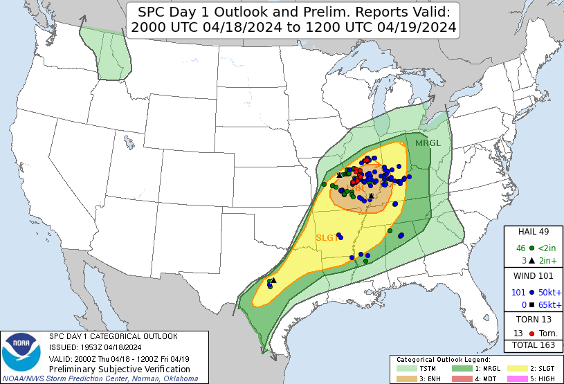
The Storm Prediction Center storm reports for 18 April, below, show severe weather clustered over Missouri and Illinois within the 2000 UTC Enhanced Risk polygon for that day. SPC’s Mesoscale Discussions Numbers 486 — at 2148 UTC — and 488 — at 2312 UTC — discussed these storms. How did the Fusion modeling system, i.e., a modeling system that includes assimilated data that has been modified by the inclusion of thermodynamic observations from Polar-Orbiting satellites, perform on this day?
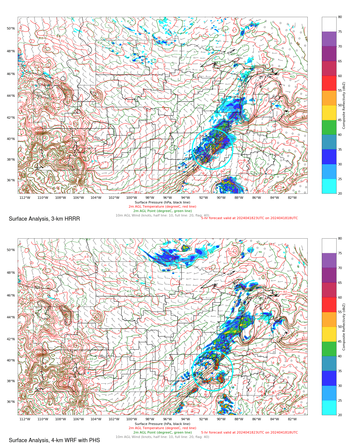
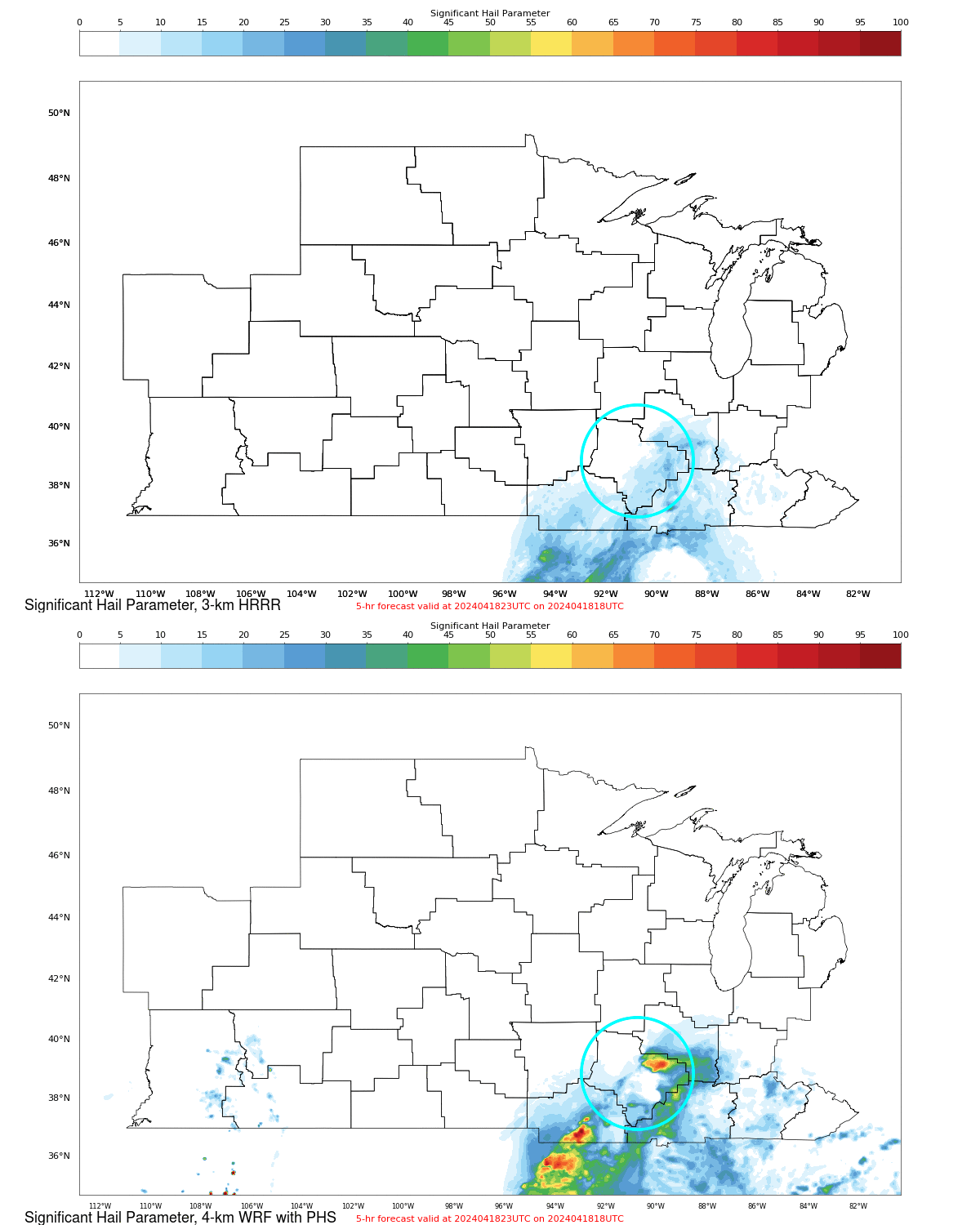
PHS model output at the website includes 4-km WRF output modified by Polar Hyperspectral Sounding input during a 3-h assimilation cycle and 3-km HRRR data that does not include any direct influence from moisture information from the Polar Hyperspectral Soundings. Consider the Surface Analysis toggle below; the forecast office in St Louis is highlighted — that CWA mapping is from here. There are several differences between these two model simulations. There are stronger northerly surface winds to the west of the convection. The character of the convection is also different: in the WRF simulation with PHS thermodynamics, convection shows up as discrete supercellular-like features vs. the less intense convection spread over a region in the HRRR model without PHS information.
Differences, especially wind differences, at 700 h-Pa are obvious in the slider shown below. There are much stronger 700-hPa winds within the area of convection in the simulation that benefits from the extra thermodynamic information delivered by Polar Hyperspectral Soundings (PHS model data with WRF, in contrast to HRRR without).
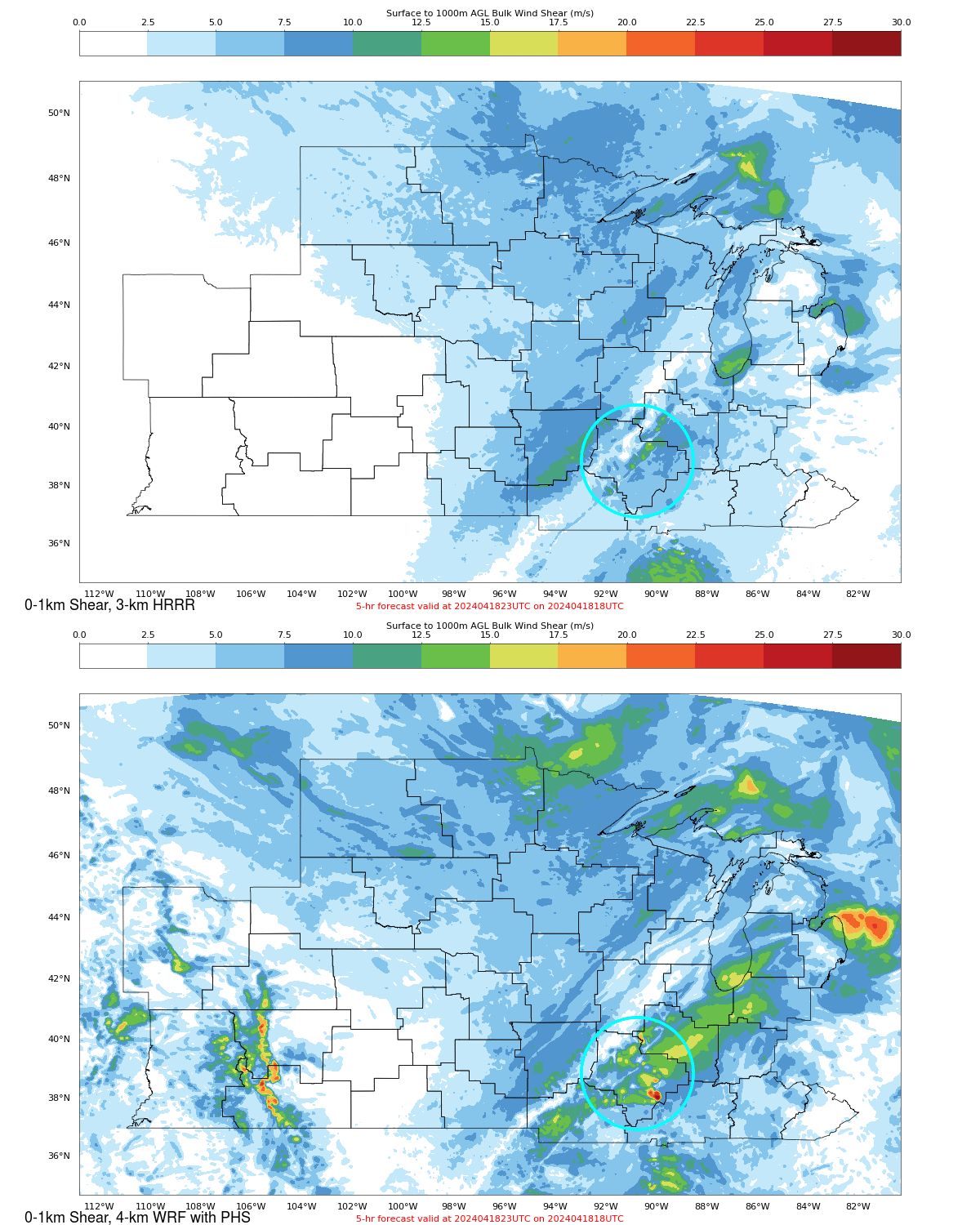
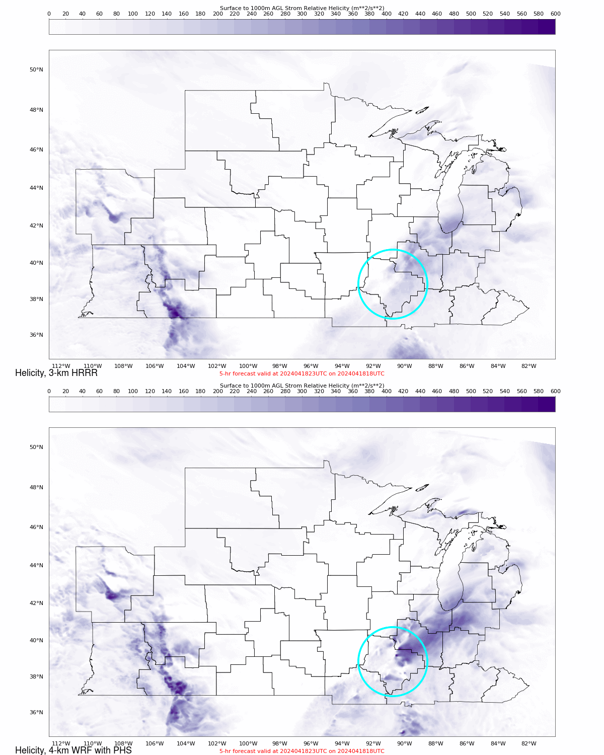
The stronger 700-mb winds are reflected the low-level Bulk Wind Shear, the low-level Helicity and the Significant Hail parameter as shown in individual toggles below. All tell the same story: inclusion of Polar Hyperspectral Sounding data into the model is leading to a simulation that more accurately includes the development of supercellular storms that can drop hail or tornadoes, and the 5-h forecast shows this development close to regions where severe weather was observed.
PHS model data are being demonstrated this year at the Hazardous Weather Testbed held in May/June at SPC.
—————
Free Secure Email – Transcom Sigma
Transcom Hosting
Transcom Premium Domains
