
Winter storm produces heavy snowfall (with some lightning) across parts of the Northeast US
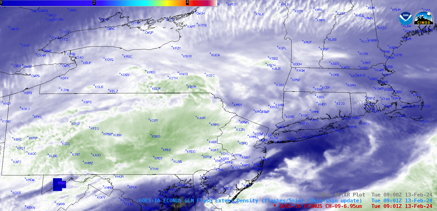
GOES-16 Mid-level Water Vapor (6.9 µm) images with an overlay of GLM Flash Extent Density, with/without plots of 15-minute METAR surface reports, from 0601-1906 UTC on 13 February [click to play animated GIF | MP4]
GOES-16 Mid-level Water Vapor (6.9 µm) images with an overlay of GLM Flash Extent Density (above) showed that there were isolated brief periods of lightning activity over parts of West Virginia / Maryland / Pennsylvania during the nighttime hours, followed by more activity off the south coast of Massachusetts during the daytime hours on 13 February 2024. Although this lightning was occurring near areas receiving moderate to heavy snowfall, there were no METAR sites that explicitly reported thundersnow.
As clouds slowly began to clear, GOES-16 Day Cloud Type RGB images (below) began to reveal areas with appreciable snow cover (darker shades of green).
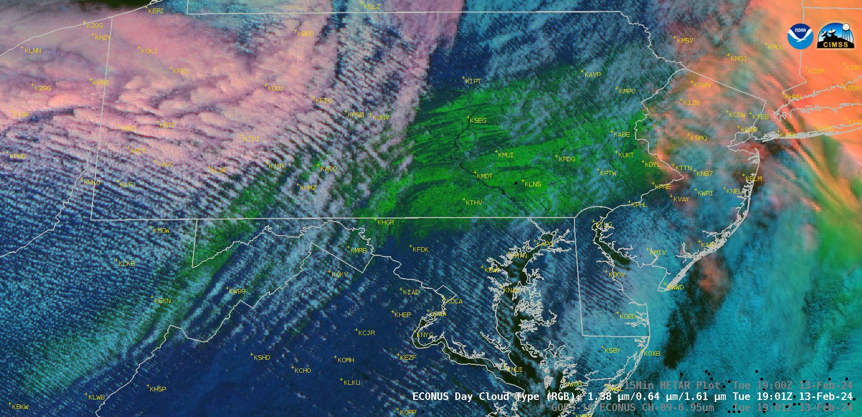
GOES-16 Day Cloud Type RGB images, from 1501-2101 UTC on 13 February [click to play animated GIF | MP4]
On the following day, with minimal cloud cover RGB imagery showed the areal extent of the swath of fresh snow cover that extended from West Virginia to Massachusetts (below). Notable snowfall accumulations included 15+ inches in Pennsylvania, New Jersey and Connecticut (storm summary).
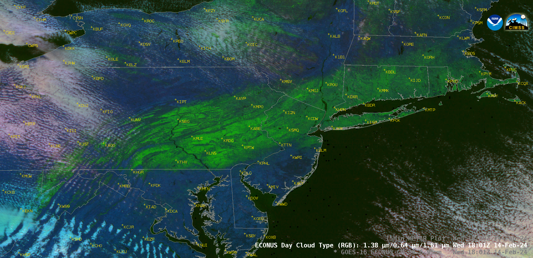
GOES-16 Day Cloud Type RGB images, from 1501-2101 UTC on 14 February [click to play animated GIF | MP4]
—————
Free Secure Email – Transcom Sigma
Transcom Hosting
Transcom Premium Domains