Widespread Convection over the central U.S.
It’s spring time on the Great Plains, which means strong dynamical systems that often bring blizzards as well as severe thunderstorms. A long-wave trough with an embedded 850-500mb jet streak created cyclogenesis in western Oklahoma and southwest Kansas on March 13, with associated low-level moisture return into eastern Kansas.
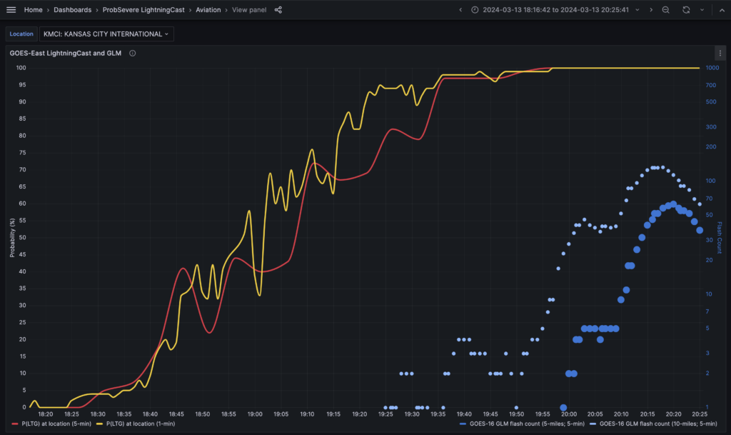
The strong instability and excellent wind shear spawned rapidly growing thunderstorms (some of which are highlighted in this blog post). ProbSevere LightningCast, which is a deep-learning model that uses GOES ABI to predict next-hour lightning, showed high probabilities on this convection 20-30 minutes before the first flashes.
While LightningCast is scheduled to become operational in NOAA in later 2024, new enhancements will be evaluated in NOAA’s Hazardous Weather Testbed in 2024, including the probability of >=10 flashes in the next 60 min, and a GOES-West-only model (trained on GOES-18 data). One important aspect that will be evaluated are lightning dashboards. These time series of the probability of lightning and observed GLM flashes can serve meteorologists providing impacts-based decision support for large venues like stadiums, concerts, fairs, and amusement parks. The dashboard below shows the progression of LightningCast probabilities and GOES-16 Geostationary Lightning Mapper (GLM) flashes near Kansas City International Airport as storms approached.
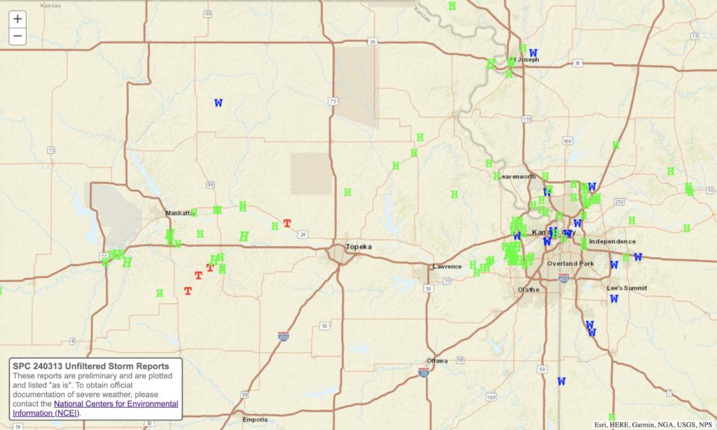
As storms became severe, the Kansas City metro region got hammered with hailstones up to 3″ in diameter, while tornadoes touched down between Manhattan and Topeka.
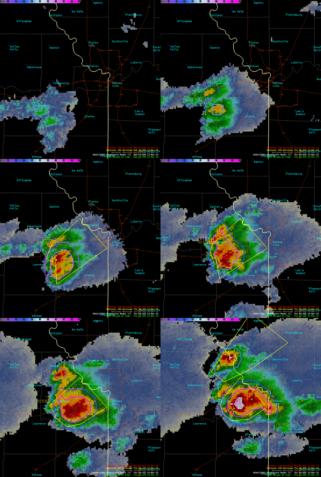
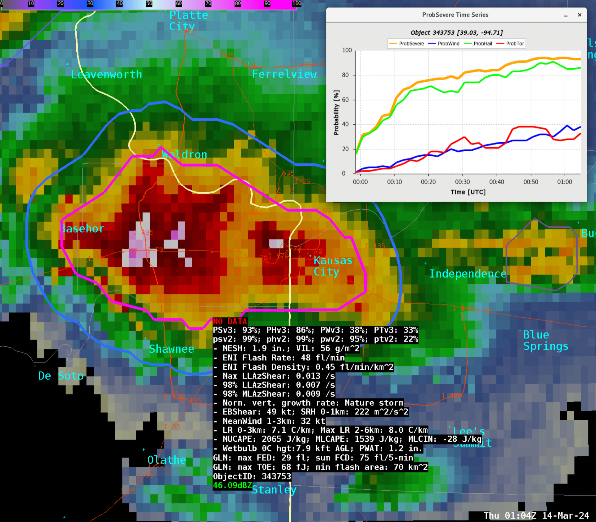
The ProbSevere v3 models track developing thunderstorms and use use radar, satellite, lightning data, and near-term near-storm environment data from the HRRR model to predict next-hour severe weather probabilities of hail, wind, and tornado. This guidance improves confidence for forecasters in their warning-decision making and helps provide enhanced situational awareness of how storms are evolving. Scientists are exploring methods to exploit polarimetric radar data and the important spatial aspects of radar and satellite data, to further improve the models’ accuracy.
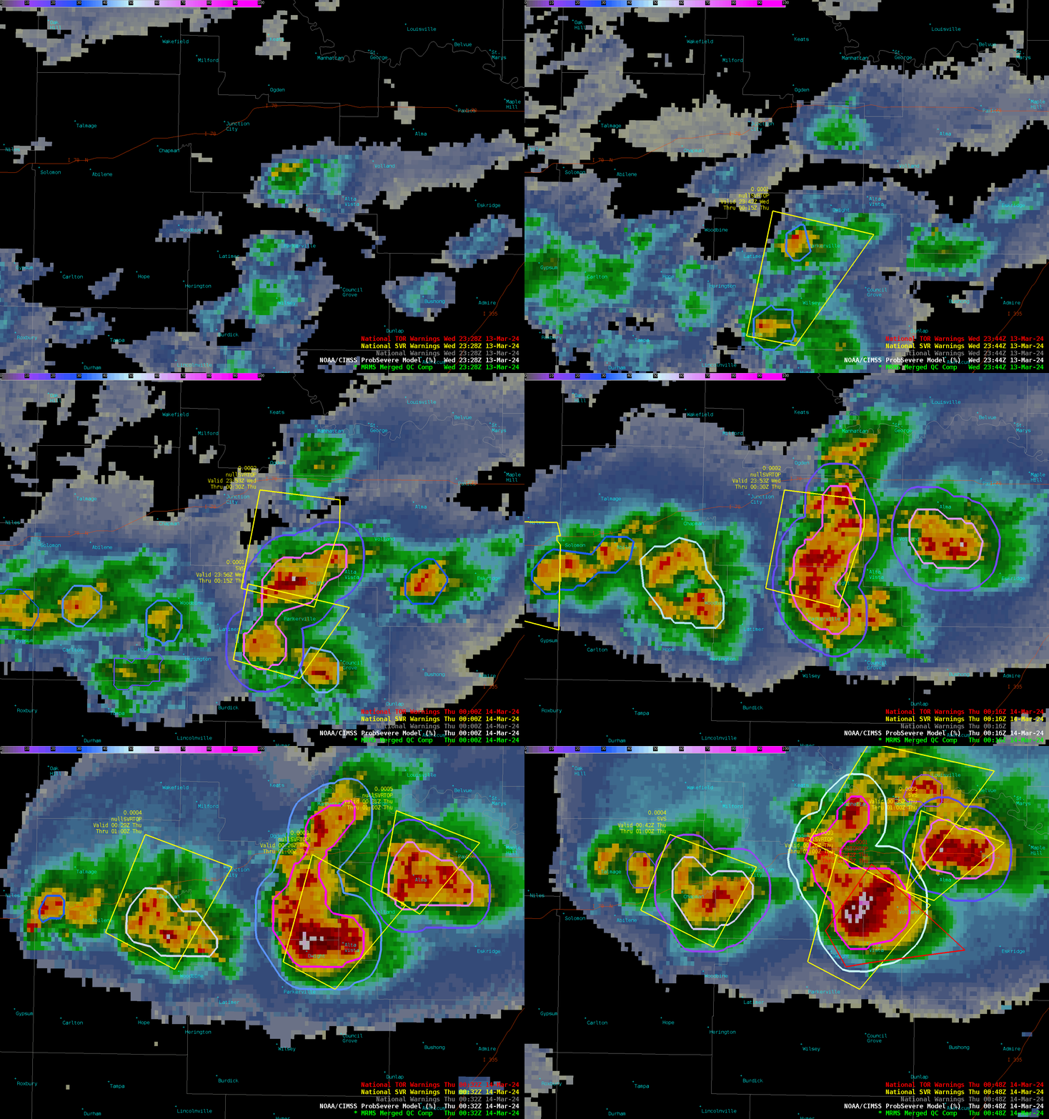
This method of data fusion and probabilistic guidance is especially useful in busy situations with numerous rapidly evolving storms with multiple threats (see below, in eastern Kansas). The quick-look probabilities, cursor read-out, and time series functionality help forecasters make more efficient and effective warning decisions.
Another machine-learning model developed at CIMSS is the IntenseStormNet, which uses GOES-R ABI and GLM images to detect “intense” convection, as viewed from a geostationary satellite perspective. This model excels at isolating the most intense parts of storms in developing and mature convection using a computer-vision approach, which holistically uses features like strong overshooting tops, above-anvil cirrus plumes, cold-U signatures, and strong anvil-edge gradients to predict probabilities.
IntenseStormNet is particularly valuable when radar coverage is diminished, but still adds value to ProbSevere v3 models even in the presence of good radar coverage. The final movie shows a zoomed-out view of IntenseStormNet applied to all of the convection in the central U.S. on March 14.
—————
Free Secure Email – Transcom Sigma
Transcom Hosting
Transcom Premium Domains
