
VIIRS imagery of a low pressure system near the North Pole
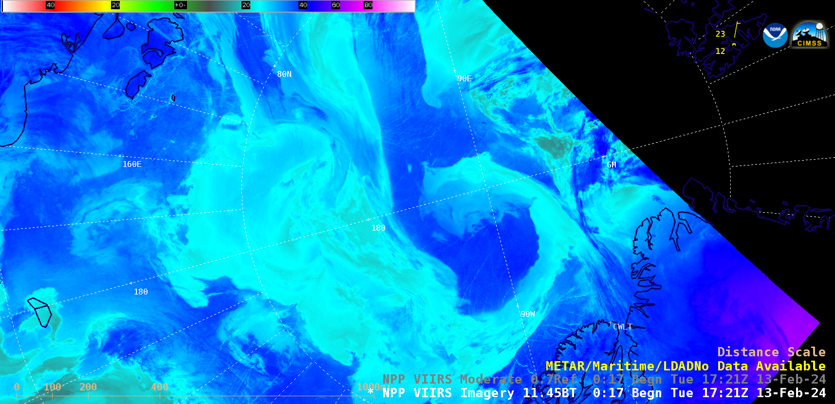
Suomi-NPP VIIRS Infrared Window (11.45 µm) images, from 2100 UTC on 12 February to 2213 UTC on 13 February [click to play animated GIF | MP4]
A sequence of Suomi-NPP VIIRS Infrared Window (11.45 µm) images (above) displayed the development of a coma-shaped cloud structure associated with a low pressure system near the North Pole (northwest of Greenland) on 13 February 2024. The single METAR surface report plotted is Svalbard, Norway (the reports for CWLT — Alert, Nunavut, Canada — were not available).
Analyses from the Canadian Meteorological Centre (below) showed the evolution of the surface low.
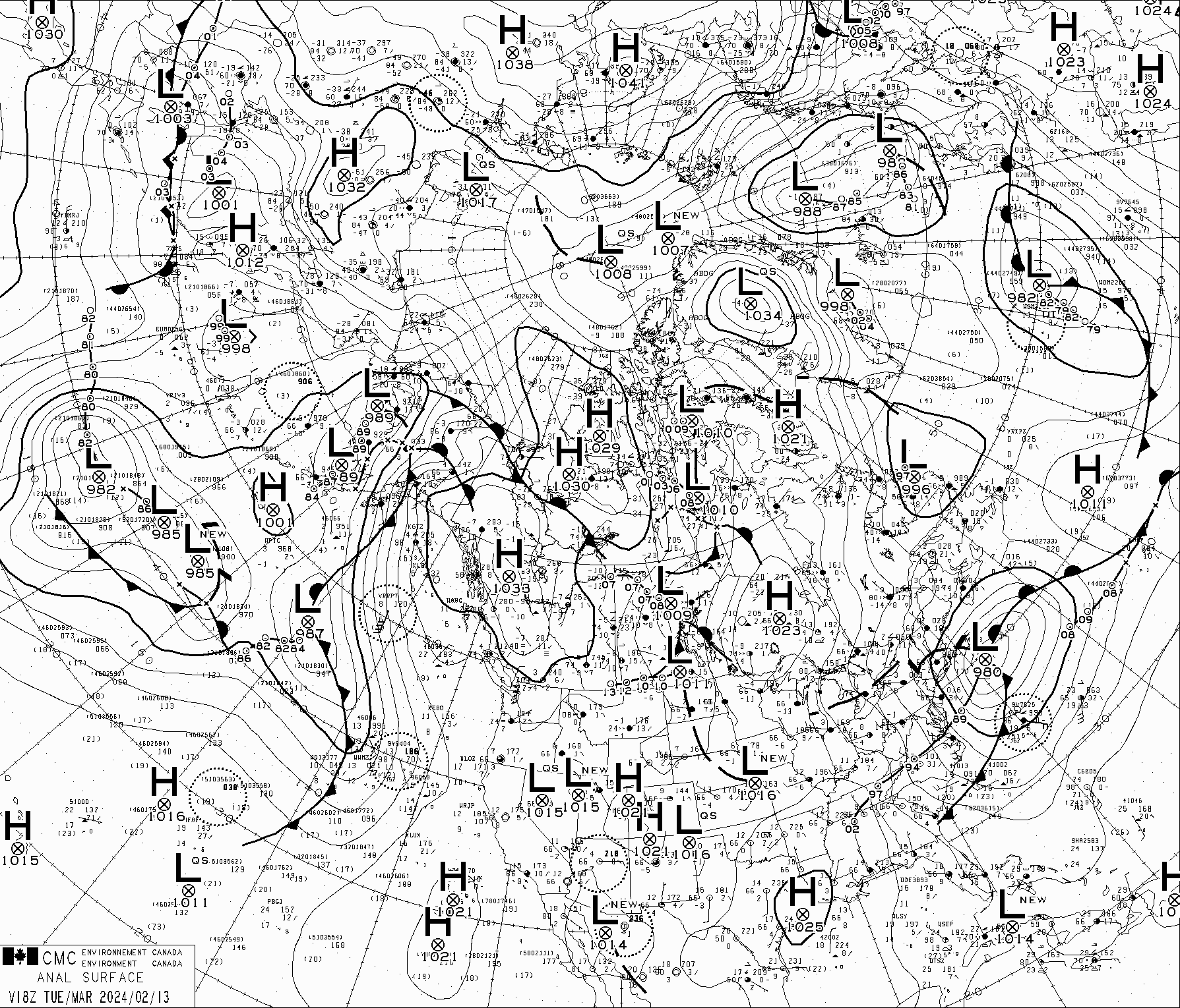
Surface analyses from 0600 UTC on 13 February to 0000 UTC on 14 February [click to play animated GIF]
Given the relatively frequent overpasses of polar-orbiting satellites over the high latitudes, cloud-tracked Atmospheric Motion Vectors (AMVs) can be calculated using Infrared data from VIIRS — examples that combine AMVs from Suomi-NPP and NOAA-20 (source) are shown below.
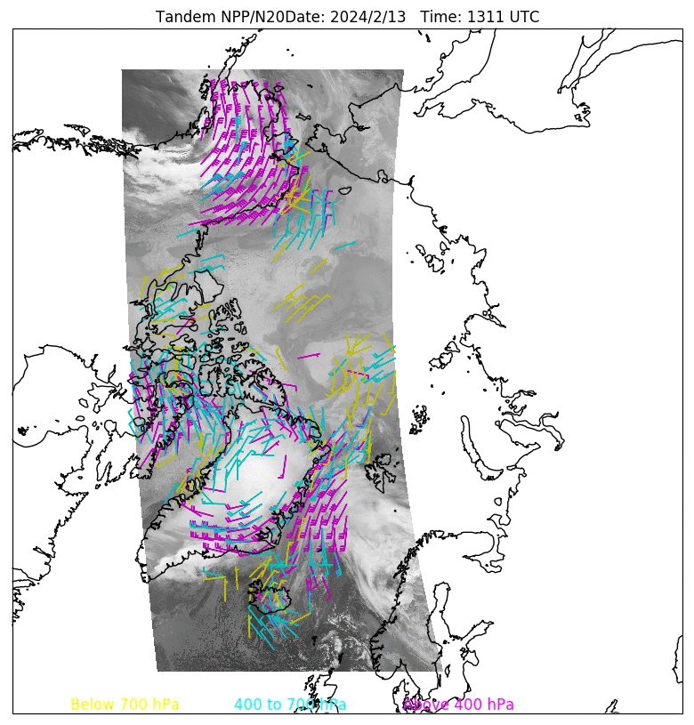
Infrared images from Suomi-NPP and NOAA-20, with overlays of Atmospheric Wind Vectors, from 1311-2138 UTC on 13 February
—————
Free Secure Email – Transcom Sigma
Transcom Hosting
Transcom Premium Domains