
VIIRS and GOES views of Hurricane Ernest in the tropical Atlantic
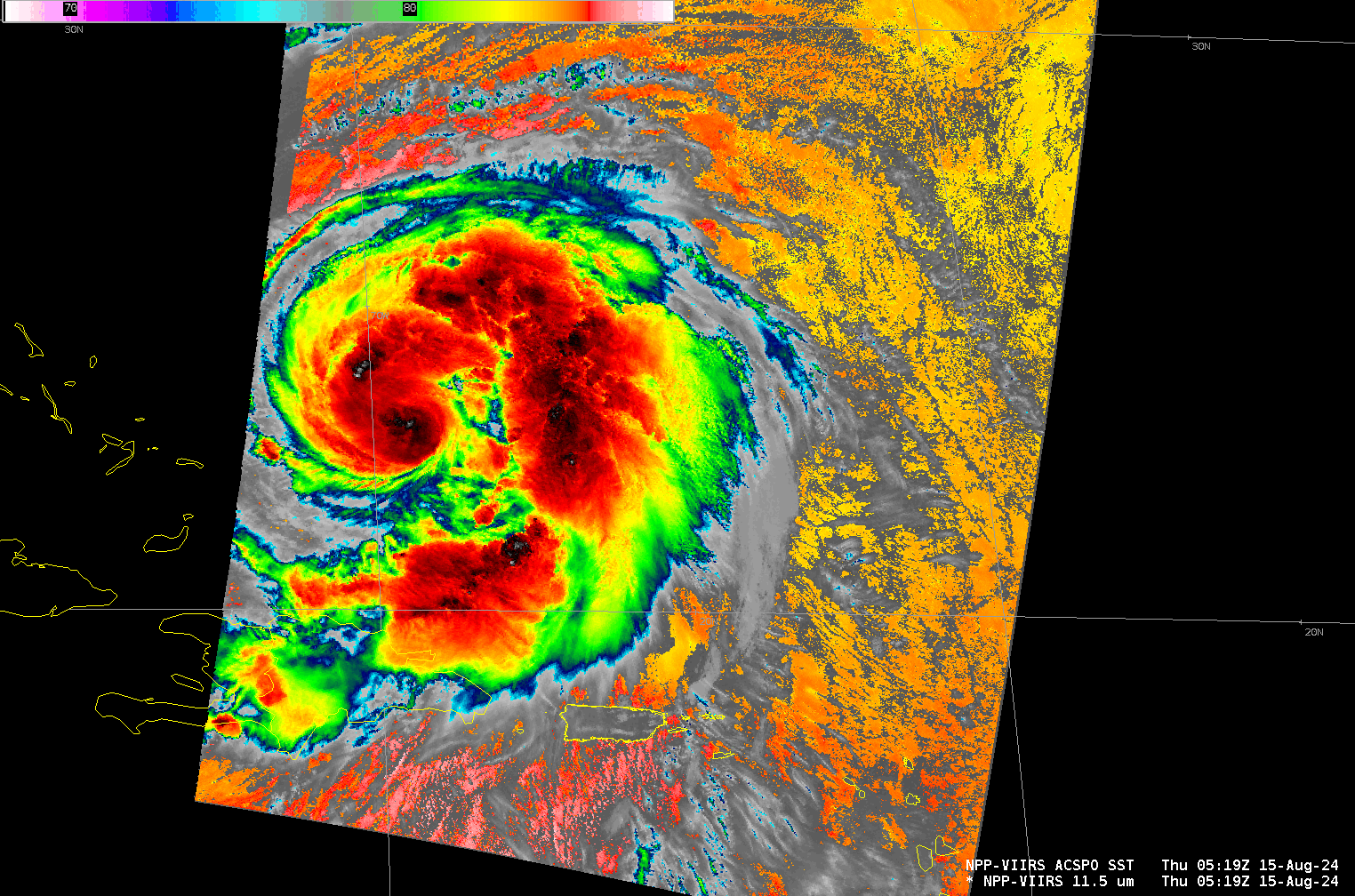
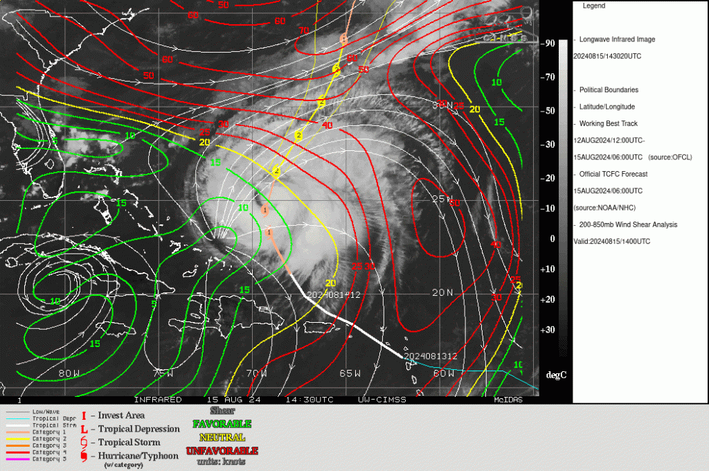
VIIRS imagery from Suomi NPP and NOAA-20, above, show the structure of Hurricane Ernesto as it pulls away from Puerto Rico. Dry air is entrained within the storm, as evidenced by the regions near the center where convection is absent. Sea-surface temperatures in the region are quite warm, however, and shear is small, as shown below: strengthening is forecast.
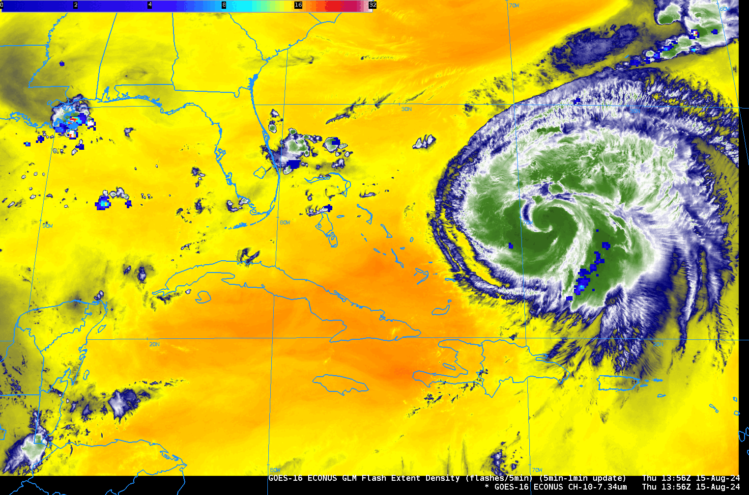
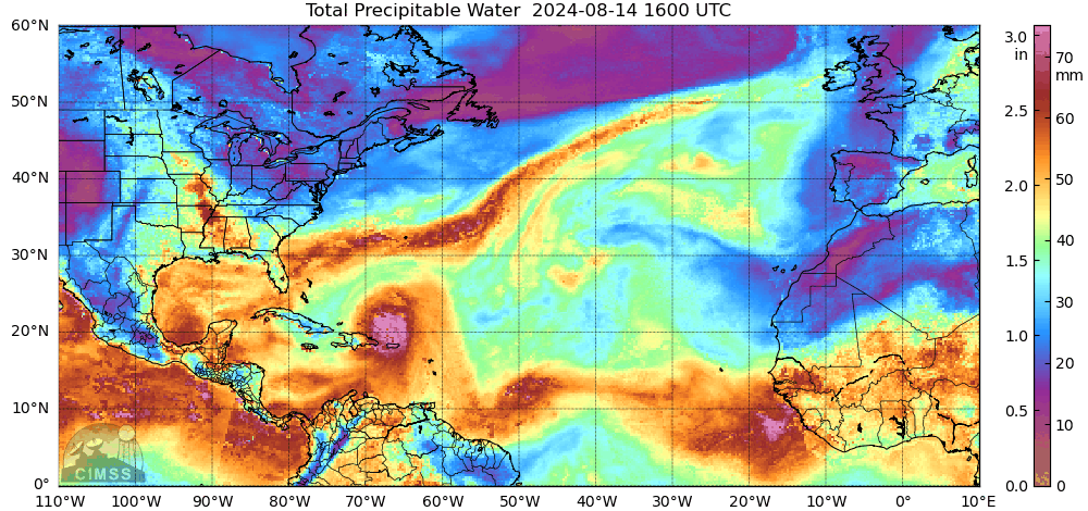
Ernesto is tucked within the southeast corner of the GOES-16 CONUS sector field of view. Five-minute GOES-16 Low-Level Water Vapor infrared imagery (Band 10, 7.34 µm) and GLM observations of Flash-Extent Density, below, show very warm brightness temperatures over the Greater Antilles. MIMIC Total Precipitable water fields (at bottom) show dry air there as well. The future intensity of Ernesto will be directly affected by how much of the dry air continues to infiltrate into the storm circulation. Lightning observations at this time were mostly confined to Ernesto’s outer bands.
For the latest information on Ernesto, refer to the National Hurricane Center: https://www.nhc.noaa.gov .
—————
Free Secure Email – Transcom Sigma
Transcom Hosting
Transcom Premium Domains