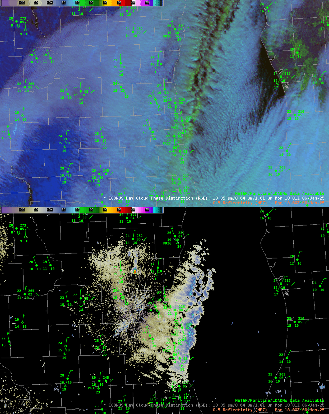
Using Day Cloud Phase Distinction RGB fields to identify precipitating Lake-Effect snow bands

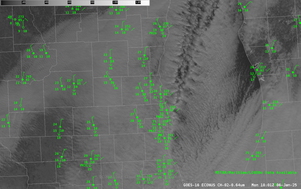
GOES-16 Day Cloud Phase Distinction RGB imagery at 1801 UTC on 6 January 2025, above, show evidence (in greenish yellow) of a glaciated band of cloudiness that is a Lake Effect snow band that deposited from 3-6″ over extreme southeast Wisconsin, in Kenosha and Racine counties. The toggle with the radar emphasizes how Day Cloud Phase Distinction can be used (in daytime) to highlight precipitating lake-effect snow bands. Visible imagery at the same time is shown below. The character of the precipitating clouds is different, and that might help you identify the precipitating clouds from the non-precipitating ones.

The use of Day Cloud Phase Distinction to highlight precipitating clouds has been discussed before on this blog, here and here, for example.
—————
Free Secure Email – Transcom Sigma
Transcom Hosting
Transcom Premium Domains
