
Using an RGB and LightningCast Probability to monitor convective development
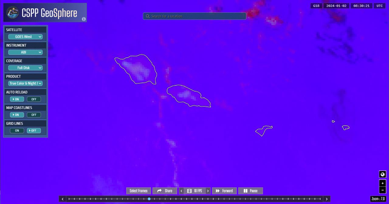
Night Microphysics RGB imagery from the CSPP Geosphere site (link to a very similar animation to the one above) shows a line of tropical cumulus approaching Samoa. There are subtle color changes in that RGB that typically presage convective development (as also shown in this blog post, for example), and as highlighted in the annotated animation below that covers 0830-1230 UTC. The last few frames of the annotation include screen captures of LightningCast probabilities over the region — and increasing probabilities over Savai’i should give a forecaster more confidence that convective initiation is ongoing. (This Night Microphysics RGB Quick Guide notes that ‘redder’ means thicker clouds are present).
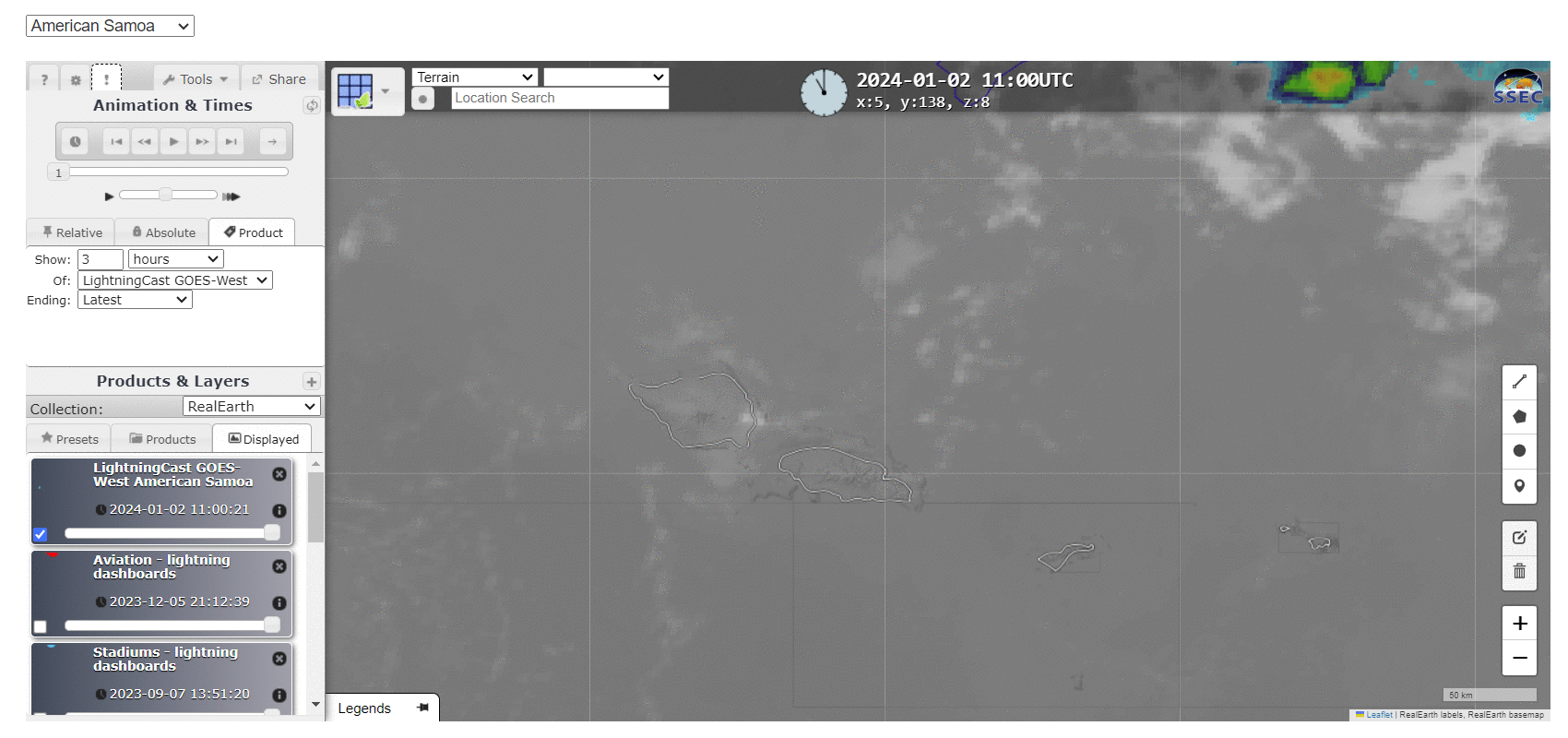
LightningCast probability estimates the likelihood that the GLM on board GOES-R satellites (for this case, GOES-18) will have a lightning observation in the next 60 minutes. Screen captures of the product over the Samoan Islands from 1100 to 1400 UTC, partially overlapping the animations above, below (from this website, choose the American Samoa sector from the drop-down menu), show a slow increase in values over eastern Savai’i, especially after 1300 UTC. The GLM observed lightning between 1330 and 1400 UTC.
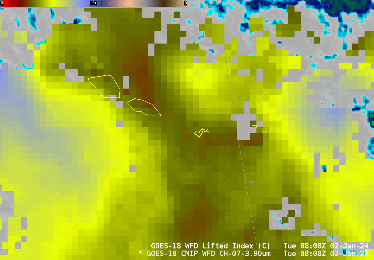
Level 2 Products from GOES-18 gave useful information during this event as well. The Derived Stability Index Lifted Index field, below, shows an axis of instability moving westward over the Samoan islands during the time of convective initiation. The default display values for AWIPS for Lifted Index (-10 to 20) have been changed (to -5 to 5) for the display below to better highlight the region of instability. Recall that level 2 Stability fields are clear-sky only, but skies around Samoa early on 2 January were largely cloud-free (in contrast to much of December 2024: link, link, link)
Use multiple tools, such as LightningCast, Night Microphysics RGB imagery, and Level 2 Products, to determine when convective initiation is occurring. Combining information from multiple satellite sources means you can be more confident about predictions of development. Also: The CSPP Software team at CIMSS is creating software that allows for stand-alone LightningCast Probability fields. Stay tuned!
—————
Free Secure Email – Transcom Sigma
Transcom Hosting
Transcom Premium Domains