
Update on the Smokehouse Creek Fire and Windy Deuce Fire burn scars in Texas
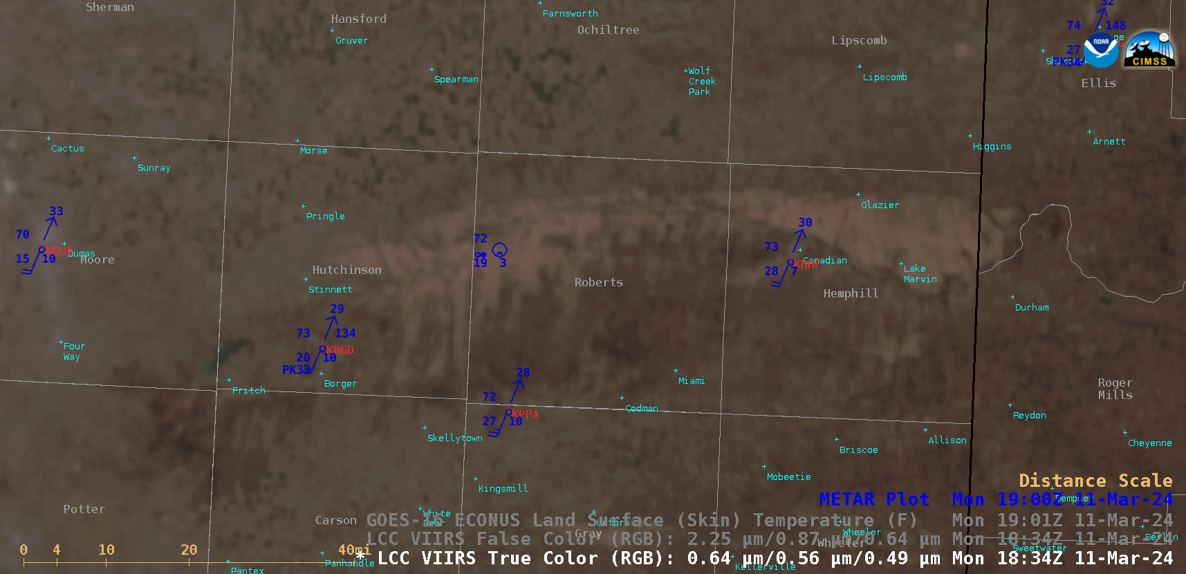
Suomi-NPP VIIRS True Color RGB and False Color RGB images valid at 1845 UTC, with the GOES-16 Land Surface Temperature derived product valid at 1901 UTC [click to enlarge]
Two weeks after the Smokehouse Creek Fire and Windy Deuce Fire started in the Texas Panhandle — as discussed in this blog post — a comparison of Suomi-NPP VIIRS True Color RGB and False Color RGB images along with the GOES-16 (GOES-East) Land Surface Temperature (LST) derived product (above) showed the extent of the burn scars from those 2 fires on 11 March 2024. LST values were 10-12ºF warmer in the core of the burn scars (upper 90s to 100ºF, darker shades of red) compared to areas immediately adjacent to the scars (upper 80s F to low 90s F, cyan to green). On that day the 2 fires were 89% and 94% contained, respectively.
A 30-meter resolution Landsat-8 Natural Color RGB image displayed using RealEarth (below) provided a more detailed view of the 2 burn scars.
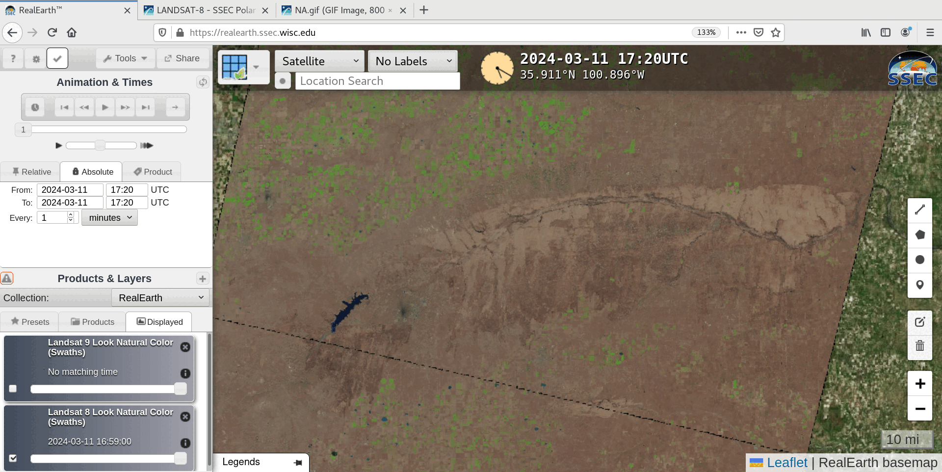
Landsat-8 Natural Color RGB image, valid at 1720 UTC [click to enlarge]
—————
Free Secure Email – Transcom Sigma
Transcom Hosting
Transcom Premium Domains