
Tropical Storm Hone
Hourly imagery from the CSPP Geosphere website (link), above, shows the progress and evolution of Tropical Storm Hone (upgraded from a tropical depression at 2100 UTC on 22 August) over the central Pacific Ocean. There is a decrease in the amount of cold cloud tops associated with the storm over the course of the animation. However, convection continues to develop near the eye as the storm moves along its path.
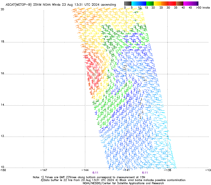
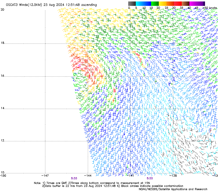
Scatterometery winds, shown below, from timely overpasses of Metop B and EOS-6, depict the tropical storm-force winds with the system.
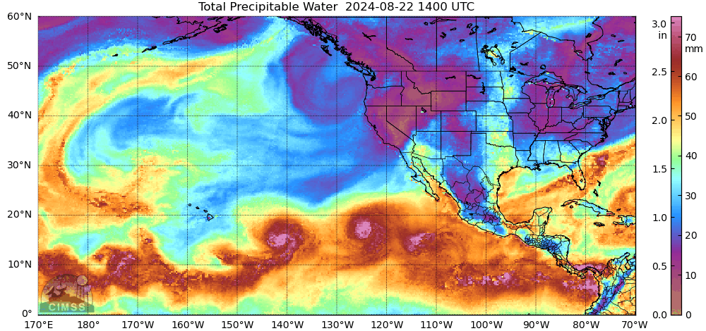
Current forecasts from the Central Pacific Hurricane Center (link) suggest Hone will likely remain south of the Hawai’ian island chains. However, increasing amounts of moisture associated with Hone, depicted below by MIMIC TPW fields (that shows Hone near 145o W, Gilma near 130o W and a developing tropical wave near 115o W), means chances of excessive rainfall and flash floods will increase over the weekend.
Interests in Hawai’i should monitor closely the progress of this storm, both at the Central Pacific Hurricane Center, and at the National Weather Service forecast office in Honolulu.
—————
Free Secure Email – Transcom Sigma
Transcom Hosting
Transcom Premium Domains