
Tropical Storm Alberto in the southern Gulf of Mexico
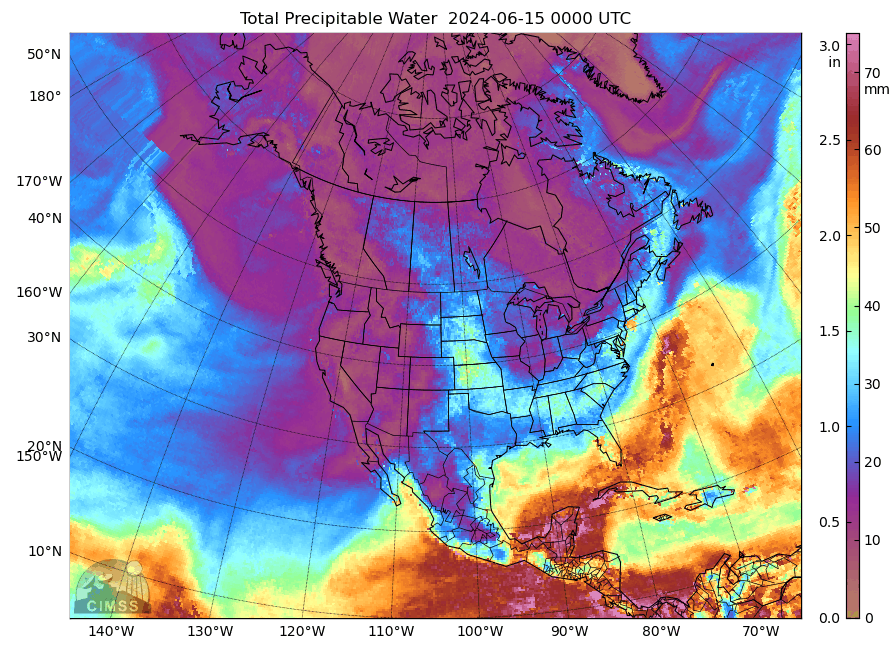
MIMIC Total Precipitable Water fields from 15 June through 19 June 2024, above, show a broad cyclonic circulation over Central America and adjacent waters (the Central American Gyre). On 18 June, shown below in an animation from the CSPP Geosphere site, the convection in this gyre was diffuse and unorganized (although the National Hurricane Center initiated Potential Tropical Cyclone advisories on the system at 2100 UTC on the 17th.
By 1500 UTC on 19 June, the system had acquired sufficient convection near its center, and had become organized enough to achieve Tropical Storm status, and the first named storm of the 2024 Atlantic Season, Alberto, was named. The Geosphere animation below, from 1300-1700 UTC on 19 June (that is, 24 hours after the animation above), shows the increase in convection over the southern Gulf of Mexico.
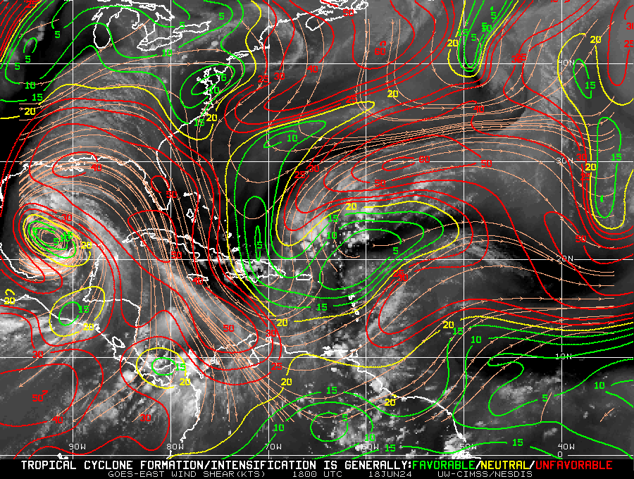
The shear over the western Gulf of Mexico became much more favorable for tropical storm development between 1800 UTC on 18 June and 1800 UTC on 19 June 2024, that is, it has decreased, as shown below (imagery taken from here).
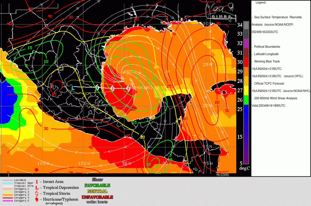
The projected path of Alberto is westward into Mexico, as shown in the image below showing the favorable shear values and warm Sea-surface Temperatures. Slow strengthening is forecast.
Although the storm center is forecast to move into Mexico, the very moist airmass surrounding the system is affecting (and will continue to affect) much of coastal and southern Texas. Tropical Storm warnings are in place from Galveston southward to Mexico, and Flash Flood Warnings have also been raised. A Flood Watch is in effect for Texas south of San Antonio. For more information on Alberto, refer to the National Hurricane Center website.
—————
Free Secure Email – Transcom Sigma
Transcom Hosting
Transcom Premium Domains