
Tropical Cyclone Kirrily in the Coral Sea
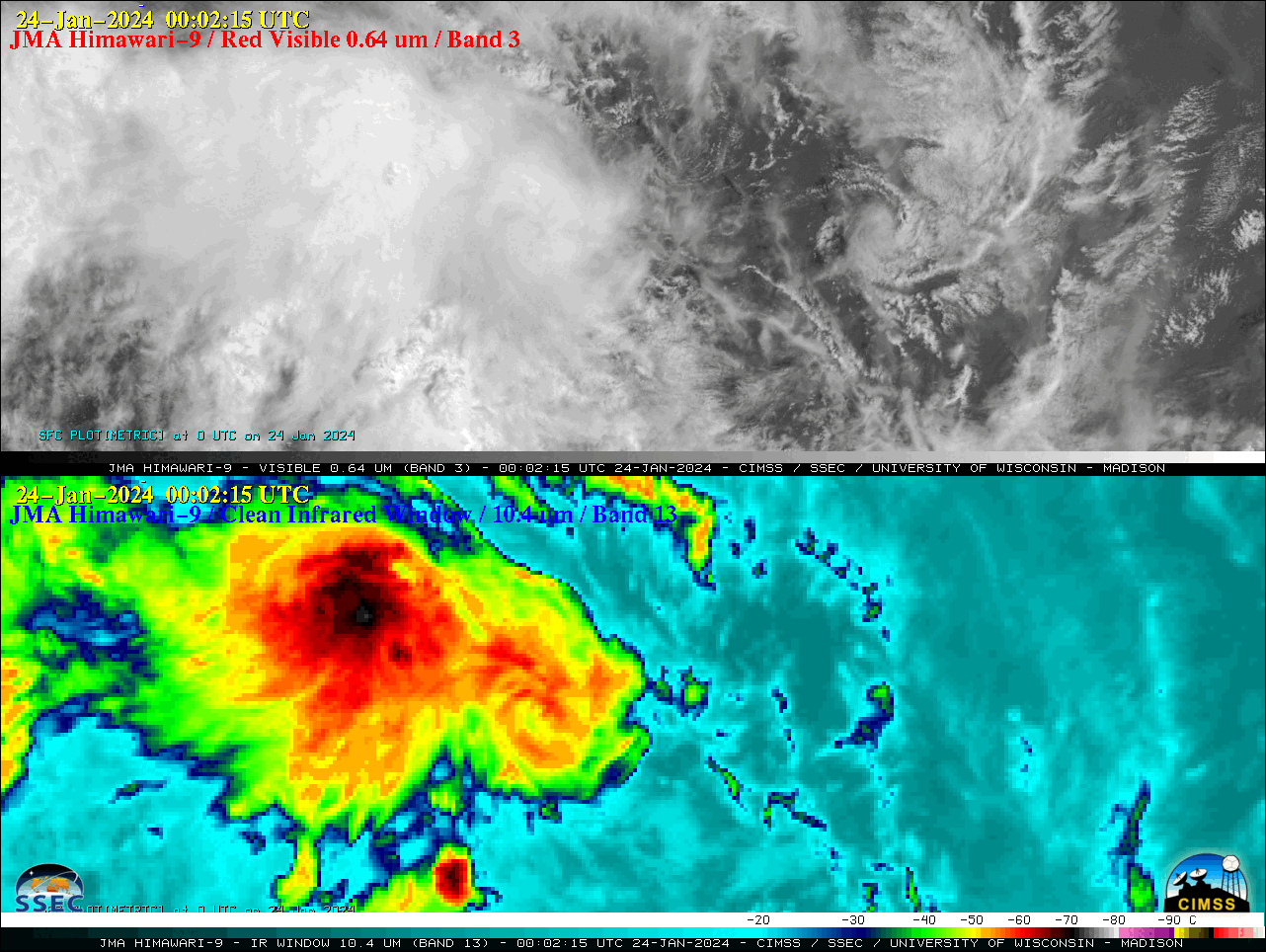
2.5-minute JMA Himawari-9 Red Visible (0.64 µm, top) and Clean Infrared Window (10.4 µm, bottom) images, from 2102 UTC on 23 January to 0742 UTC on 24 January [click to play animated GIF | MP4]
Target Sector (2.5-minute interval) JMA Himawari-9 AHI Red Visible (0.64 µm) and Clean Infrared Window (10.4 µm) images (above) showed Invest 90P as it intensified to become Tropical Cyclone Kirrily over the Coral Sea on 23-24 January 2024. Visible images showed multiple exposed low-level circulation centers, while Infrared images showed that deep convection was mainly developing west of the storm center.
Himawari-9 Infrared Window (11.2 µm) images from the CIMSS Tropical Cyclones site (below) showed that Tropical Cyclone Kirrily was moving through an environment of low deep-layer wind shear (in contrast to the high values of shear that were affecting Invest 90P on 20 January).
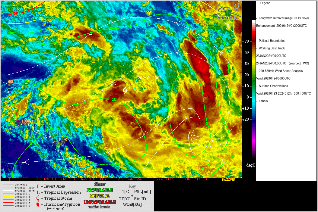
JMA Himawari-9 Infrared Window (11.2 µm) images, with contours and streamlines of deep-layer wind shear at 0000 UTC on 24 January [click to enlarge]
—————
Free Secure Email – Transcom Sigma
Transcom Hosting
Transcom Premium Domains