Tornado in the Sacramento Valley of California

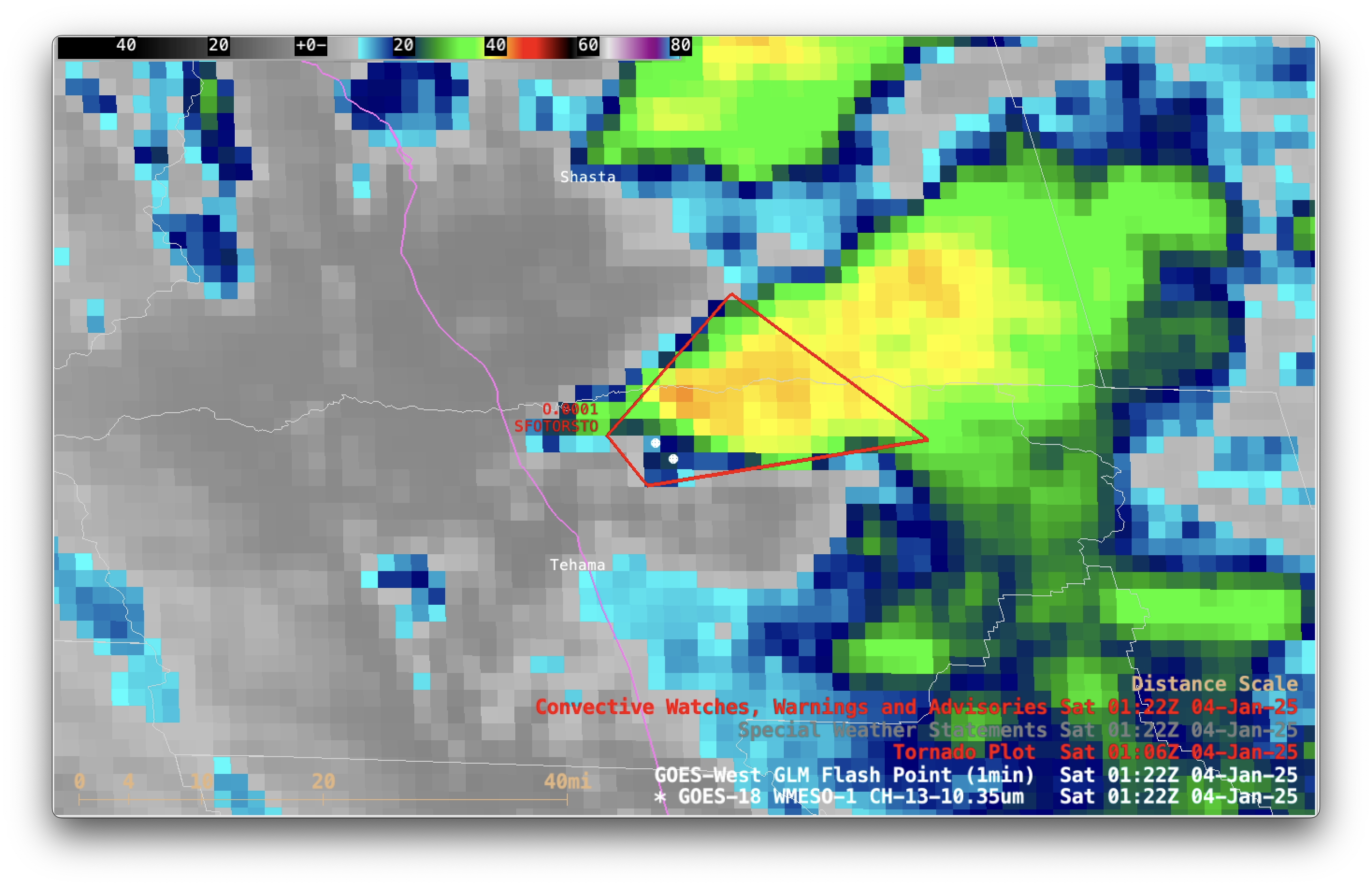
1-minute GOES-18 Clean Infrared Window (10.3 µm) images with plots of 1-minute GLM Flash Points (white), Tornado Warning polygon (red) and Tornado report location (red T), from 0100-0200 UTC on 4th January [click to play MP4 animation]
1-minute Mesoscale Domain Sector GOES-18 (GOES-West) Clean Infrared Window images (above) showed the thunderstorm that produced a EF-U rated tornado in northern Tehama County, California late in the day on 3rd January 2025 (this was first verified tornado in the US for 2025). Cloud-top infrared brightness temperatures of that particular thunderstorm cooled to the -40 to 42ºC range beginning at 0101 UTC — and GLM-detected lightning activity began at 0108 UTC, reaching a peak at 0126 UTC.
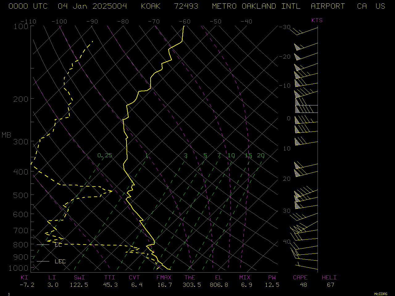
A plot of rawinsonde data from Oakland, California at 0000 UTC (below) indicated that air temperatures of -40 to 42ºC were present at a pressure of ~300 hPa (or an altitude ~9.2 km).

Plot of rawinsonde data from Oakland, California at 0000 UTC on 4th January [click to enlarge]
—————
Free Secure Email – Transcom Sigma
Transcom Hosting
Transcom Premium Domains
