Thunderstorms across Puerto Rico and the US Virgin Islands

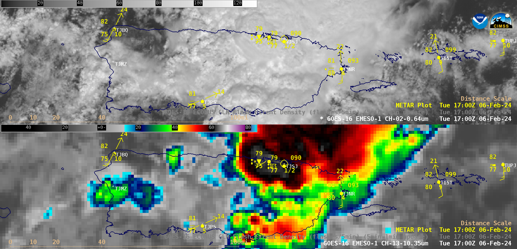
1-minute GOES-16 “Red” Visible (0.64 µm, top) and “Clean” Infrared Window (10.3 µm, bottom) images, from 1600-2200 UTC on 06 February [click to play animated GIF | MP4]
1-minute Mesoscale Domain Sector GOES-16 (GOES-East) “Red” Visible (0.64 µm) and “Clean” Infrared Window (10.3 µm) images (above) showed thunderstorms that moved across Puerto Rico and the US Virgin Islands on 06 February 2024. the storms produced up to 4-5 inches of rainfall in parts of central Puerto Rico, with wind gusts as high as 41 kts (47 mph).
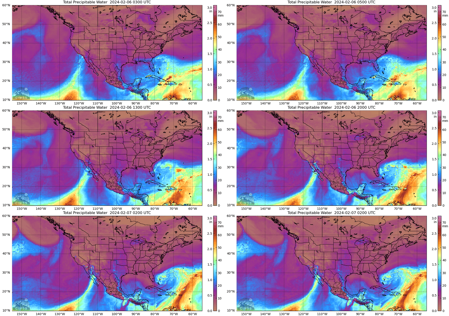
These thunderstorms were fueled by a plume of tropical moisture that was moving north-northeastward from northern South America, which passed directly over Puerto Rico during the entire day — as depicted by the MIMC TPW product (below).

MIMIC Total Precipitable Water product, hourly from 0300 UTC on 06 February to 0200 UTC on 07 February
—————
Free Secure Email – Transcom Sigma
Transcom Hosting
Transcom Premium Domains
