
The Samoan Islands see Rain
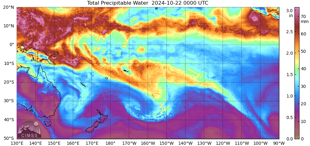
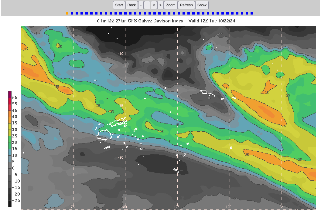
MIMIC TPW fields for the first half of 22 October (at which point the data feed from NOAA/NESDIS was interrupted) shows the Samoan Islands within an isolated region of relatively dry air with moisture moving in from the east. GFS fields showing the Galvez Davison Index (GDI) that is sometimes used to anticipate rain in the tropics, below (from this site), shows a predicted increase in index values (suggesting an increase in rain probabilities; GDI has been discussed on this Blog previously here and here).
Given this background, what might you examine to determine if rain is imminent? Visible imagery from GOES-18 might be one example, as shown in the animation below from the CSPP-Geosphere site. Convective clouds approach the Samoan Islands from the east, coming very close to American Samoa but not overspreading the islands. Convection does overspread Upolu by the end of the animation.
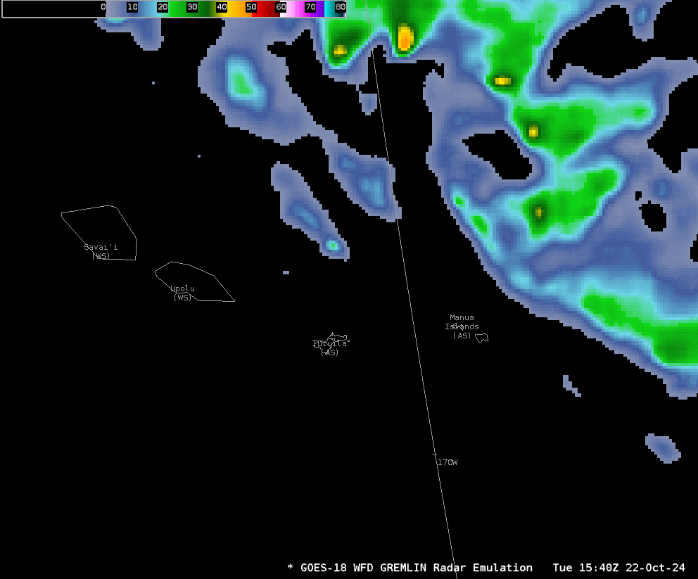
GREMLIN is a product that predicts what radar would show given a distribution of GOES data (from bands 7, 9, and 13). The animation below shows predicted radar echoes getting very close to Tutuila (the island including Pago Pago), and overspreading Upolu, the island of Samoa that includes its Capital city Apia.
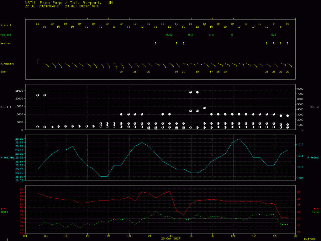
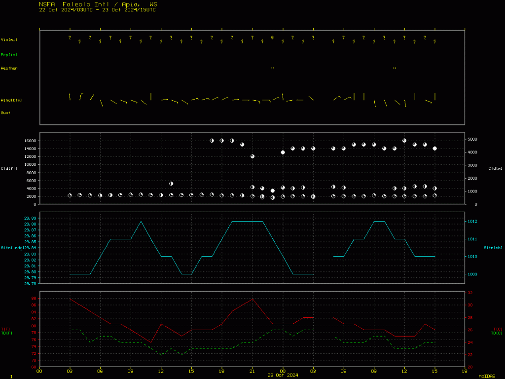
A meteorogram for Pago Pago, American Samoa (station NSTU) from 0300 UTC 22 October through 1500 UTC 23 October, below, shows that light rain was observed at Pago Pago airport at 22 UTC on 22 October. Heavier rain overspread the region on 23 October. A similar meteorogram for Apia, Samoa (station NSFA), follows, showing a similar tale, but does it show the rain that might have been expected (at Apia especially) given the imagery above?
Use large-scale products such as MIMIC or model fields of GDI to get a general feel for how precipitation might be approaching and/or evolving, then examine satellite imagery, either individual bands or derived products, as guidance for your precipitation forecast in the short-term.
GREMLIN fields are now available at the CIRA SLIDER.
—————
Free Secure Email – Transcom Sigma
Transcom Hosting
Transcom Premium Domains