
Sun glint and light winds to the west of Invest 95L in the tropical Atlantic
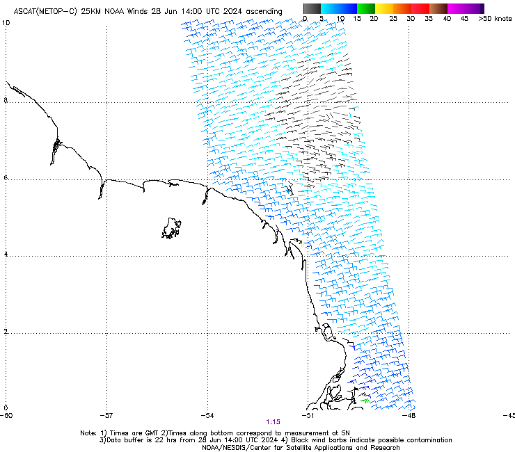
CSPP Geosphere imagery above (direct link) shows an area of sun glint over the tropical Atlantic. Embedded within the brighter areas of sun glint is a dark path centered near 7oN, 52oW over the ocean to the northeast of French Guiana. Long-time readers of this blog will no doubt recognize this feature as an area with very light winds (link). Indeed, Advanced Scatterometer (ASCAT) winds from MetopC (source), below, from 0121 UTC on 28 June, show light winds in the vicinity.
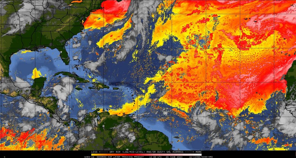
Your eye might also be drawn to the circulation in the animation above that is the current invest 95L in the tropical Atlantic. In what kind of environment is that system developing? What satellite data can be used to describe this system? The Saharan Air Layer analysis, below (source), shows the storm south of an extensive SAL region. A water vapor image (sensing the mid-troposphere) at 1200 UTC (link) also shows extensive dry air surrounding the system.
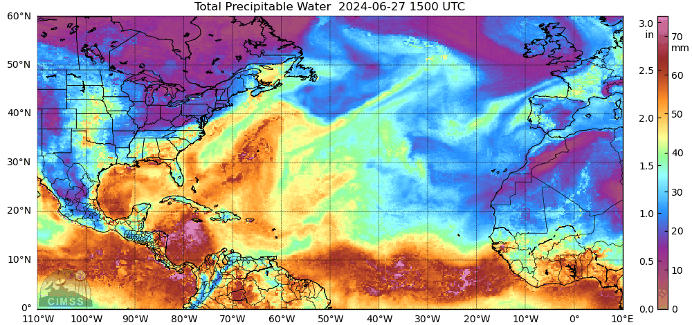
MIMIC Total Precipitable Water analyses (source) for the 24 hours ending at 1400 UTC on 28 June 2024, below, shows the cyclonic circulation associated with the Invest as it moves across 40oW longitude (another concentrated area of moisture is moving through the northwestern Caribbean Sea).
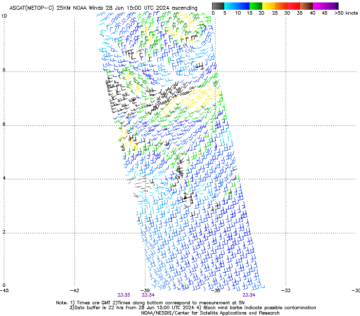
MetopC ASCAT winds, below, show a circulation near 9oN/38oW at 2334 UTC on 27 June 2024.
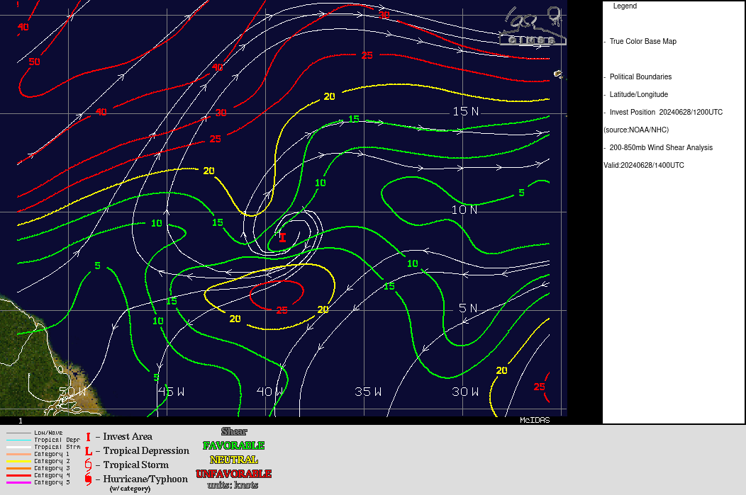
Wind shear and Sea Surface Temperature (SST) analyses surrounding 95L, below, show a favorable environment (that is, low values of wind shear, and warm SST values). Imagery below is from the SSEC Tropical Website.
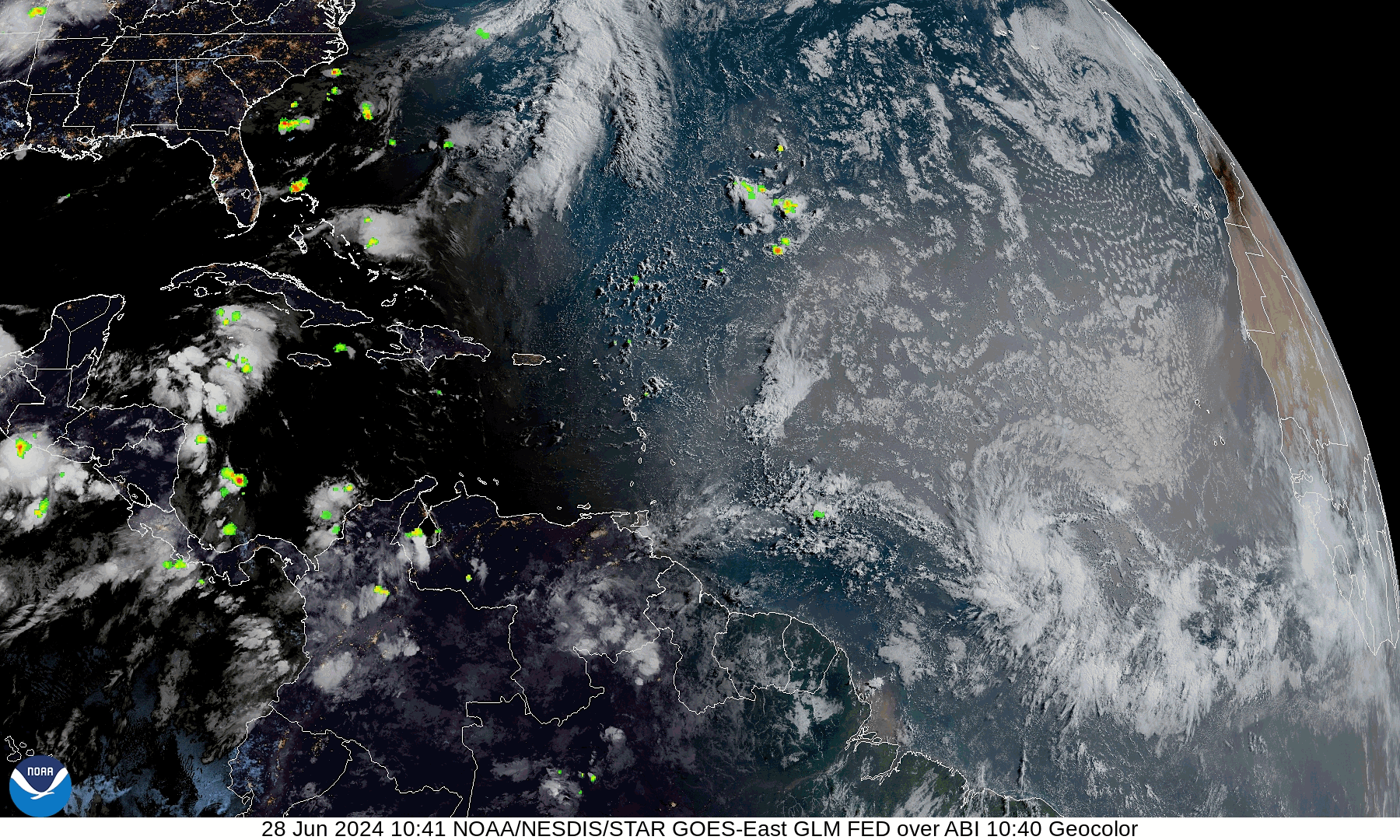
GeoColor imagery overlain with GLM observations, below (source), show occasional GLM lightning strikes within the convective cluster surrounding the tropical invest.
For more information on this system, refer to the National Hurricane Center and CIMSS Tropical Weather websites.
—————
Free Secure Email – Transcom Sigma
Transcom Hosting
Transcom Premium Domains