
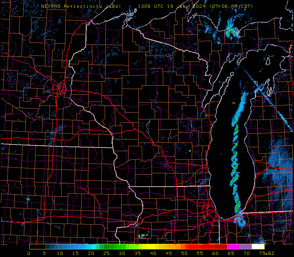
Single-banded snow squall along the length of Lake Michigan
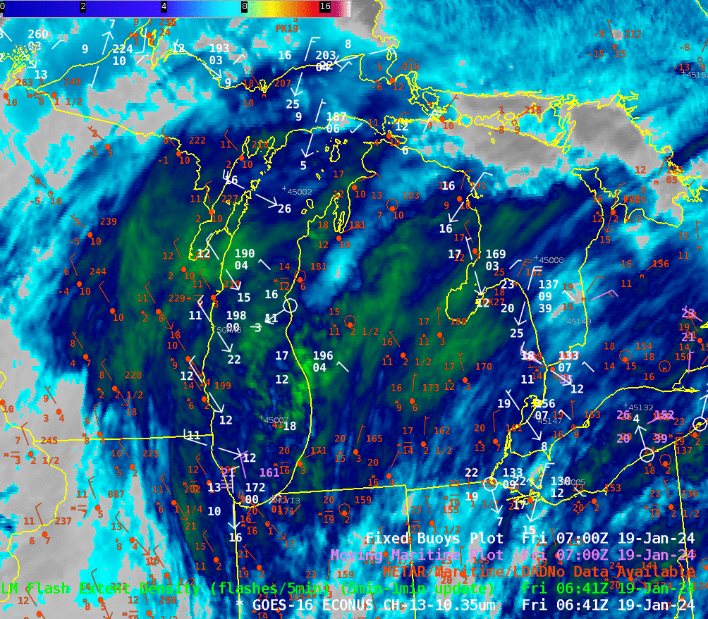
Morning radar on the morning of 19 January 2024 (shown below from this source) showed a single band of snow squalls moving southward over central Lake Michigan. Then band moved inland over northwestern Indiana, resulting in a winter storm warning over northwestern Indiana (More information from NWS IWX) and hazardous travel conditions through that heavily-traveled corridor between Chicago and Detroit. GOES-16 Clean Window Infrared (Band 13, 10.3 µm) imagery, below, shows a subtle lake-effect band signature emerging as the clouds associated with a system that deposited widespread light snow over the upper Midwest exits to the east. Surface observations, especially of CMAN sites, show convergence over the lake. Note the east/northeast winds at stations LDTM4 (Ludington MI) and BSBM4 (Big Sable Point MI) over central lower Michigan and the northwest winds along Lake Michigan’s western shore. Sometimes lake effect bands are vigorous enough to produce convection. That was not the case for this band; GLM detected no flash events (in addition, LightningCast probabilities were less than 2%!)
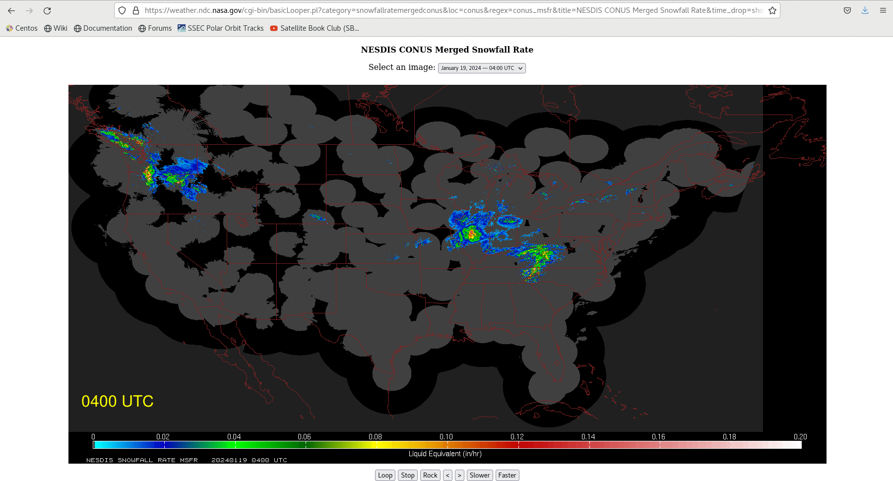
Merged Snowfall rates (source; a field that combines observations from radars and from polar orbiting satellites’ microwave observations of the atmosphere), below, show that the single band started to coalesce shortly after 0700 UTC. Microwave observations over the Great Lakes did not occur at the hourly intervals shown (although some observations are present over the Pacific Northwest, where the gap-filling between radars is more important!); however, there were microwave estimates of snowfall rate at 0850 and 0920 UTC, as shown in this toggle. Light snow in Madison WI was just ending at 0900 UTC/3 AM CST; compare the 0900 mSFR field (radar-only coverage over the midwest) and the 0850 UTC/0920 UTC mSFR fields (here are all 3 in an animation): satellite-based microwave estimates of snow better capture the back edge of the light snow than the radar-only image.
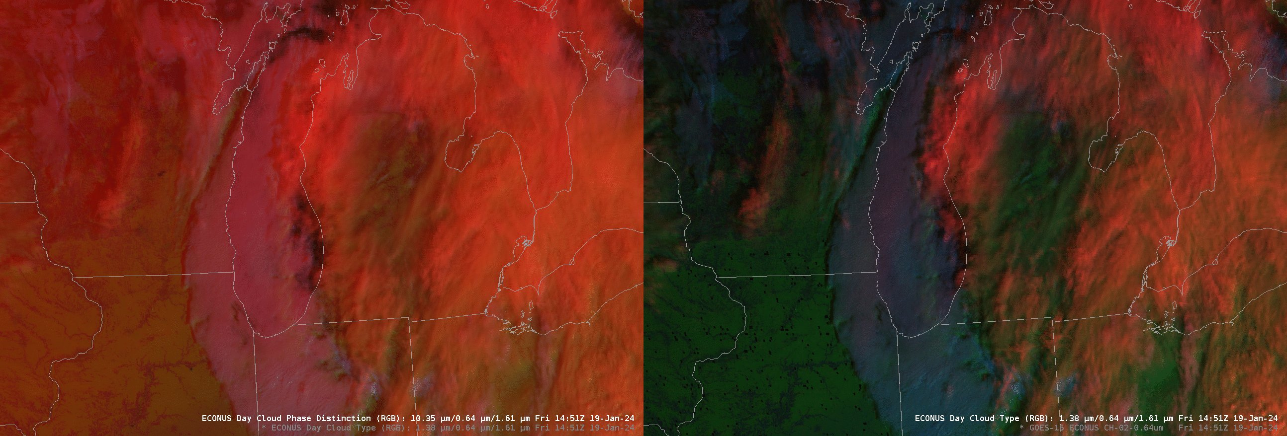
The single band is increasingly apparent in the animations below of Day Cloud Phase Distinction and Day Cloud Type RGBs. Because the airmass is very cold, the Day Cloud Phase Distinction RGB (that has as its red component the 10.3 brightness temperature) shows low-level snow-cover as much redder than in the Day Cloud Type RGB that has as it red component the 1.38 reflectance. (There is sufficient water vapor in the atmosphere that a surface reflectance signal is absorbed). Both RGBs show the mid-lake convective band as a series of discrete convective towers forming a sinuous band as it approaches the southern Lake Michigan shoreline. Shortly the end of the animation one of the towers over north central Lake Michigan is vigorous enough that LightningCast probabilities have reached 10% (click here to see the Day Cloud Type RGB at 1601 UTC) .
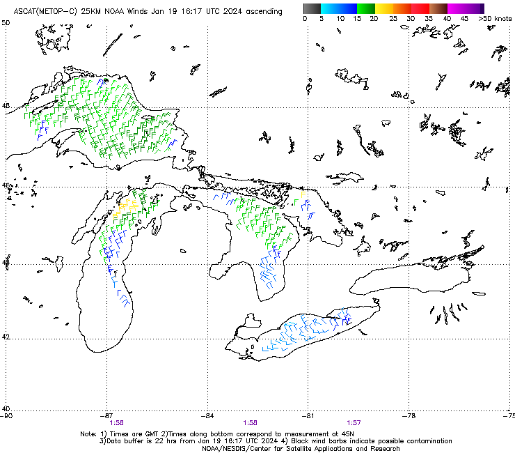
MetopC overflew the western Great Lakes shortly before 0200 UTC on 19 January 2024. Advanced Scatterometer (ASCAT) imagery from that time (source) show northeasterly winds, suggesting mid-lake convergence, along the southeast edge of the swath.
—————
Free Secure Email – Transcom Sigma
Transcom Hosting
Transcom Premium Domains