
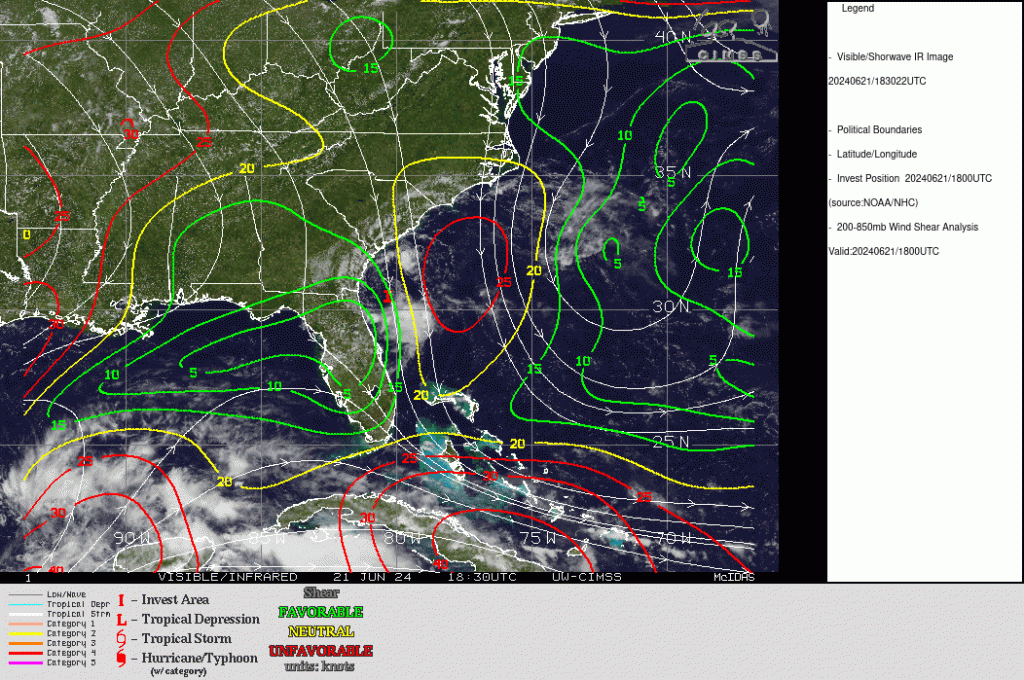
Sheared Tropical System approaching the coast of Georgia
Geosphere true-color imagery over the Atlantic Ocean to the east of Florida and Georgia, above, shows a low-level cyclonic circulation with strong convection to its south. The appearance of the system suggests strong shear; an analysis of shear from the SSEC Tropical Weather website, below, shows the northerly shear over the storm that displaces the convection.
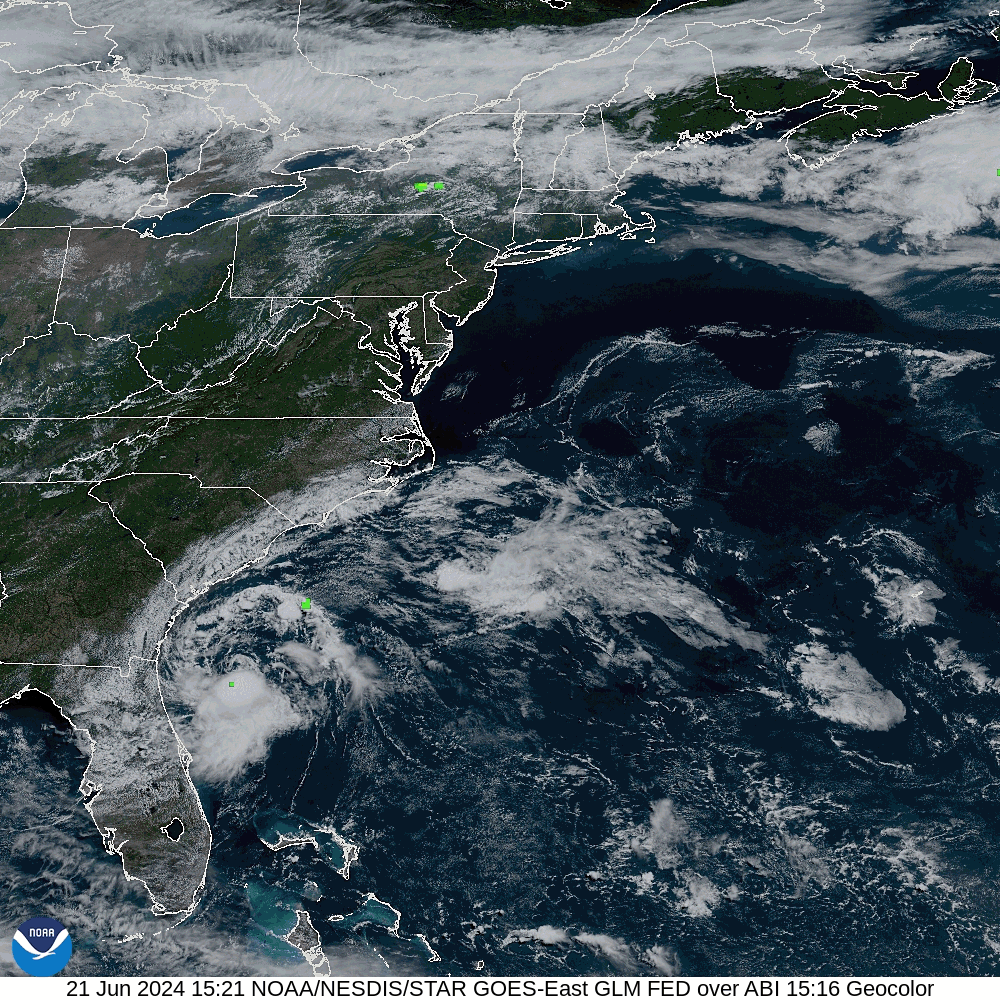
GOES-16 Geocolor imagery, overlain with GLM Flash Extent Density fields, below, (from this source), show meager lightning within the convection to the south of the low-level cyclonic circulation.
More information on this system is available at the National Hurricane Center, and from the NWS Forecast Offices in Jacksonville FL and in Charleston SC.
—————
Free Secure Email – Transcom Sigma
Transcom Hosting
Transcom Premium Domains