Severe Weather over Kansas
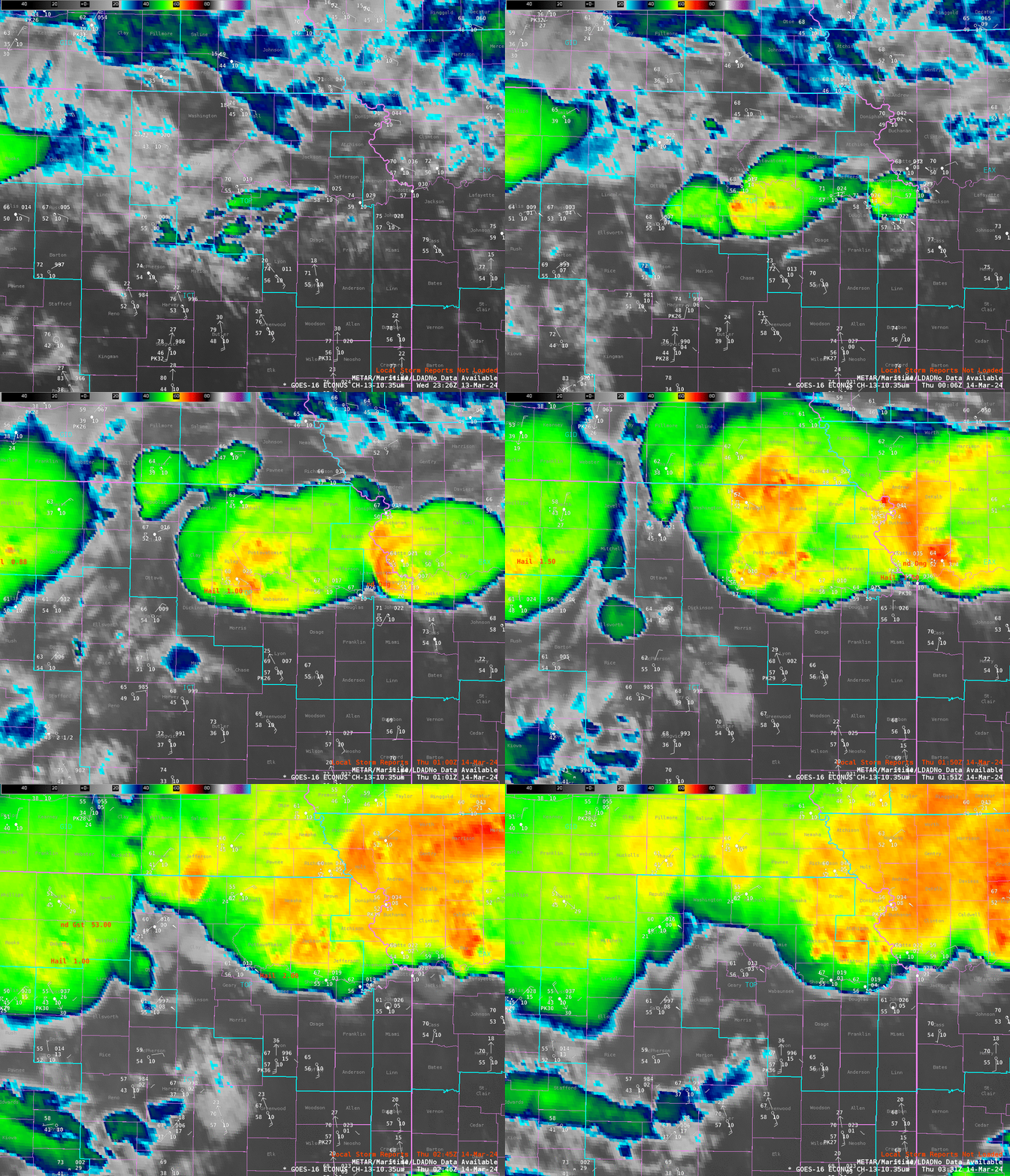
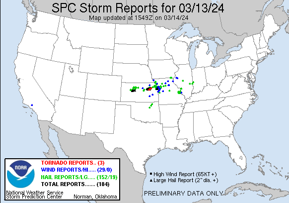
Severe weather occurred over Kansas late in the day 13 March. SPC Storm Reports, shown below, indicate three tornadoes (as of 13 March) within a swath of wind and hail reports. The animation above shows the development of the strong thunderstorms along a warm front in northern Kansas. The tornado observations are plotted between 0046 and 0146 UTC on 14 March. They occurred within the Topeka KS CWA (WFO TOP) that is outlined in the animation above.
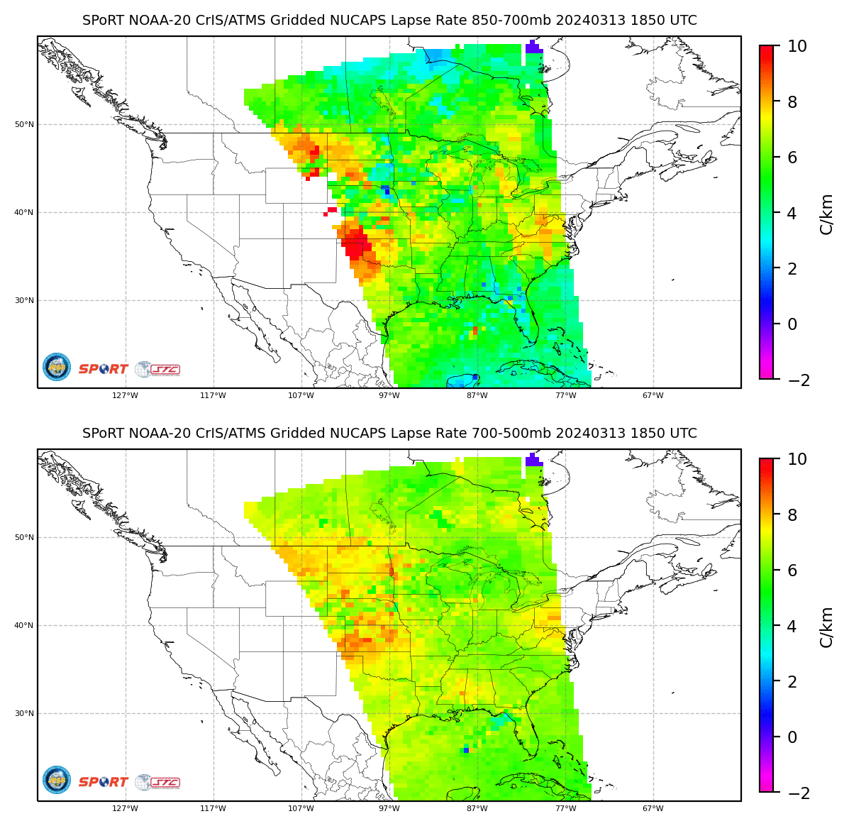
What satellite products might have been used before this outbreak to better understand or anticipate it? The toggle below shows lapse rates (700-500mb and 850-700 mb) derived from gridded NOAA-20 NUCAPS profiles (source). Steep lapse rates exist over Kansas from 700-500 mb; convection that develops there will not be impeded by stability.
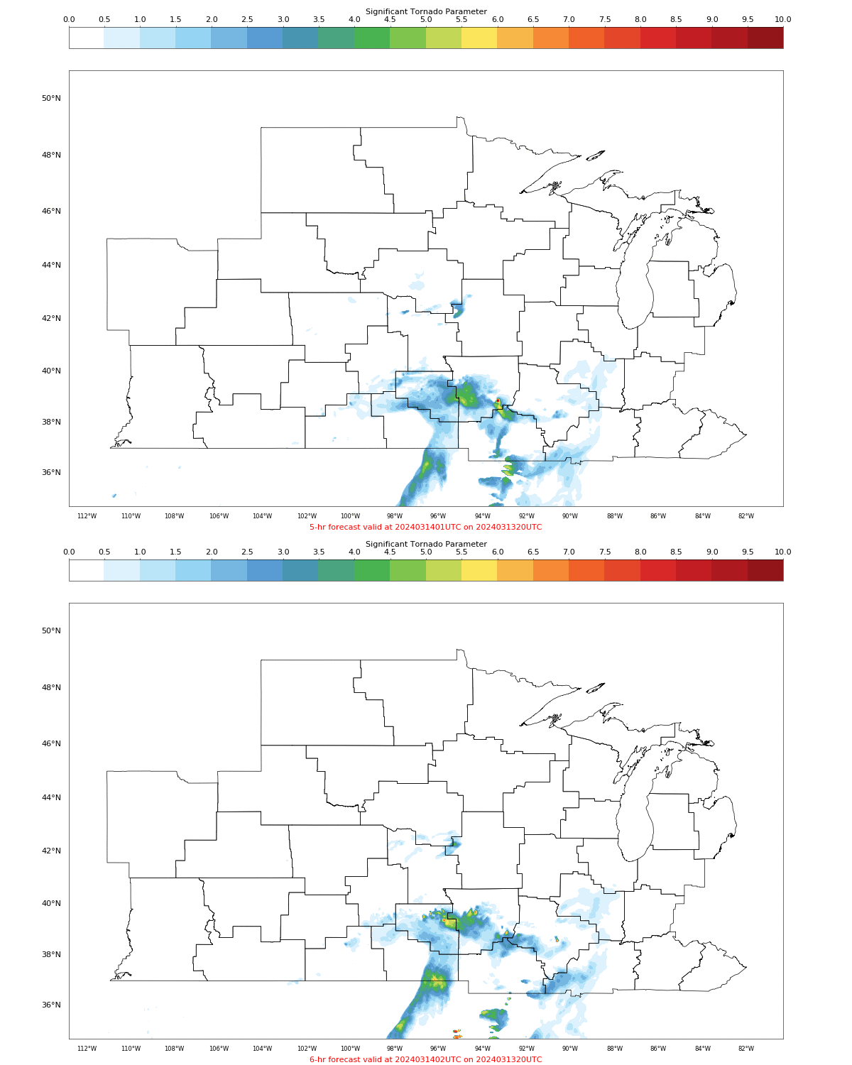
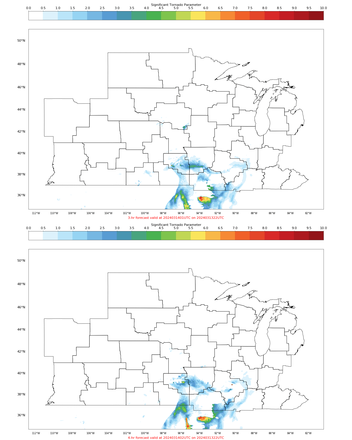
Polar Hyperspectral Soundings can be fused with ABI data to blend the high spectral resolution Polar Data with the high spatial and temporal resolution of geostationary data. That thermodynamic information can then be assimilated into a high-resolution mesoscale model to give short-term forecasts that include better moisture information. Model output is here (this model is one of the products to be demonstrated at the Hazardous Weather Testbed at the Storm Prediction Center in late May and early June). What did model output suggest. The animations below shows Significant Tornado Parameter at 0100 and 0200 UTC on 14 March (from two consecutive model runs initialized at 2000 UTC and 2200 UTC on 13 March 2024, respectively). Both model runs suggest greater tornado probabilities within the TOP CWA, as was observed.
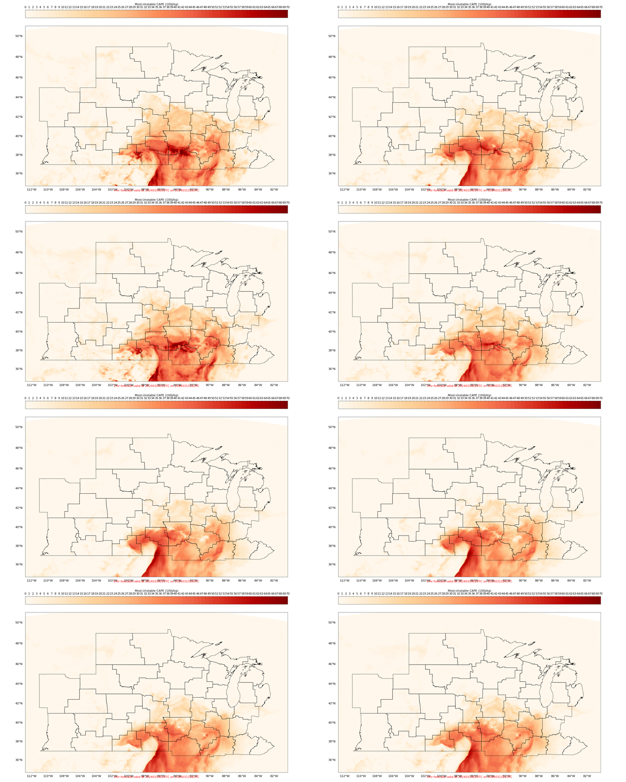
Animations of MUCAPE, below, valid at 0000, 0100 and 0200 UTC on 14 March, show the northward motion to the most unstable air through the Topeka CWA
—————
Free Secure Email – Transcom Sigma
Transcom Hosting
Transcom Premium Domains
