Severe thunderstorms in the northern High Plains

1-minute GOES-16 “Red” Visible (0.64 µm, top) and “Clean” Infrared Window (10.3 µm, bottom) images with time-matched (+/- 3 minutes) SPC Storm Reports plotted in red/blue, from 1900-2352 UTC on 10 June [click to play animated GIF | MP4]
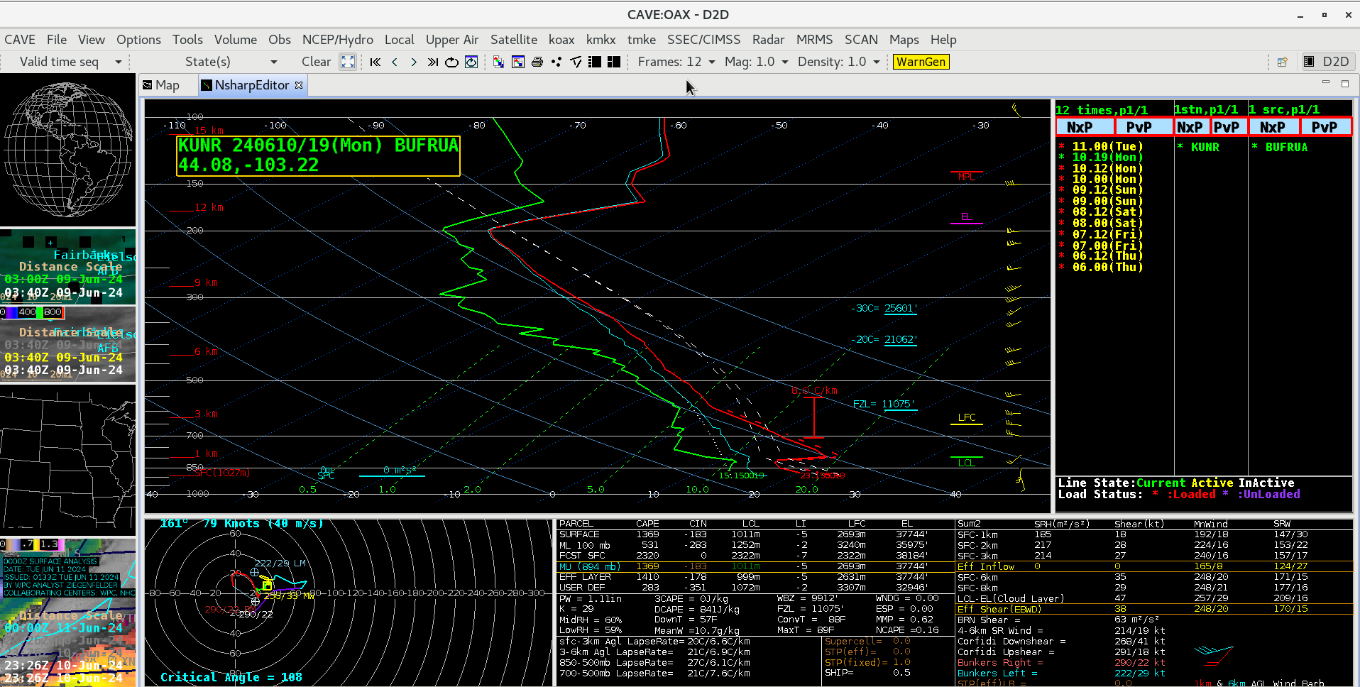
1-minute Mesoscale Domain Sector GOES-16 (GOES-East) “Red” Visible (0.64 µm) and “Clean” Infrared Window (10.3 µm) images (above) showed thunderstorms that produced hail as large as 1.75 inch in South Dakota along with wind gusts as high as 75 mph in Wyoming and Nebraska, and 74 mph in South Dakota (SPC Storm Reports | KUNR Local Storm Reports) on 10 June 2024. The Infrared images revealed thunderstorm overshooting tops that exhibited infrared brightness temperatures as cold as -65ºC (darker shades of red) — according to a plot of rawinsonde data from Rapid City, South Dakota at 1900 UTC on 10 June (below) that temperature represented a slight overshoot of the Most Unstable (MU) air parcel Equilibrium Level (EL).

Plot of rawinsonde data from Rapid City, South Dakota at 1900 UTC on 10 June [click to enlarge]

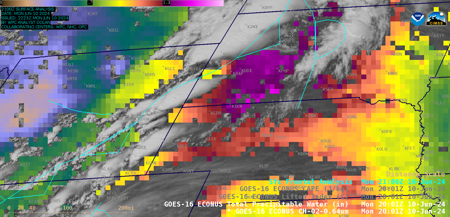
5-minute GOES-16 “Red” Visible (0.64 µm) images, combined with the Total Precpitable Water derived product in cloud-free areas, from 1801 UTC on 10 June to 0001 UTC on 11 June [click to play animated GIF | >MP4]
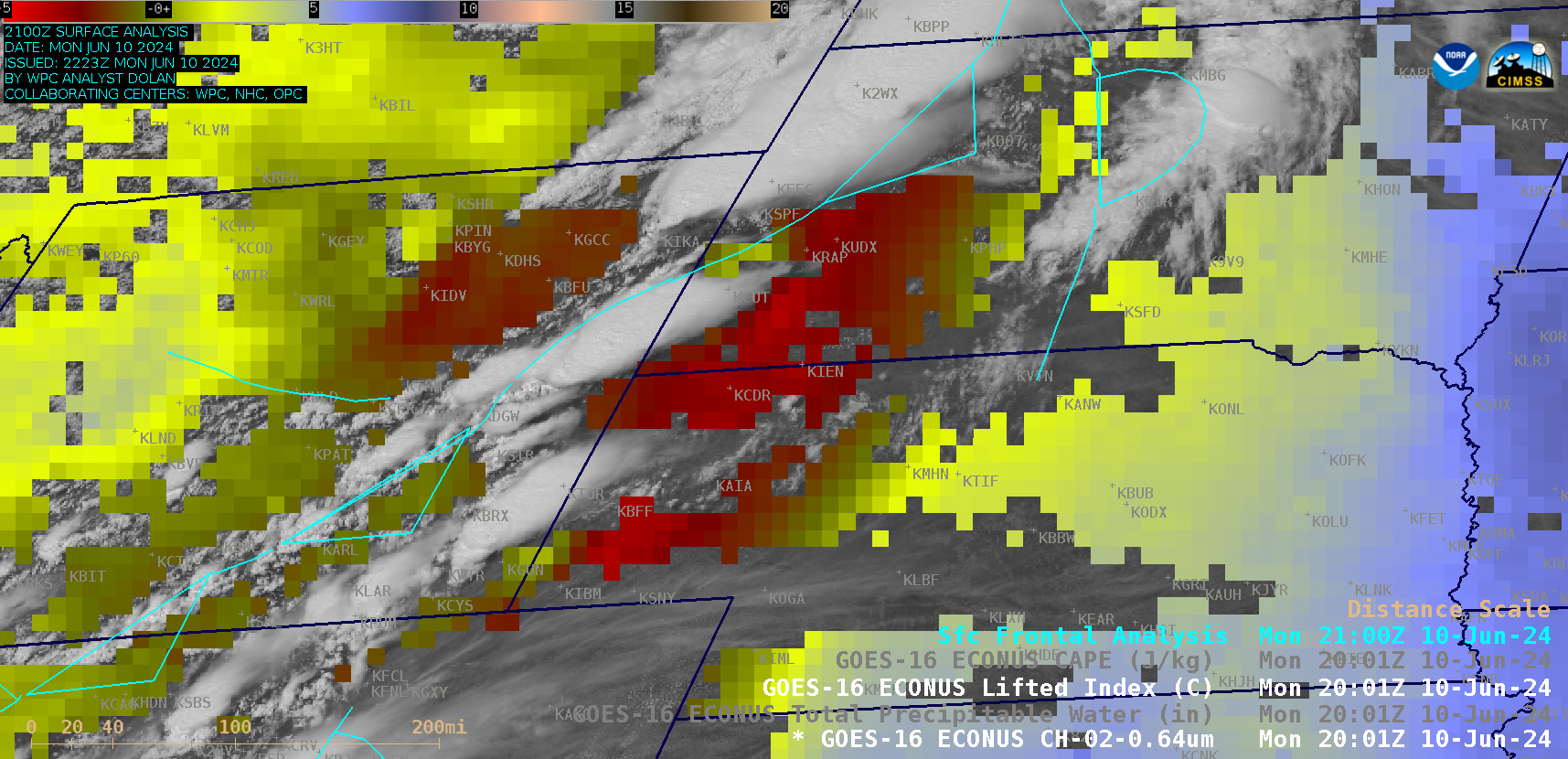
5-minute GOES-16 Visible images combined with the Total Precpitable Water (TPW) derived product (above) and the Lifted Index (LI) and CAPE derived stability indices (below) indicated that these thunderstorms developed along or just ahead of an advancing cold front — and a corridor of modest moisture (TPW values to 1.5 in) and minor instability (LI values to -4ºC and CAPE values to 850 J/kg) was in place ahead of this cold front.

5-minute GOES-16 “Red” Visible (0.64 µm) images, combined with the Lifted Index and Convective Available Potential Energy (CAPE) derived products in cloud-free areas, from 1801 UTC on 10 June to 0001 UTC on 11 June [click to play animated GIF | MP4]
—————
Free Secure Email – Transcom Sigma
Transcom Hosting
Transcom Premium Domains
