
Severe thunderstorms across southern Wisconsin
1-minute GOES-16 “Red” Visible (0.64 µm, top) and “Clean” Infrared Window (10.3 µm, bottom) images with time-matched (+/- 3 minutes) SPC Storm Reports plotted in red/blue, from 2232 UTC on 22 June to 0122 UTC on 23 June [click to play animated GIF | MP4]
1-minute Mesoscale Domain Sector GOES-16 (GOES-East) “Red” Visible (0.64 µm) and “Clean” Infrared Window (10.3 µm) images (above) showed thunderstorms that produced 5 tornadoes, hail as large as 2.00 inch in diameter and damaging wind gusts across southern Wisconsin (SPC Storm Reports) on 22 June 2024. The Infrared images revealed pulses of thunderstorm overshooting tops that exhibited 10.3 µm brightness temperatures as cold as -75ºC (brighter white pixels embedded within dark black regions).
1-minute GOES-16 Visible and Infrared images with an overlay of GLM Flash Extent Density (below) showed the lightning activity associated with these thunderstorms, which included a few brief lightning jumps.
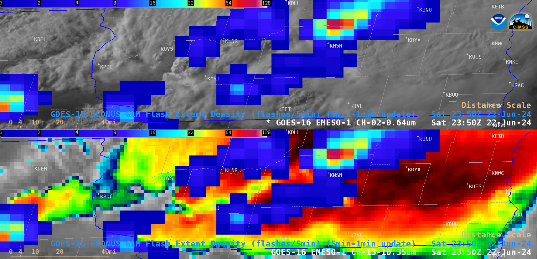
1-minute GOES-16 “Red” Visible (0.64 µm, top) and “Clean” Infrared Window (10.3 µm, bottom) images, with/without an overlay of GM Flash Extent Density, from 2230 UTC on 22 June to 0120 UTC on 23 June [click to play animated GIF | MP4]
—————
Free Secure Email – Transcom Sigma
Transcom Hosting
Transcom Premium Domains