
Satellite signatures of the GOES-U launch, from both GOES-16 and GOES-18
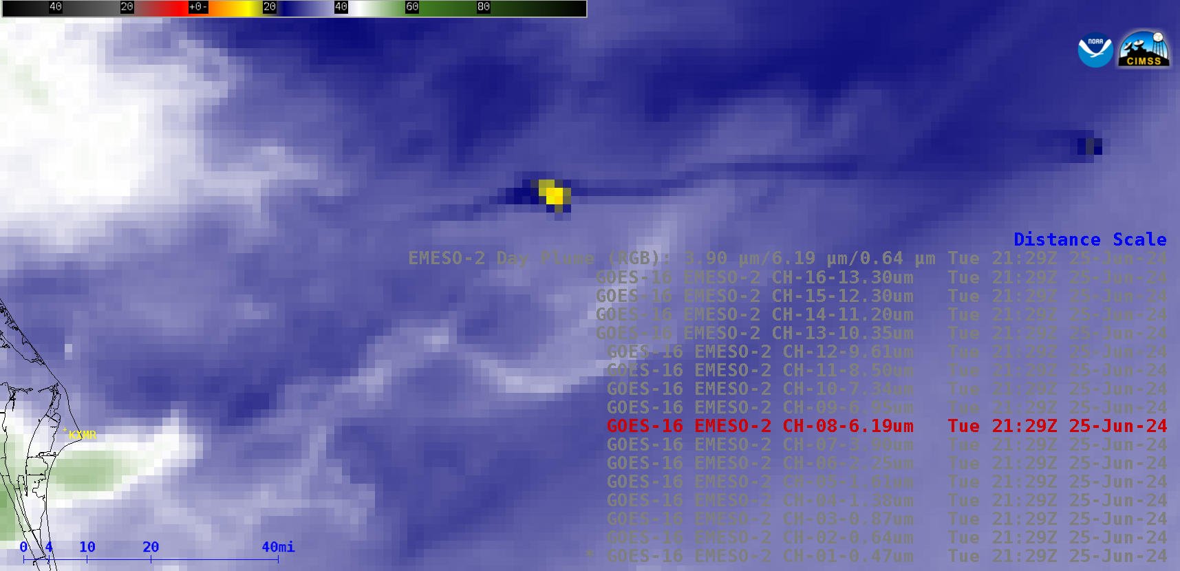
Stepped sequence of 1-minute GOES-16 images from all 16 ABI spectral bands, plus a Rocket Plume RGB; KXMR denotes the location of the Cocoa Beach rawinsonde site [click to play animated GIF | MP4]
1-minute Mesoscale Domain Sector GOES-16 (GOES-East) images from all 16 of the ABI spectral bands along with a Rocket Plume RGB (above) displayed signatures of the SpaceX Falcon Heavy rocket booster that launched GOES-U from NASA Kennedy Space Center in Florida at 2126 UTC (5:26 PM EST) on 25 June 2024. A warm thermal signature of the rocket booster (moving rapidly to the east-northeast) and/or the relatively bright in bands 01-06 or cold in bands 07-16 rocket condensation cloud (which remained just off the coast, due to wind shear with height) were evident in all 16 of the ABI spectral band images, as well as the Rocket Plume RGB imagery. One of the more notable rocket signatures was seen in imagery at 2129 UTC: the very warm thermal anomaly of the boostback burn of the two Stage 1 side boosters, along with the warm thermal anomaly of the Stage 2 engine start (located farther downrange).
30-second images from GOES-18 (GOES-West) are shown below.
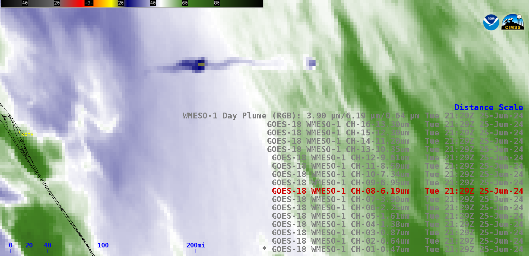
Stepped sequence of 30-second GOES-18 images from all 16 ABI spectral bands, plus a Rocket Plume RGB; KXMR denotes the location of the Cocoa Beach rawinsonde site [click to play animated GIF | MP4]
1-minute GOES-16 Visible/Infrared Sandwich RGB images with/without an overlay of GLM Flash Extent Density (below) showed the cold overshooting tops and lightning activity associated with a small cluster of thunderstorms that was moving eastward toward the coast — at the 2126 UTC launch time, the edge of a thunderstorm anvil (and its associated lightning) was about 20 miles southwest of Launch Complex 39A at Kennedy Space Center (where the Falcon Heavy condensation cloud originated).
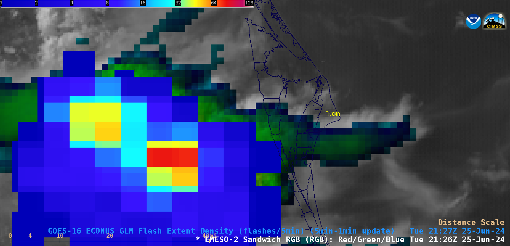
1-minute GOES-16 Visible/Infrared Sandwich RGB images with/without an overlay of GLM Flash Extent Density; KXMR denotes the location of the Cocoa Beach rawinsonde site [click to play animated GIF | MP4]
Note that the Falcon Heavy condensation cloud became sheared, and eventually began drifting back toward the coast — a plot of rawinsonde data (source) from Cocoa Beach KXMR (below) depicted the shift to northeasterly winds at the 100 hPa pressure level (an altitude of about 17-18 km).
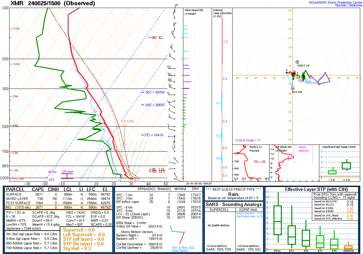
Plot of rawinsonde data from Cocoa Beach (KXMR) at 1500 UTC on 25 June [click to enlarge]
—————
Free Secure Email – Transcom Sigma
Transcom Hosting
Transcom Premium Domains