Rain Chances over American Samoa
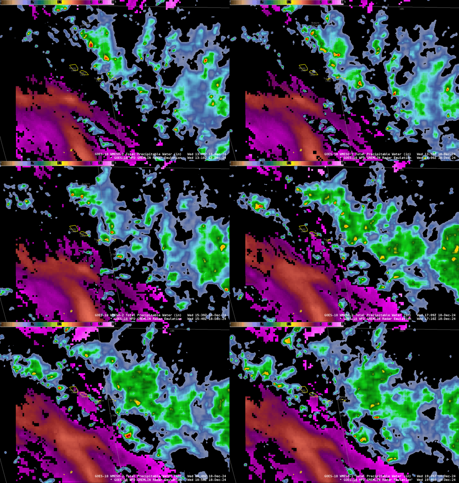
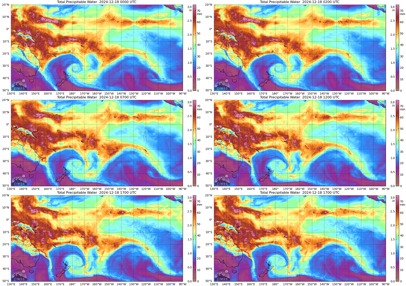
The possibility of heavy rain over the Samoan islands led the Pacific Region to request 1-minute imagery over American Samoa, imagery that ended at 2107 UTC on 18 December when the domain was moved to cover the southwestern US (where a significant fire risk was occurring on 18 December). GREMLIN observations from 13-19 UTC on 18 December, shown below with Total Precipitable Water (TPW), suggest the heaviest rains were over the Manu’a Islands to the east of Tutuila Island. Note the region of slightly drier air — TPW < 2″ — (orange/rust in the enhancement) south of the Samoan Islands, where TPWs are closer to 2.3″ (magenta in the enhancement).
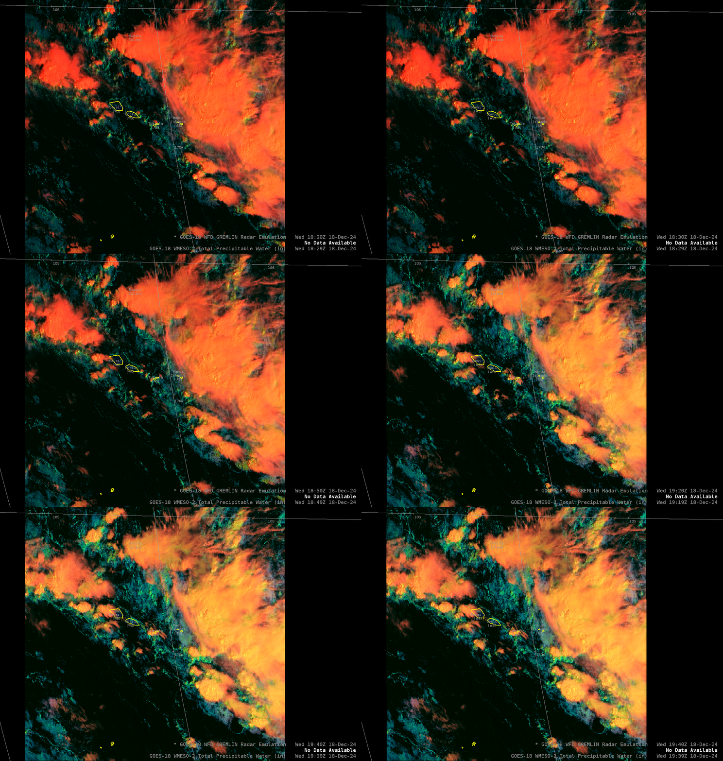
Day Cloud Phase Distinction fields as sun rose over Samoa on 18 December show convection developing over the main Samoan Islands as active convection continues to the east. (Click here for the Day Cloud Phase Distinction overlain by GREMLIN).
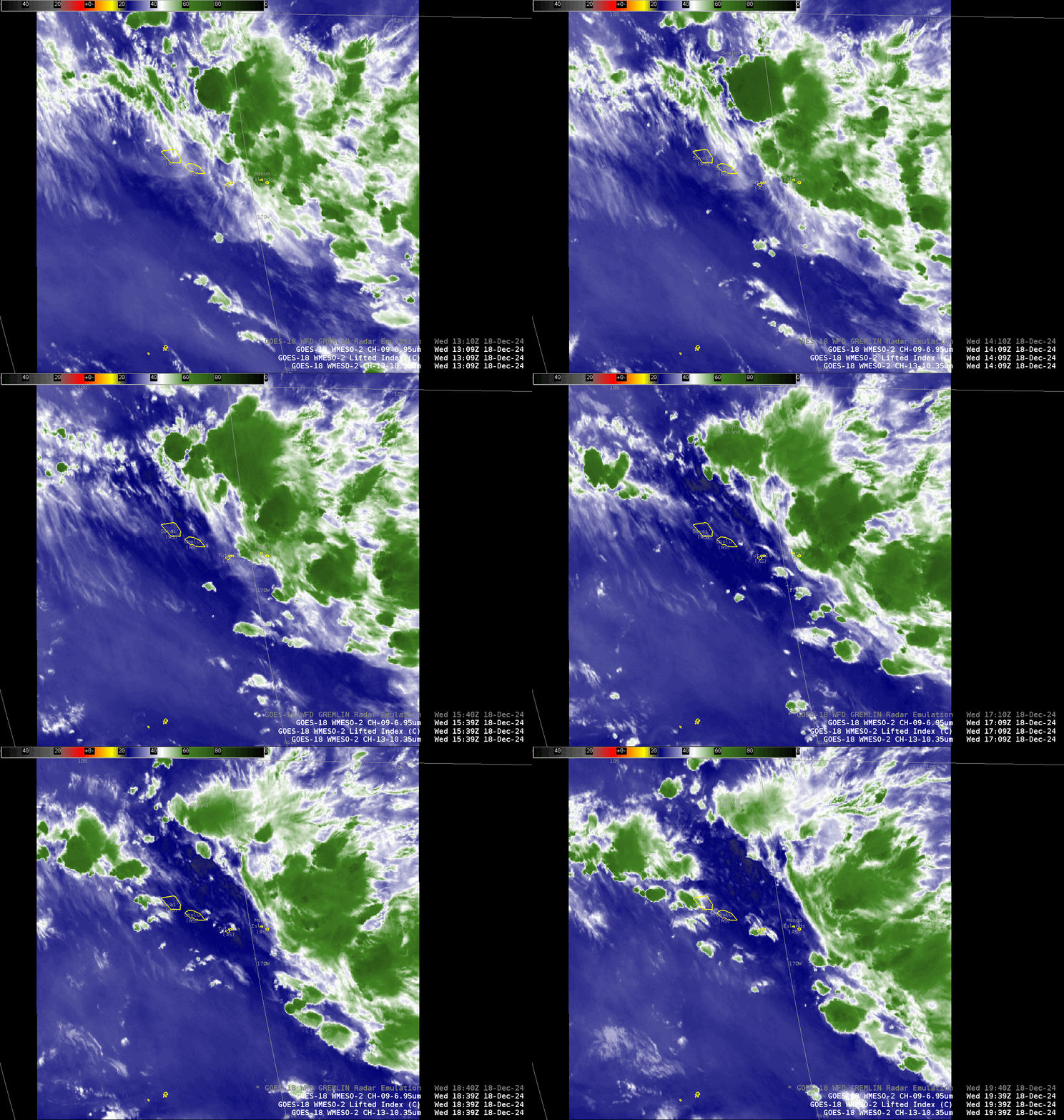
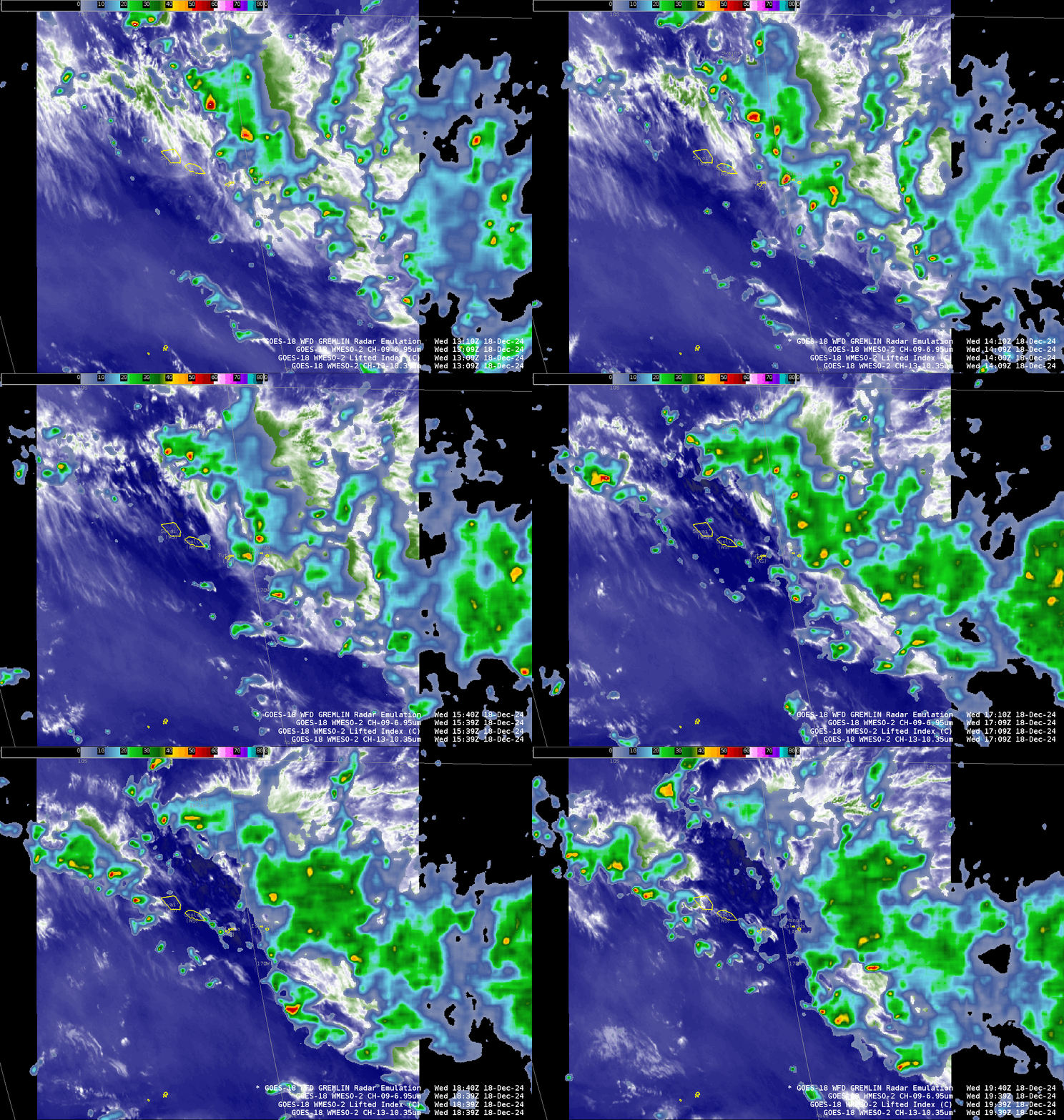
One of the ABI fields used in the Machine Learning algorithm that estimates radar echoes is Band 9 (Mid-level water vapor at 6.95 µm). The animations below show Band 9 and also Band 9 overlain with GREMLIN.
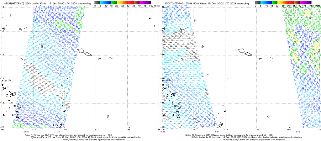
What kind of winds accompanied this convection? ASCAT observations can give a hint, as the observations below from Metop-C show. However, large regions are unsampled.
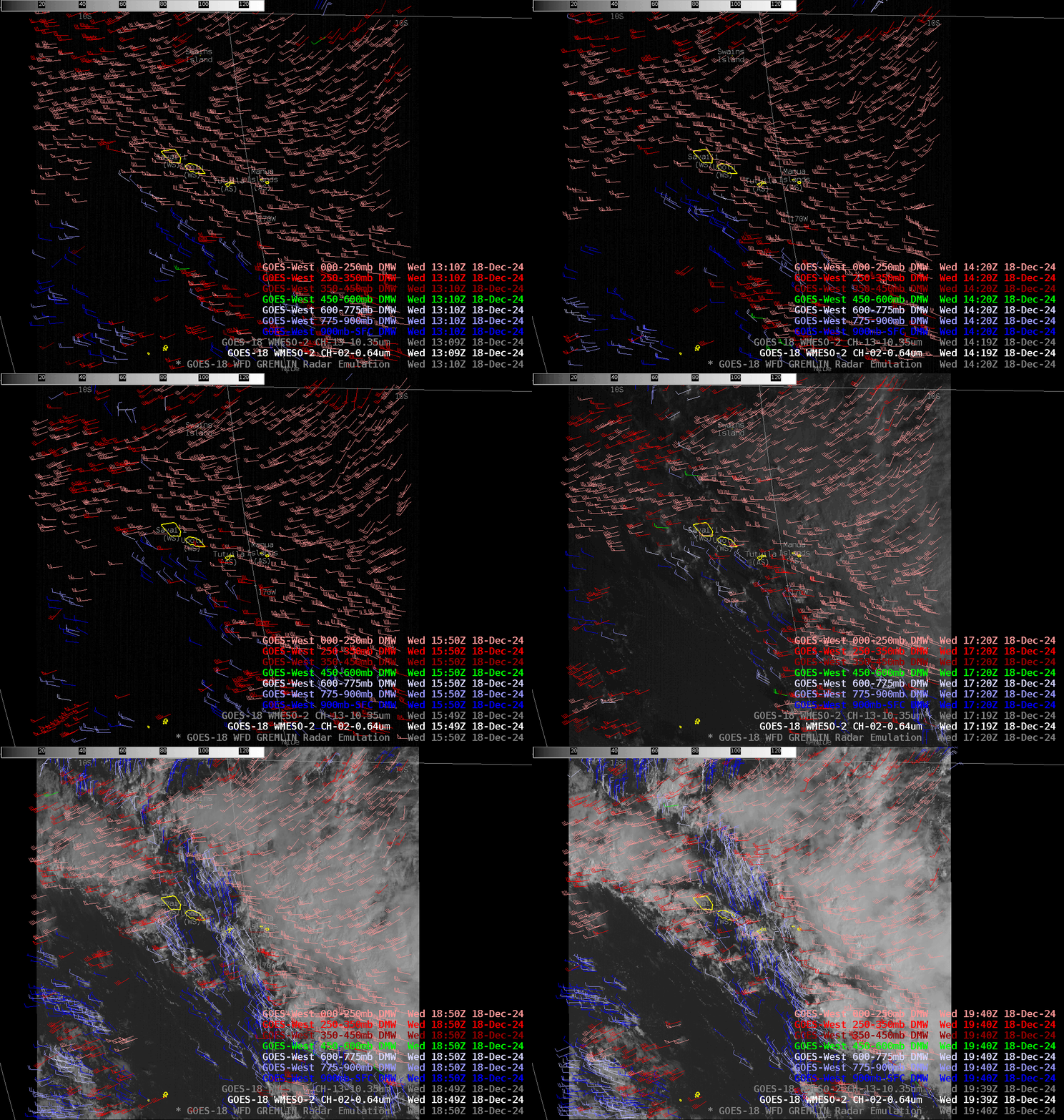
Derived Motion Winds calculated from GOES-18 imagery (Bands 2, 7, 8, 9, 10, 14) can give wind information, and values are shown below. Low-level winds (violet and dark blue in the imagery below) are from the northwest whereas upper-level winds (shades or red) are from the southwest, so there is considerable shear over the Islands (Here is a still image from 1940 UTC). There is a noticeable increase in the number of derived wind vectors as the sun rises and visible imagery becomes available! Low level winds are not moving the dry air to the southwest of Samoa over the islands.
Microwave estimates of TPW, below, taken from the MIMIC website, also show Samoa deep within the moisture of the South Pacific Convergence Zone. Heavy rain chances will likely continue there for the next few days.
GREMLIN fields for GOES-West are also available here on the CIRA SLIDER. Finally, maybe you’re wondering why, if the Mesoscale sector was over Samoa, didn’t I show 1-minute imagery!? I matched the time increment to that of the GREMLIN product, which is a full-disk field, produced every 10 minutes.
—————
Free Secure Email – Transcom Sigma
Transcom Hosting
Transcom Premium Domains
