
Prescribed burning in the Flint Hills of Kansas and Oklahoma

GOES-16 True Color RGB images, from 1501 UTC on 04 April to 0016 UTC on 05 April [click to play MP4 animation]
5-minute CONUS Sector GOES-16 (GOES-East) True Color RGB images from the CSPP GeoSphere site (above) displayed smoke plumes from widespread prescribed burning in the Flint Hills of eastern Kansas and Oklahoma on 04 April 2024. There were also dense smoke plumes originating from another cluster of prescribed burns in the vicinity of the Oklahoma/Arkansas border.
GOES-16 “Red” Visible (0.64 µm) images with an overlay of the Fire Mask derived product (a component of the GOES Fire Detection and Characterization Algorithm FDCA) depicted the areal coverage and diurnal behavior of the fire thermal signatures (below). A similar animation using the GOES-16 Fire Power derived product is available here: GIF | MP4.
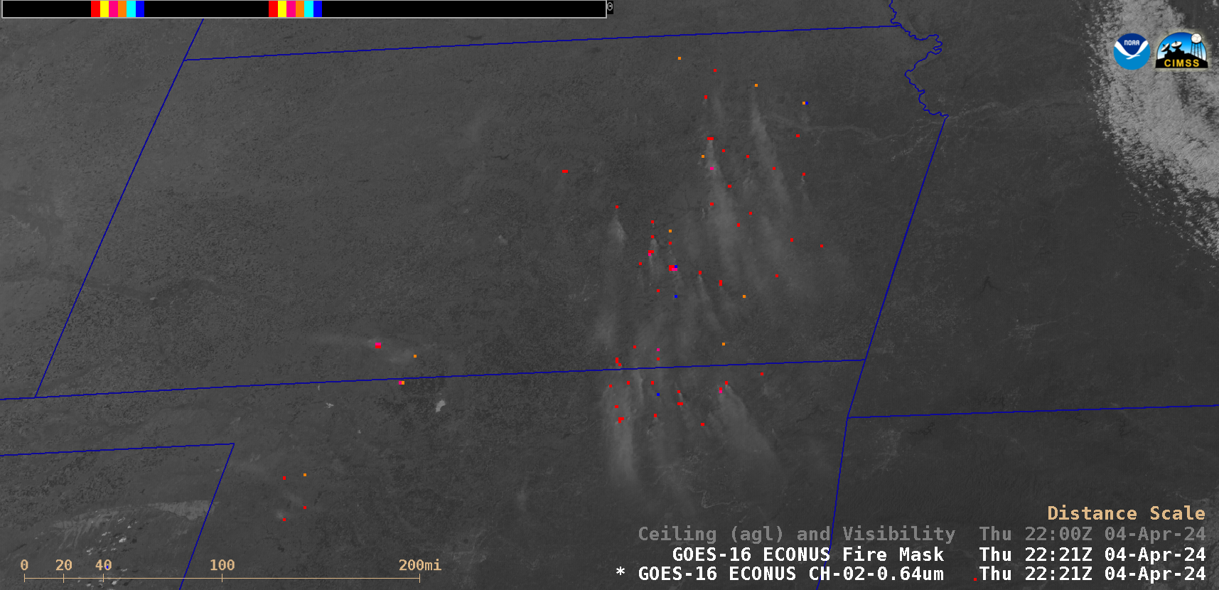
GOES-16 “Red” Visible images + an overlay of the GOES-16 Fire Mask (with/without surface plots of Ceiling and Visibility), from 1401 UTC on 04 April to 0016 UTC on 05 April [click to play animated GIF | MP4]
Judging from the surface reports, most of the smoke appeared to have been dispersed above the boundary layer (a few locations intermittently reported the base of the smoke layer to be in the 2200-4400 ft range) — but the surface visibility was briefly reduced by smoke to 4-6 miles at sites such as Emporia, Kansas and Claremore, Oklahoma (below).
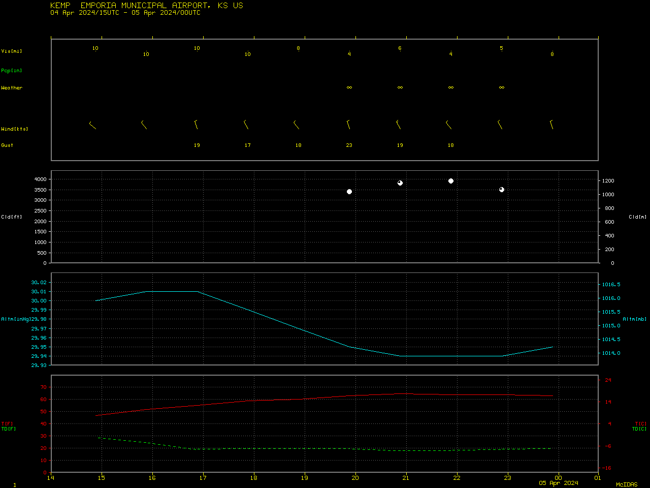
Plot of surface report data from Emporia, Kansas [click to enlarge]
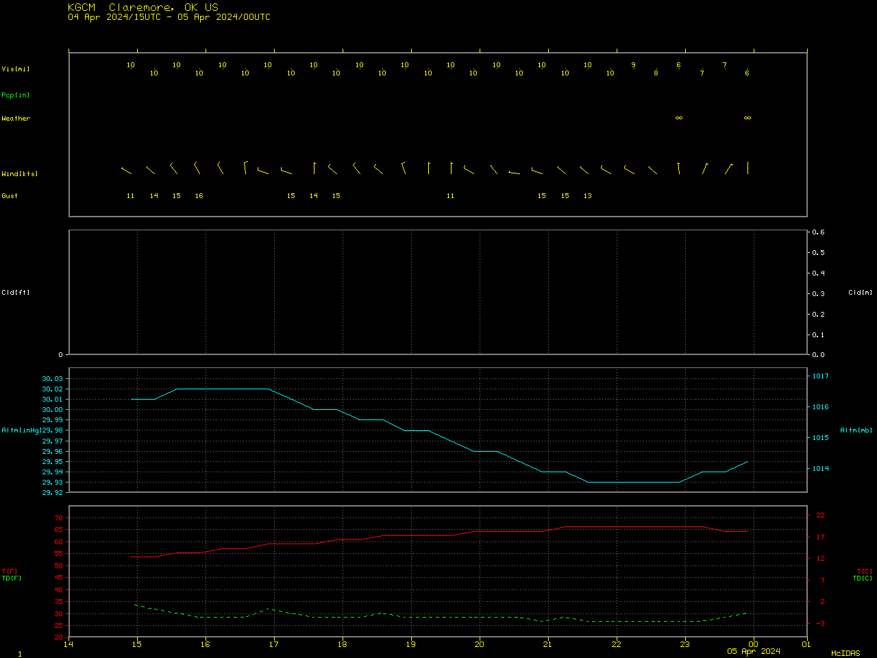
Plot of surface report data from Claremore, Oklahoma [click to enlarge]
Previous examples of the annual Flint Hills prescribed burn activity during the Spring season have been documented on this blog in 2022, 2019, 2017,and 2010.
—————
Free Secure Email – Transcom Sigma
Transcom Hosting
Transcom Premium Domains