Polar Low over the Bering Sea

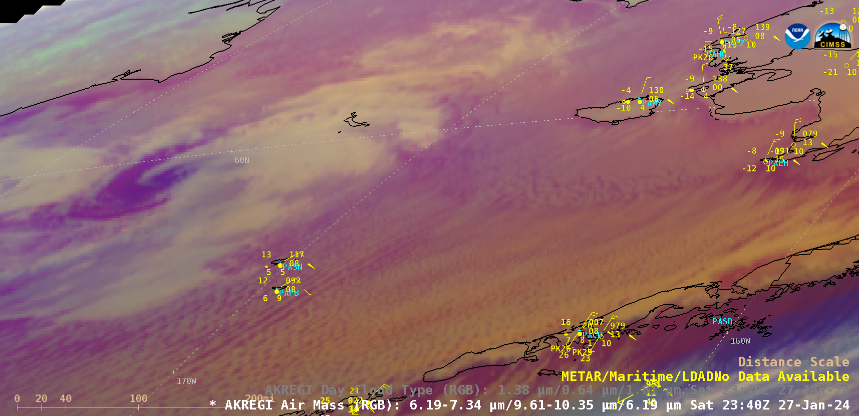
GOES-18 Air Mass RGB images, from 1450 UTC on 27 January to 1820 UTC on 28 January [click to play animated GIF | MP4]
10-minute Full Disk scan GOES-18 (GOES-West) Air Mass RGB images (above) showed a compact polar low as it migrated southeastward across the Bering Sea (not far south of the sea ice edge: surface analyses) on 27-28 January 2024. As the polar low moved through the Pribilof Islands on 28 January, St Paul Island (PASN) experienced a peak wind gust of 59 knots (68 mph) at 1216 UTC, and St. George (PAPB) had a peak wind gust of 47 knots (54 mph) at 1445 UTC. In addition, at PASN the surface visibility was restricted to 1/4 mile with heavy snow as the polar low passed through the Pribilofs.
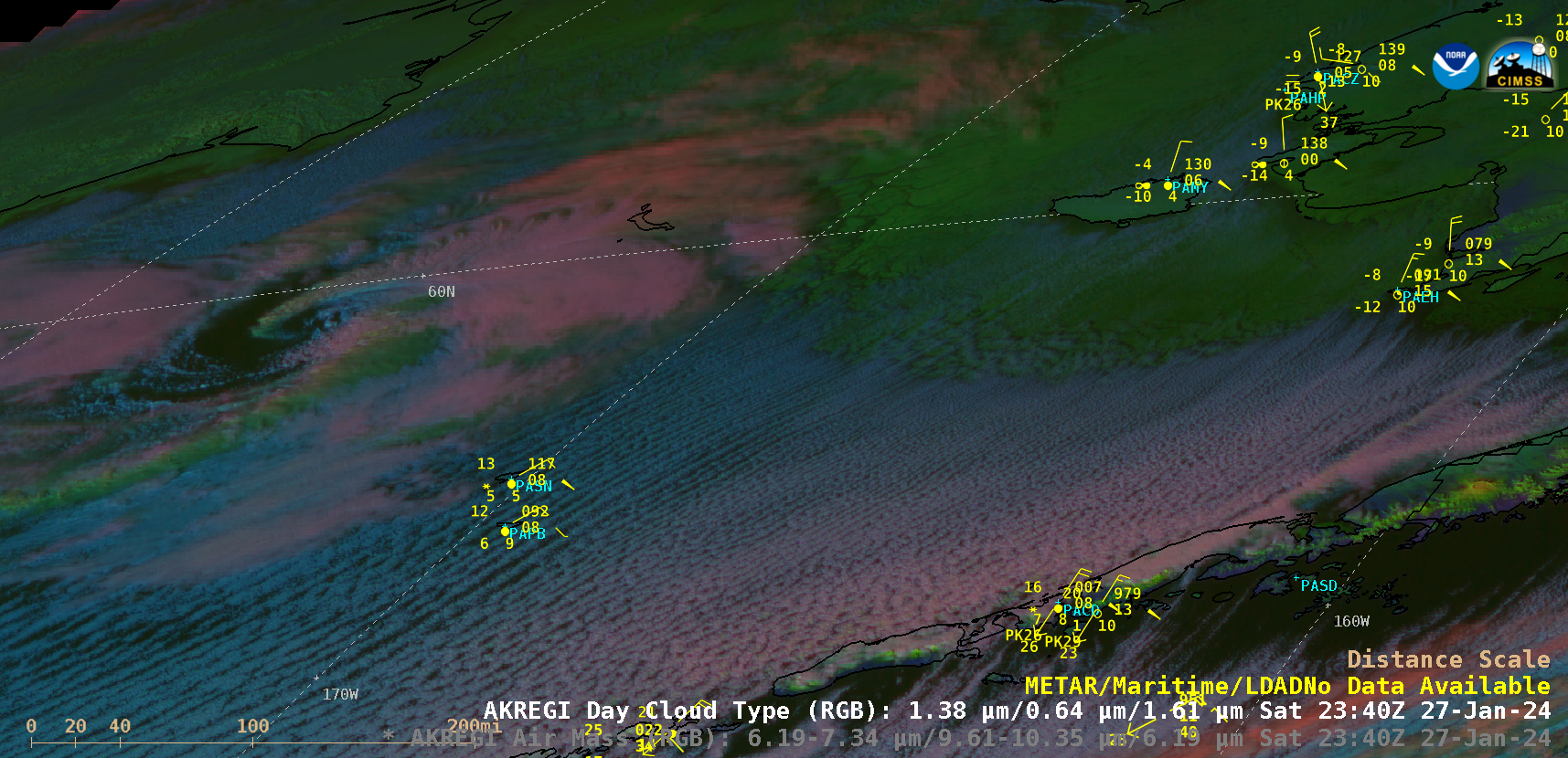
During the relatively brief ~4 hour period of daylight hours on 27 January, GOES-18 Day Cloud Type RGB images (below) displayed a signature near the core of the polar low — and along its trailing cold front — suggestive of glaciating shallow convective clouds (darker shades of green). With the strong offshore flow of very cold arctic air from Southwest Alaska, widespread parallel cloud streets were evident across the open water of the Bering Sea (likely causing areas of ocean effect snow).

GOES-18 Day Cloud Type RGB images, from 2120 UTC on 27 January to 0120 UTC on 28 January [click to play animated GIF | MP4]
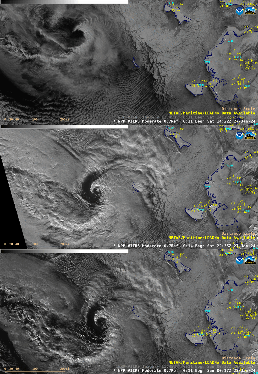
A sequence of 3 Suomi-NPP VIIRS Day/Night Band images (below) provided further evidence of shallow convective cloud banding near the low center and along the cold front.

Suomi-NPP VIIRS Day/Night Band (0.7 µm) images, from 1422 UTC on 27 January to 0017 UTC on 28 January [click to enlarge]
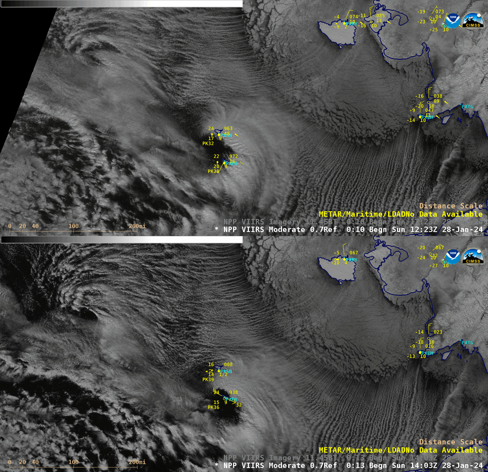
Suomi-NPP VIIRS Day/Night Band images at 1223 UTC and 1403 UTC on 28 January (below) showed 2 nighttime views of the polar low as it was in the vicinity of the Pribilof Islands.

Suomi-NPP VIIRS Day/Night Band (0.7 µm) images, at 1223 UTC and 1403 UTC on 28 January [click to enlarge]
—————
Free Secure Email – Transcom Sigma
Transcom Hosting
Transcom Premium Domains
