
PHS model output during Day 3 of Week 2 at HWT
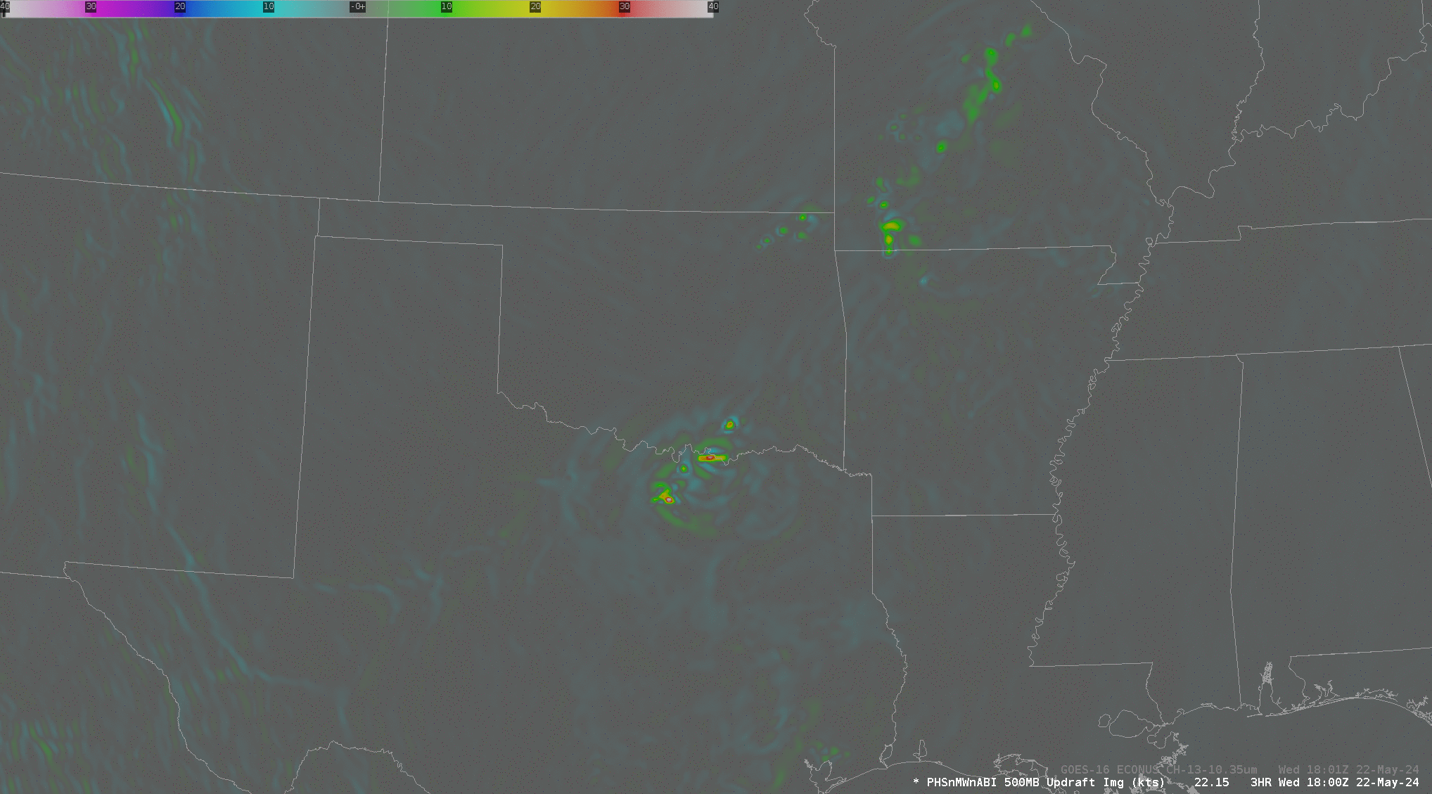
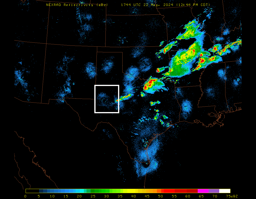
The San Angelo TX forecast office (WFO SJT) was an area of focus during HWT at SPC on 22 May. This blog posts includes observations about how the model performed (other observations on PHS performance are in the HWT Blog here). The animation above shows updraft velocity at 500mb over the course of the afternoon. Strong convection developed during this time over the San Angelo WFO County Warning Area. What did the radar show? The animation below, from 1744 to 2054 UTC, shows a splitting cell within the white box after about 2000 UTC. Does the modeled convection above show a similar splitting behavior? An argument for yes can be made, although It’s hard to tell for certain given the 1-hour time step (A note on the timing of the convection: on 22 May 2024, all of the Convection-Allowing Models — CAMs — were late in developing convection). GOES-16 imagery below also shows the storm split.
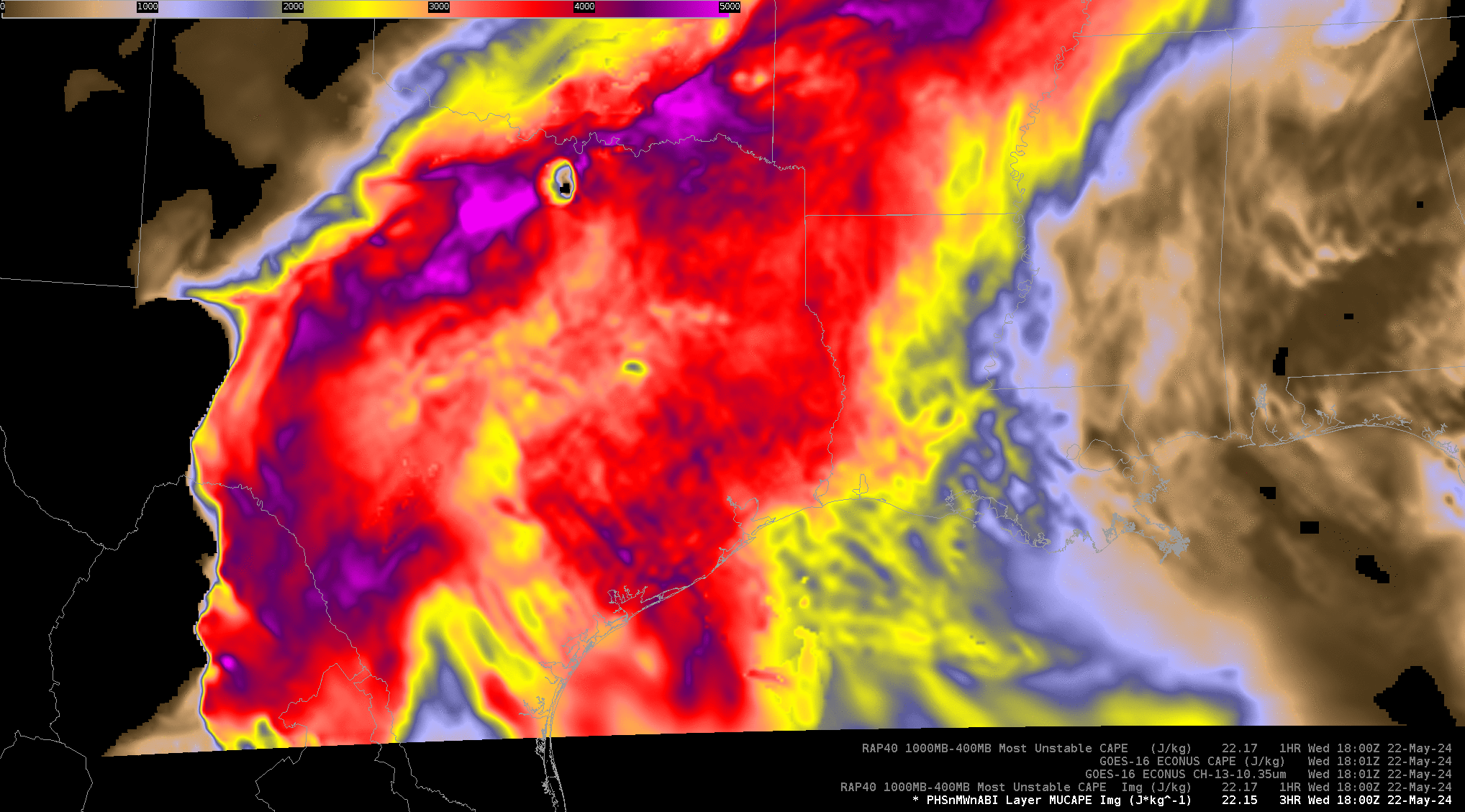
I also compared instability values on this day, both from the RAP-40km model run, from PHS, and from GOES-16. Those are shown in the toggle below. Note the PHS CAPE minimum under the strong convection over north-central Texas that is shown in the plot with GOES-16 CAPE that is clear-sky only. Overall, there is good agreement in the distribution of CAPEs
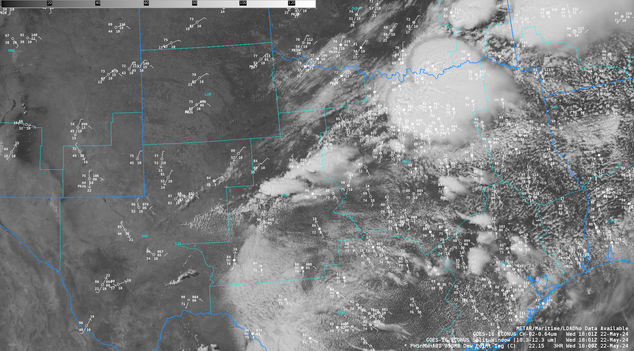
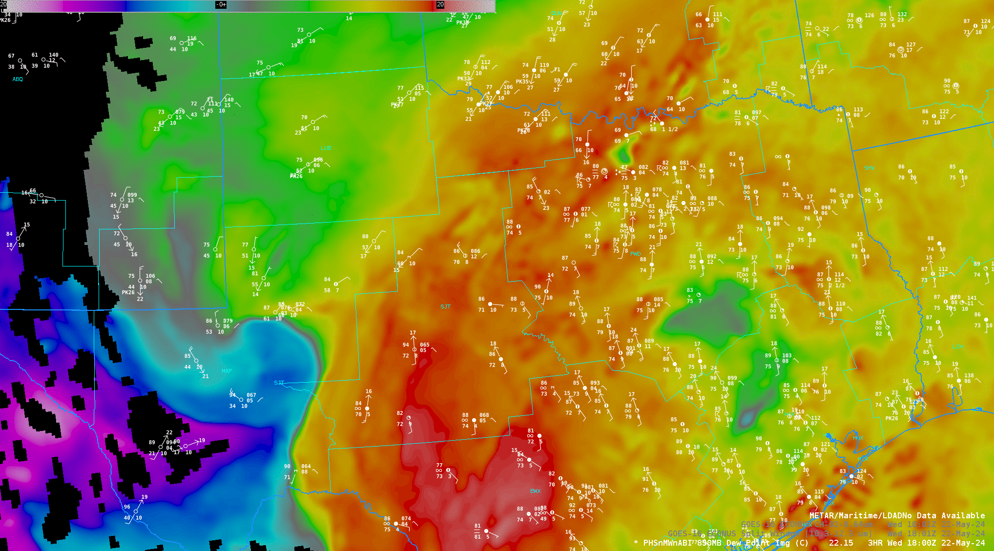
One thing that struck my eye in the 850-mb dewpoint field from PHS, shown below, was the notch of drying over southwest Texas, mostly west of WFO SJT. There’s fair agreement between that modeled dry air at 850 mb and the plotted surface dewpoints.
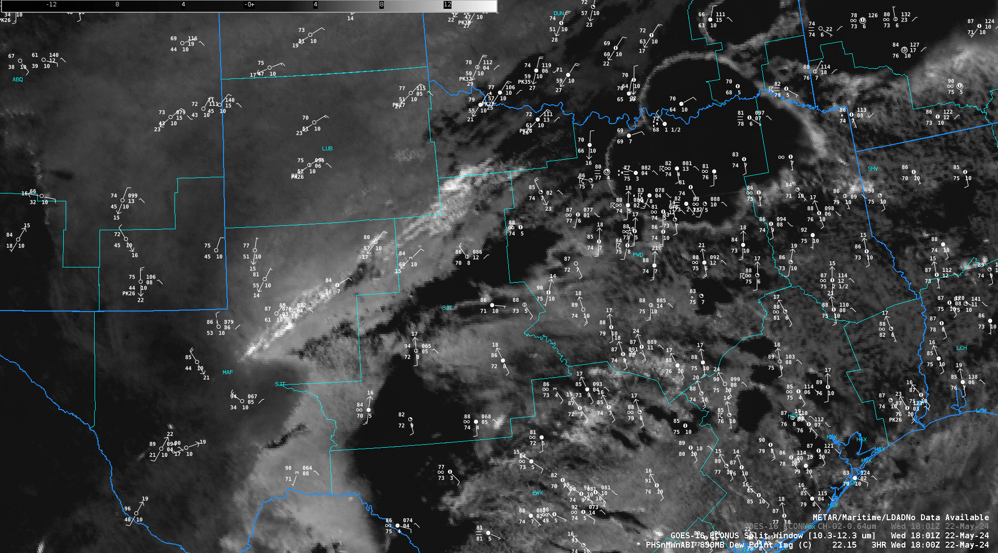
The GOES-16 Split Window Difference field for the same time shows a similar notch of dry air (that pinches off by 2300 UTC). In the enhancement used below, the dry air over west Texas is darker, the moist air over WFO SJT is lighter. Convection that develops as the dry slot pinches off shows as black in the enhancement below, and is also apparent in the GOES-16 visible imagery shown above.
HWT continues through Thursday 23 May 2024 in Norman.
—————
Free Secure Email – Transcom Sigma
Transcom Hosting
Transcom Premium Domains