Parade of tropical cyclones across the western Pacific
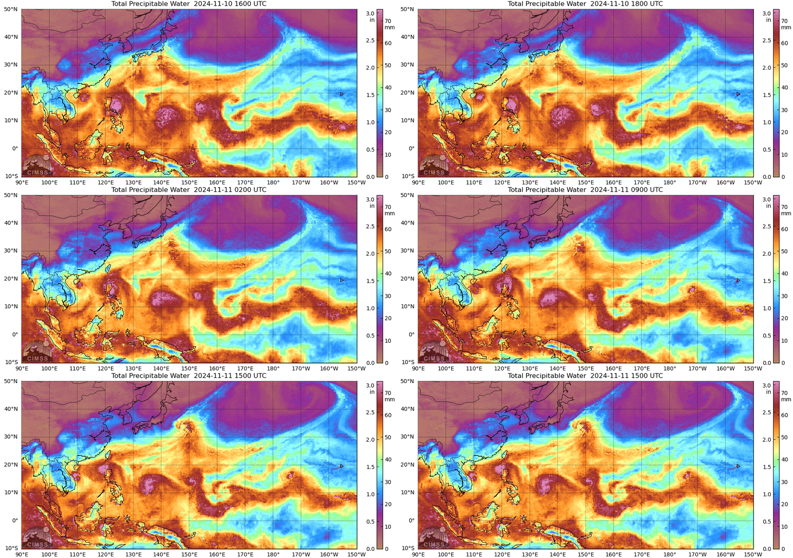
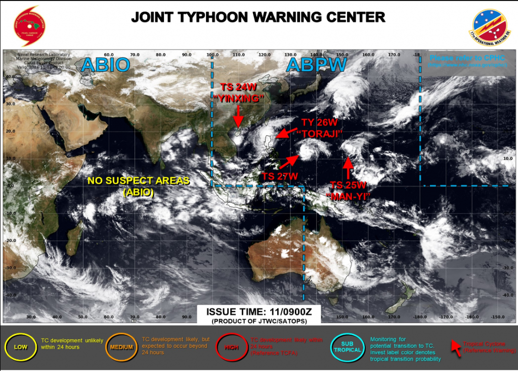
Total Precipitable Water fields over the western Pacific on 10/11 November 2024, above, show 4 tropical cyclones at different stages of development across the West Pacific. The screenshot from the Joint Typhoon Warning Center, below, shows the 4 storms: Yinxing, about to make landfall in Vietnam, Toraji pulling away from the northern Philippines, Tropical Storm 27W in between the Marianas and the Philippines, and Man-yi moving through the Marianas. This screenshot from the CIMSS Tropical Weather website similarly shows the 4 storms lined up in a row.
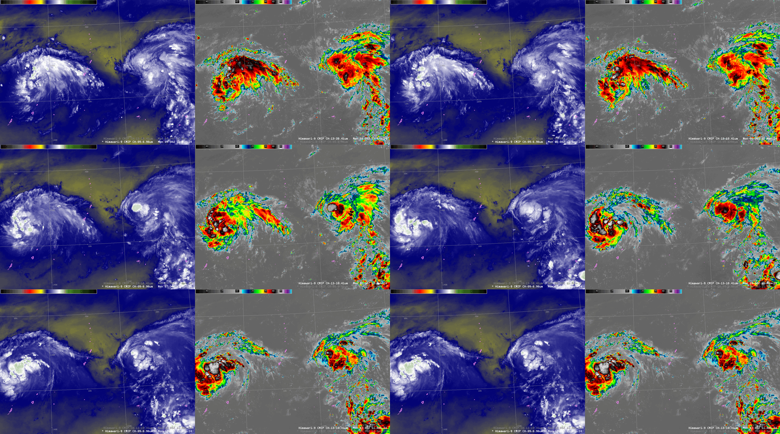
Himawari-9 imagery, below, shows the two easternmost tropical cyclones. Mid-level water vapor imagery shows dry(ish) mid-level air between the two systems; total precipitable water imagery from (say) 1200 UTC on 11 November also shows a filament of relatively dry air that might influence the development of Man-yi, the easternmost system, in the short term. Clean window infrared imagery shows strong convection intermittently over both systems.
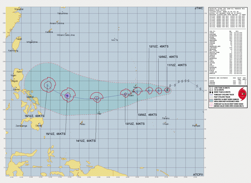
The Joint Typhoon Warning Center suggests Man-Yi will move mostly west towards Guam, affecting the Marianas between 0000 and 1200 UTC on 13 November (this is late in the day on the 13th on Guam). As noted in this Facebook Live recording (from the Science and Observation Officer on Guam), the forecast path for Man-Yi has been evolving with time. Interests throughout the Marianas and Micronesia show pay attention to advisories on this storm, both from JTWC and from the National Weather Service on Guam.
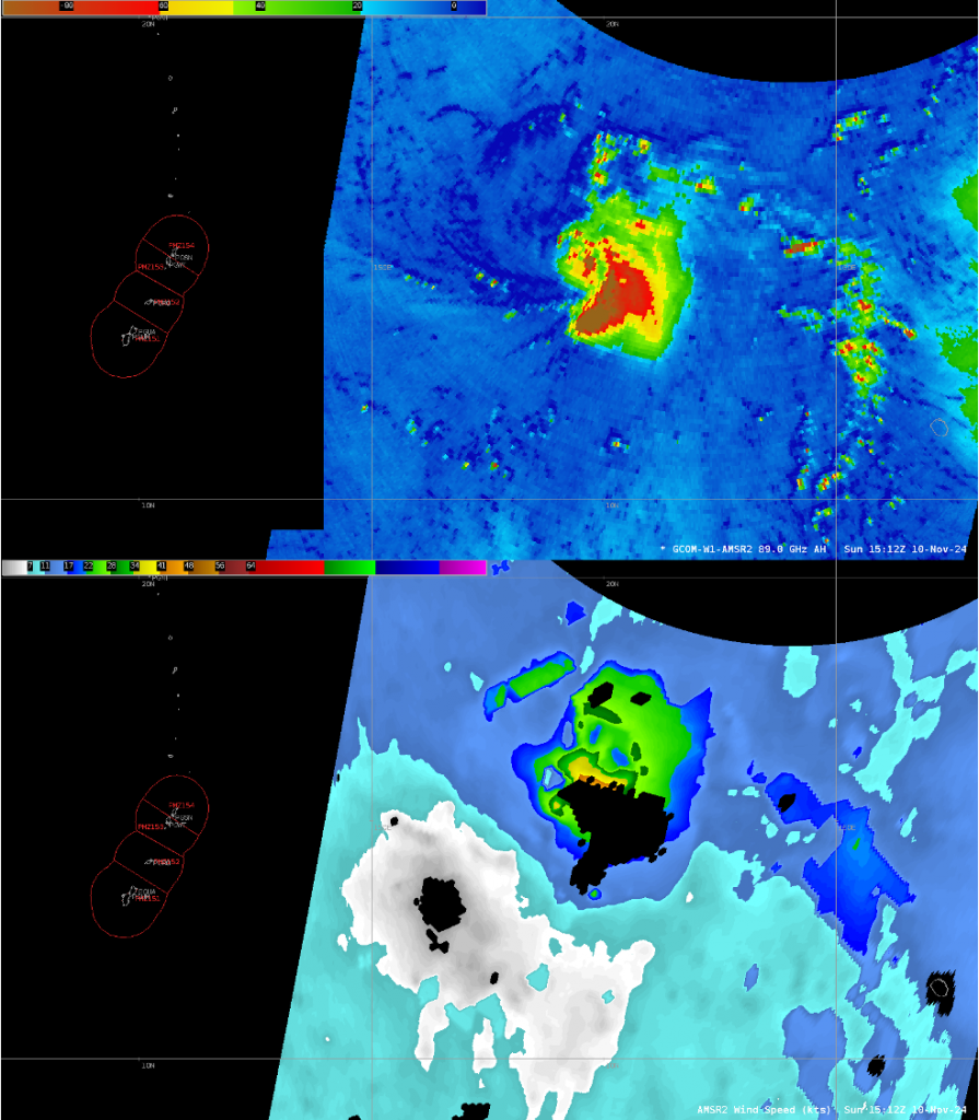
On 10 November, GCOM-W1 overflew the developing system. Microwave information at 89 GHz is shown below with derived AMSR-2 surface wind speeds (imagery from Brandon Aydlett, SOO at NWS Guam); the imagery was produced by CSPP software operating on data downloaded at the Direct Broadcast antenna on Guam. Microwave data revealed a sheared system. A low-level swirl is centered near 16oN Latitude, 154oE Longitude, note the curved bands to the west and north (darker blue in the enhancement) and deep convection (yellow/red/brown in the enhancement) to the southeast of the low-level swirl. Derived wind speeds show values exceeding 40 knots underneath the strongest convection. (You can view AMSR-2 windspeed at the NASA Worldview site as well here)
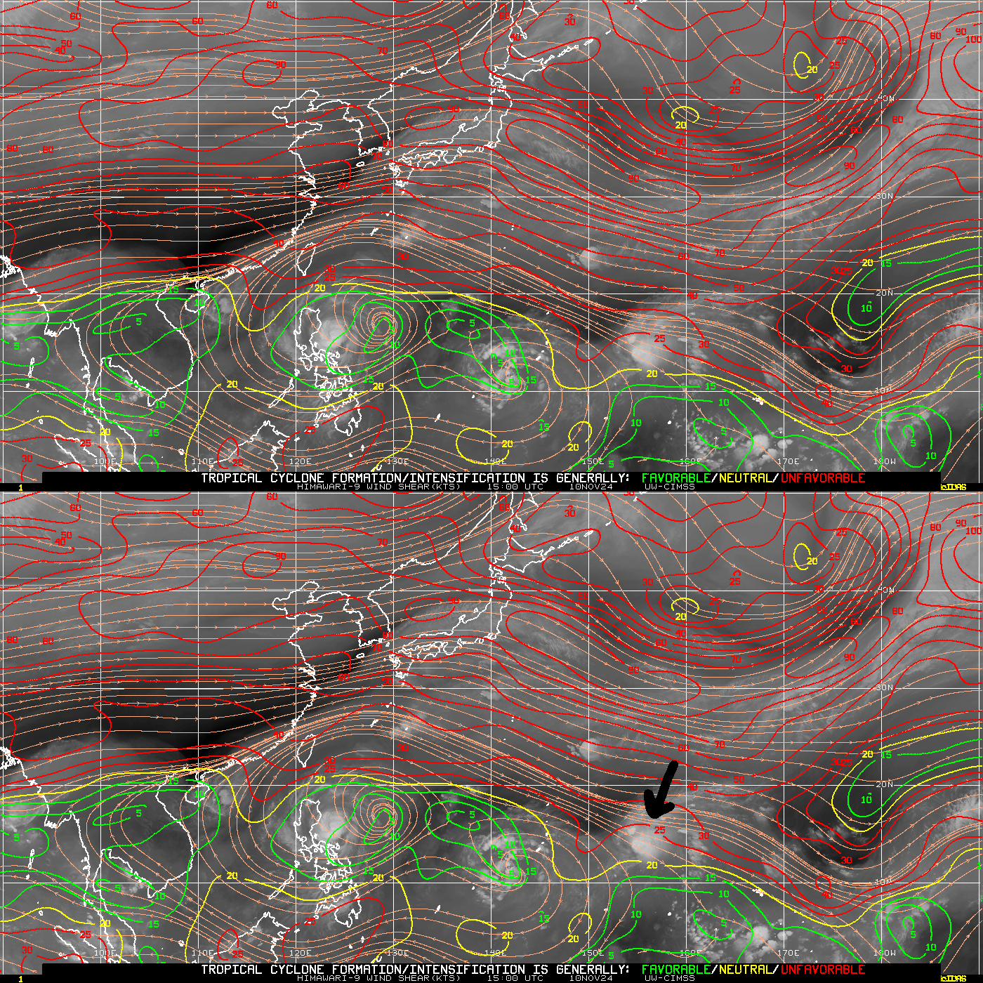
A basin-wide Shear Analysis, below, from the CIMSS Tropical Weather Site (link), shows strong shear over the system at 1500 UTC on 10 November 2024. Man-Yi’s convection was between 150o and 160o E Longitude, and around 13o N Latitude, as highlighted by the dark arrow below. Strong shear that is diagnosed over the system would displace the convection to the southeast of the near-surface circulation as shown in the microwave imagery above.
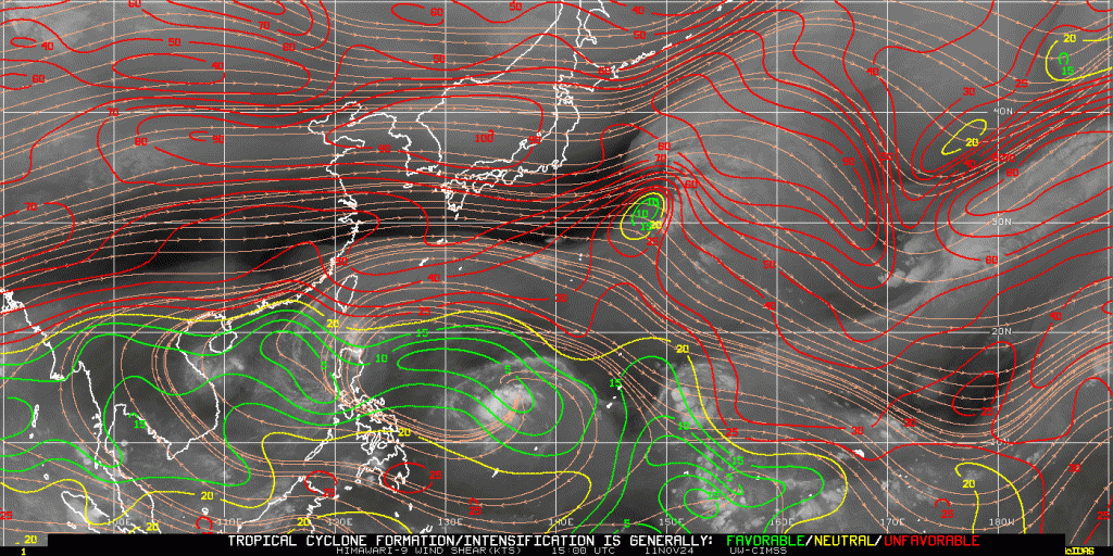
By 1500 UTC on 11 November, the shear over the system has weakened as the system approached 150o E Longitude. Slow strengthening is forecast. The northern Marianas Islands are all under a Tropical Storm Watch.
Thanks to Brandon Aydlett, WFO GUM for the alert about this storm and for the imagery. Thanks also to Douglas Schumacher for the GCOM-W1 imagery. Note that there is more Guam-centered GCOM-W1 89 GHz imagery on 11 November in this blog post.
—————
Free Secure Email – Transcom Sigma
Transcom Hosting
Transcom Premium Domains
