
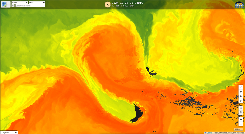
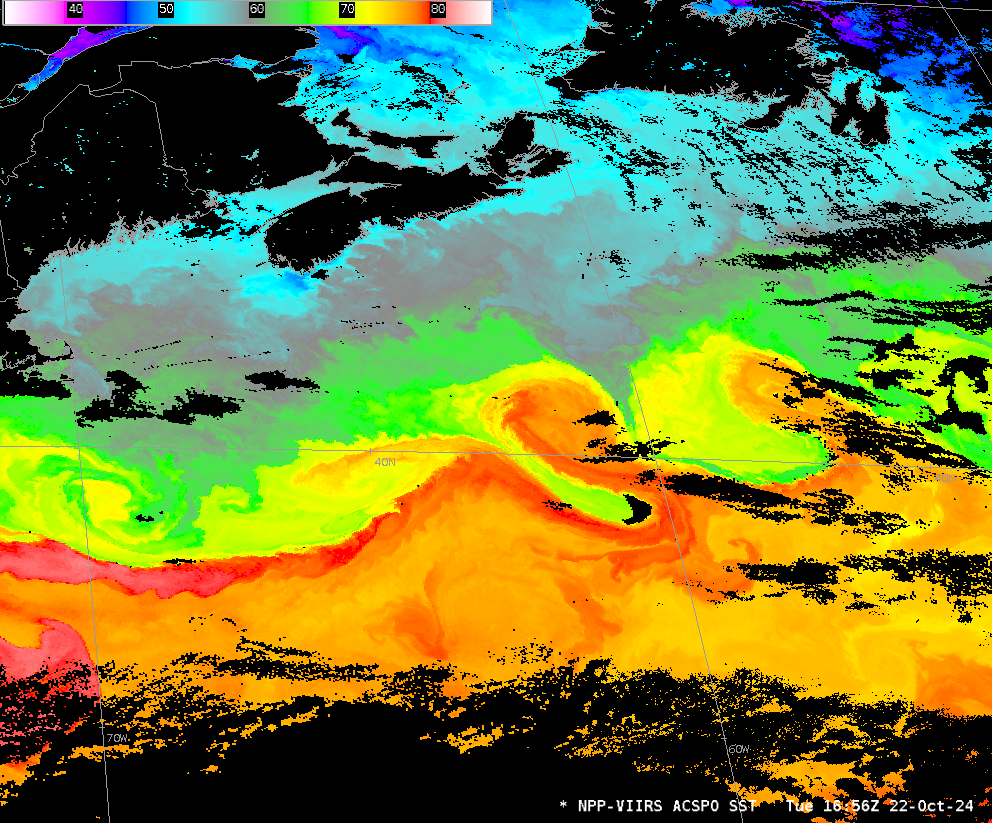
NOAA-20 views of the Gulf Stream
From a Slack Channel (because email is so 2012!) comes a link to RealEarth (imagery shown below) that shows Advanced Clear-Sky Processor for Oceans (ACSPO) estimates of SSTs. The sinuous bendings of the Gulf Stream include a pronounced warm eddy with a ragged thermal edge. (The exercise in determining whether this is inertial instability in this anticyclonic gyre is one that is left to the reader). A zoomed in view of the anticyclone is below. VIIRS has excellent horizontal resolution (375 m) that allows the great imagery shown. A larger view that covers much of the western Atlantic is here.
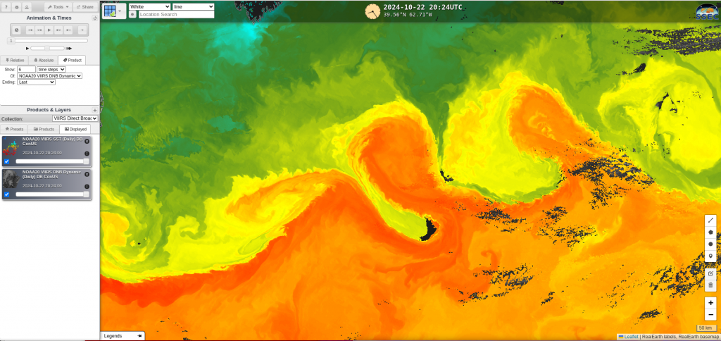
This derived-from-VIIRS imagery was processed by CSPP software at the CIMSS Direct Broadcast sites, and ingested into an LDM feed for AWIPS. The image below from AWIPS can be sampled to show temperature values. Gulf Stream SSTs leading into the anticyclonic gyre (red-orange in color) are around 79oF (they are warmer than 80oF (red/white in the color) at the western edge of the domain, south of New England); the cooler temperatures (south of the gyre; green in the enhancement) are close to 68oF.
—————
Free Secure Email – Transcom Sigma
Transcom Hosting
Transcom Premium Domains