
NGFS views of a wildfire in Oregon
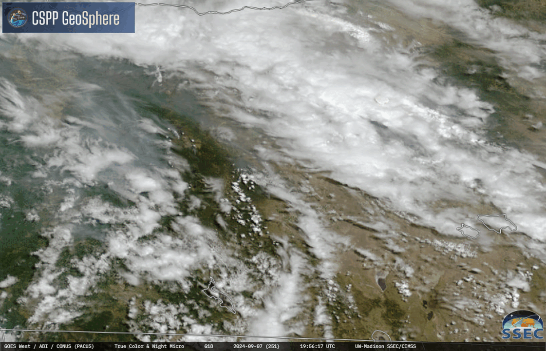
True-color imagery from the CSPP Geosphere site, above, is annotated to identify a wildfire in progress. This is one of several fires over Oregon, as evidences by the widespread smoke that is present. The animation below, shows the evolution during the day of the fires. Pyrocumulonimbus clouds — with lightning (see below) — develop over the fires.
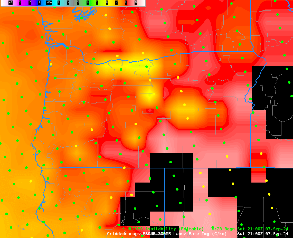
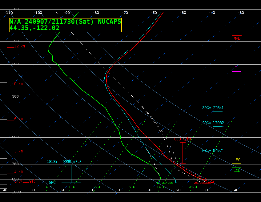
Lapse rates derived from NUCAPS profiles, below, show a large region of near-dry adiabatic conditions (between 7 and 9o C/km) over much of central Oregon where the convection developed. And individual NUCAPS profile, from 44.3oN, 122oW, below, shows an atmosphere at that point that will not greatly resist motions in the vertical. The Equilibrium Level (EL) is diagnosed to be at the Tropopause.
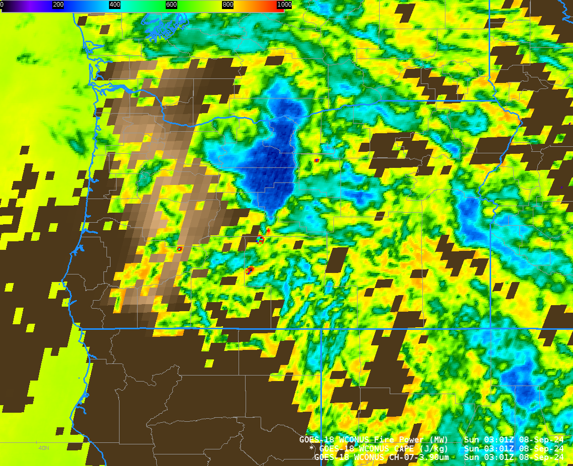
GOES-18 Derived Stability Index values of CAPE (clear sky only) from 0300 UTC on 8 September 2024, plotted with 3.9 µm brightness temperatures and fire radiative power show instability over eastern Oregon and fire signatures.
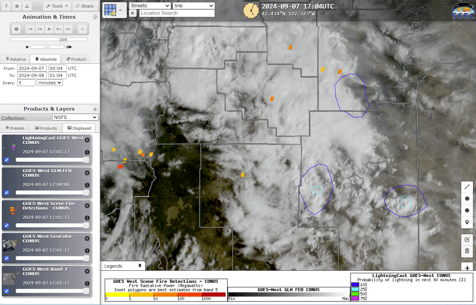
If you know the area you are monitoring has active fires, and satellite data is telling you the overlying atmosphere is nearly unstable, what might you expect from NGFS displays? The RealEarth NGFS display is shown below, at hourly timesteps from 1700 UTC 7 September through 0100 UTC 8 September. Note the presence of LightningCast probability contours (and GLM observations). NGFS detections — in red and orange — show an increase in Fire Radiative Power. Thunderstorms develop to the west of the fire; subsequently a pyrocumulus develops over the main fire (GLM FED at 0014 UTC shows lightning). This is the kind of information that is useful for Fire Weather Decision Support.
—————
Free Secure Email – Transcom Sigma
Transcom Hosting
Transcom Premium Domains