
NGFS Detection of the Remington Fire
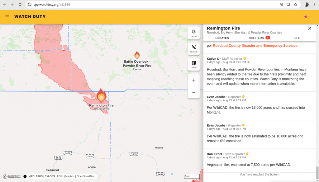
True-color imagery, above, shows the evolution of the Remington Fire in extreme northern Wyoming on 22 August 2024. (Geography note: The Wyoming/Montana border in the image is at 45oN Latitude). The WatchDuty website on the Remington fire, shown below (link) has an initial report at 2:33 PM on 22 August 2024 — after 7500 acres have already burned. Fire initiation in northeast Wyoming was in a very remote region, so it should not surprise that the initial detection occurred after the fire had burned.
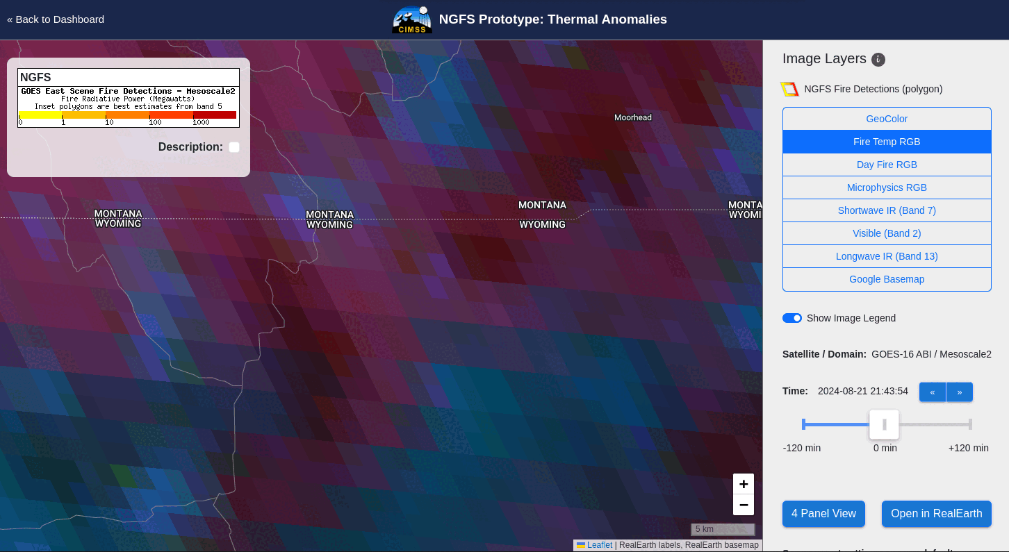
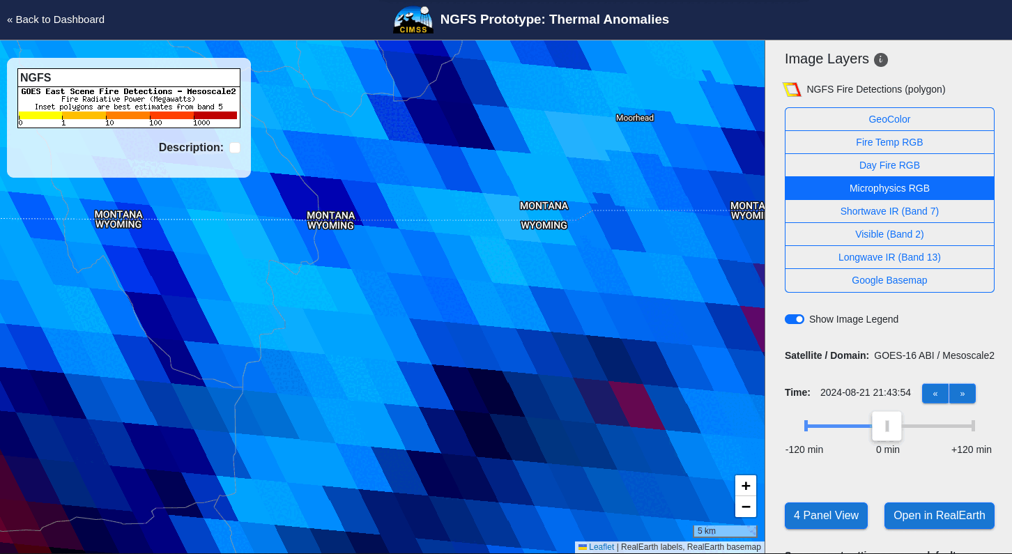
The Next Generation Fire System had detections in the region of initiation starting at 2143 UTC on 21 August (!) as shown below. This is an excellent example showing NGFS’s importance for wildfire detection in remote regions where human eyes (or webcams) aren’t available to monitor things. The animations below show the Fire Temperature RGB and the NGFS Microphysics RGB. The complex nature of the RGBs is in part due to cloudiness occurring over the region. (Here’s the visible imagery at 21:47:54) An NGFS detection is shown by the orange polygons at 21:47:54 UTC on 21 August. Northern Wyoming was in a region of elevated fire risk as shown in this graphic from SPC.
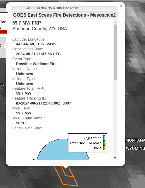
An important feature of the NGFS RealEarth instance is that imagery can be probed. By mousing over the NGFS pixels (that is, the orange polygons), and clicking, information about the surface properties in the region of the developing fire can be investigated. The Probe for this NGFS polygon is shown below, including the latitude/longitude (just south of the Wyoming/Montana border), and the physical description of the land — mostly vegetation — grass and chapparal — and very little urban areas. This information can help a forecaster determine the likelihood of fire and risk to populations. It might also influence a decision to commit fire-fighting resources.
NGFS output is available at this website. Previous blog posts on NGFS capabilities are here.
—————
Free Secure Email – Transcom Sigma
Transcom Hosting
Transcom Premium Domains