Mountain Fire in Ventura County California
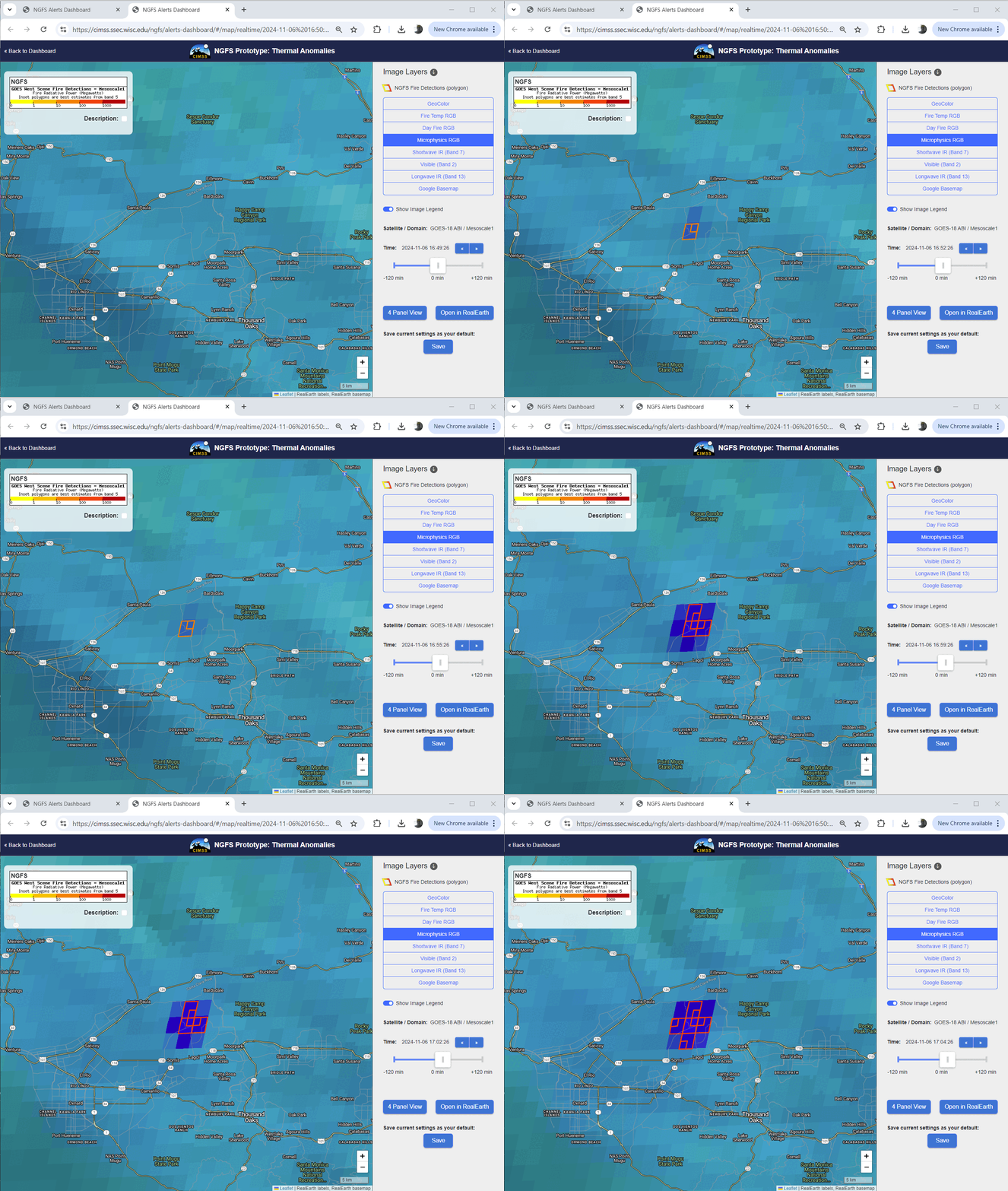
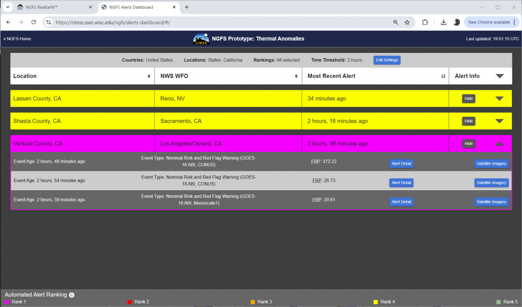
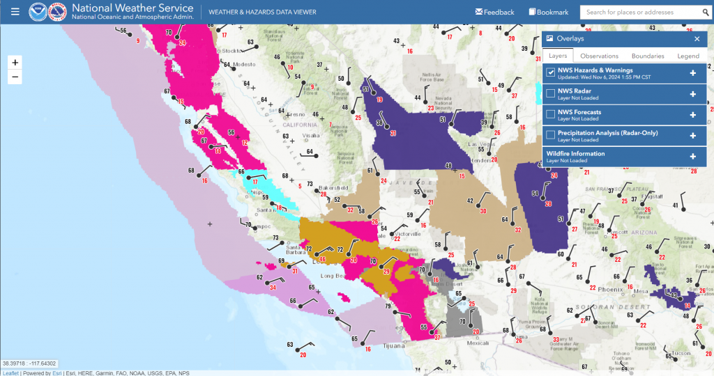
The Storm Prediction Center issued an Extreme Fire Weather Outlook (note that those conditions are #6 on the Priority List for Mesoscale Sectors!) for portions of southern California on 6 November 2024, and the forecast office in Los Angeles issued both High Wind Warnings — for strong Santa Ana winds — and a Red Flag Warning, as shown here, noting that this was a Particularly Dangerous Situation. The NGFS dashboard shown below includes the alert readout for this fire several hours after its initiation. The fire was detected by three different scannings: the GOES-16 CONUS scan, the GOES-18 PACUS scan, and the GOES-18 Mesoscale Sector 1 scan. Which scan strategy saw it first? It should be no surprise that the 1-minute cadence of the Mesoscale Sector first saw the fire. The first 15 minutes of the detections are shown above.
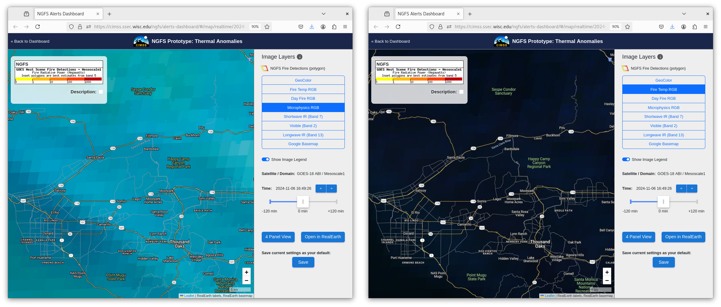
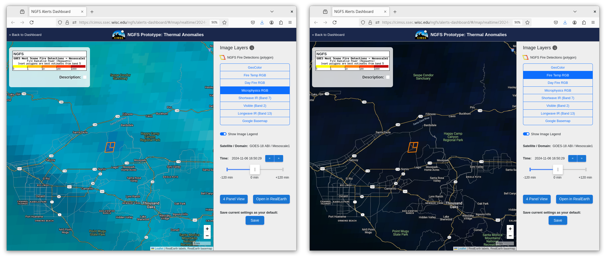
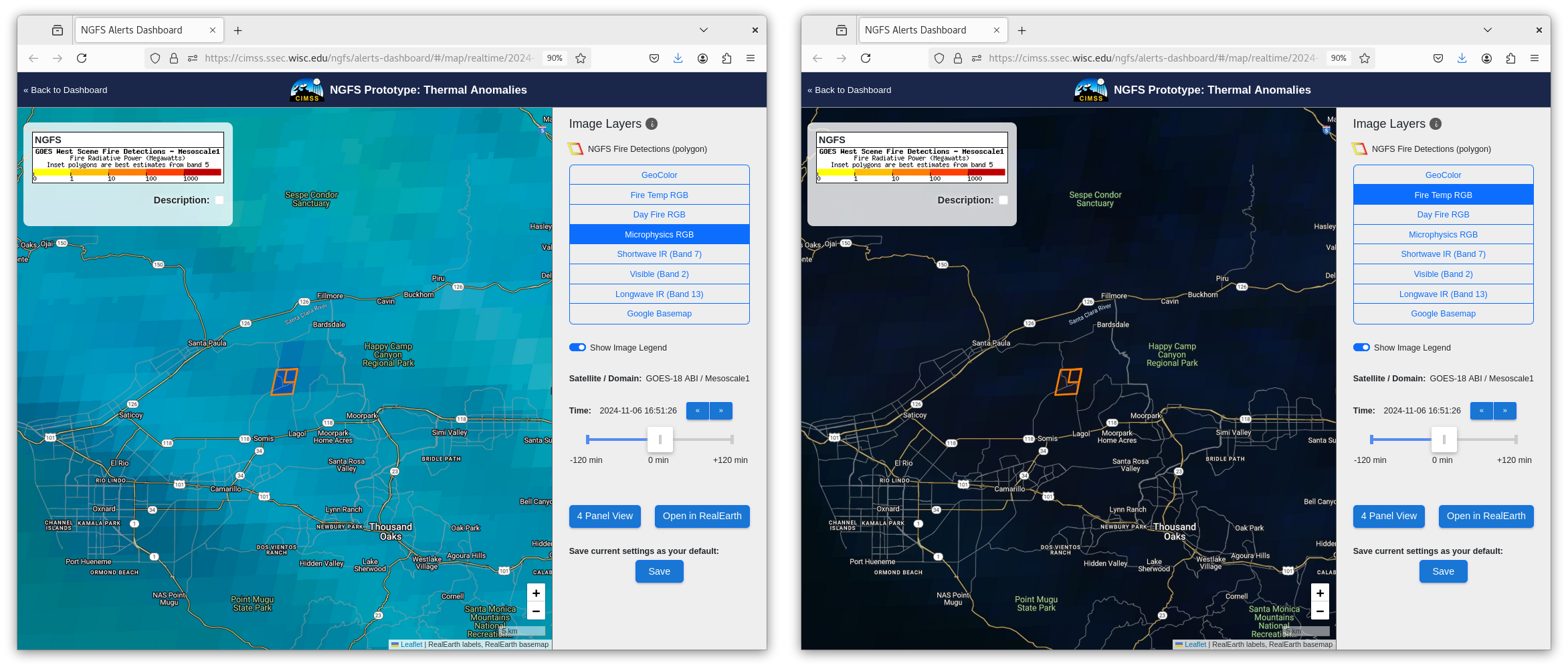
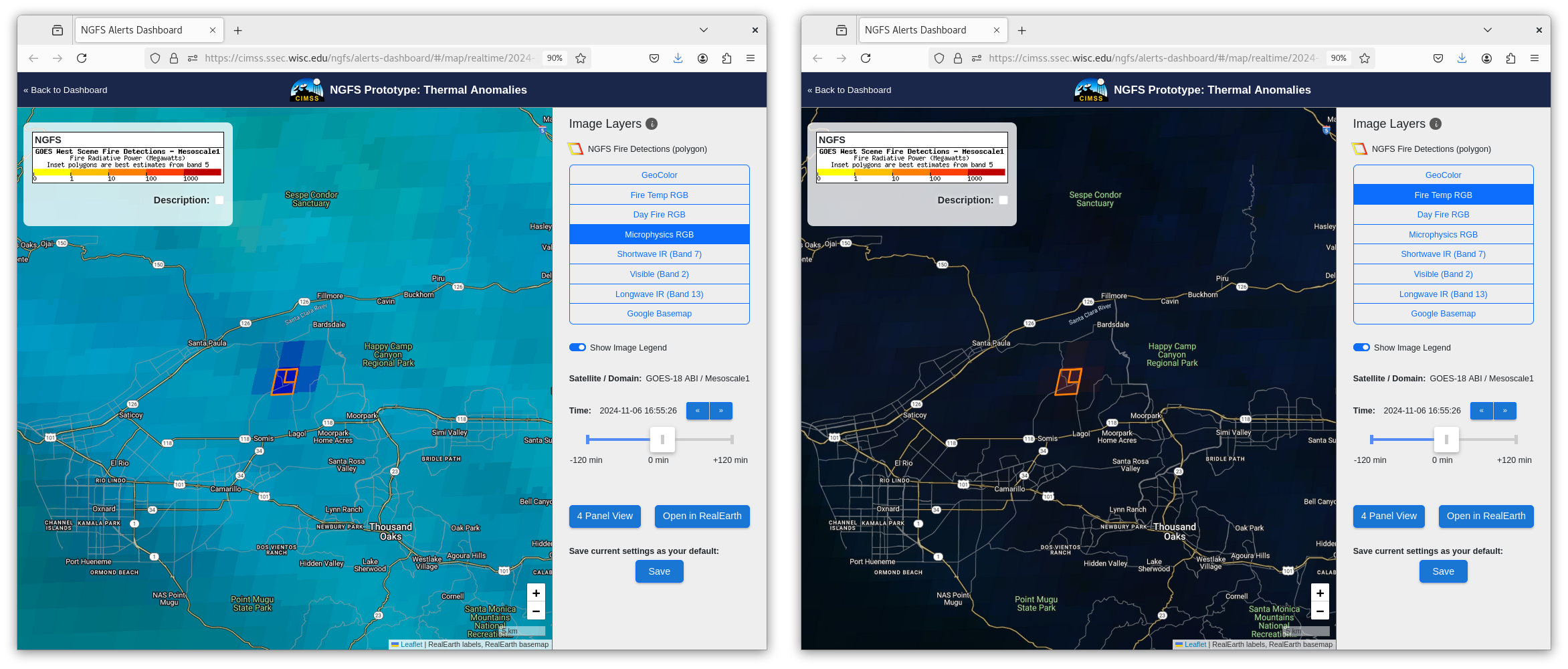
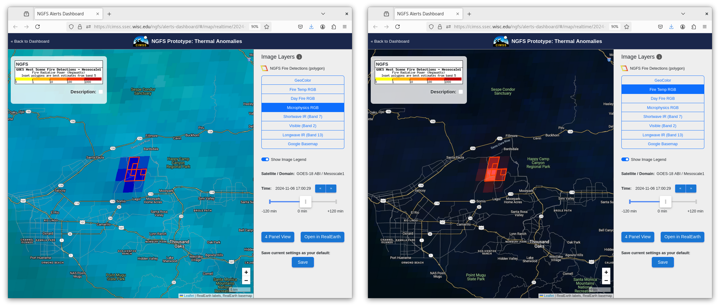
NGFS imagery below tracks the early development of the detections, at 1649, 1650, 1651, 1655 and 1700 UTC. NGFS Microphysics RGB is on the left, Fire Temperature RGB is on the right. The signal is initially apparent only in the NGFS Microphysics. It takes several minutes for a credible signal to appear in the Fire Temperature RGB — at 1655 UTC. These 5 images also show how mesoscale scanning (every minute) captures the rapid changes that occur.
Santa Ana winds (surface analysis shown below) means that this fire grew quickly.
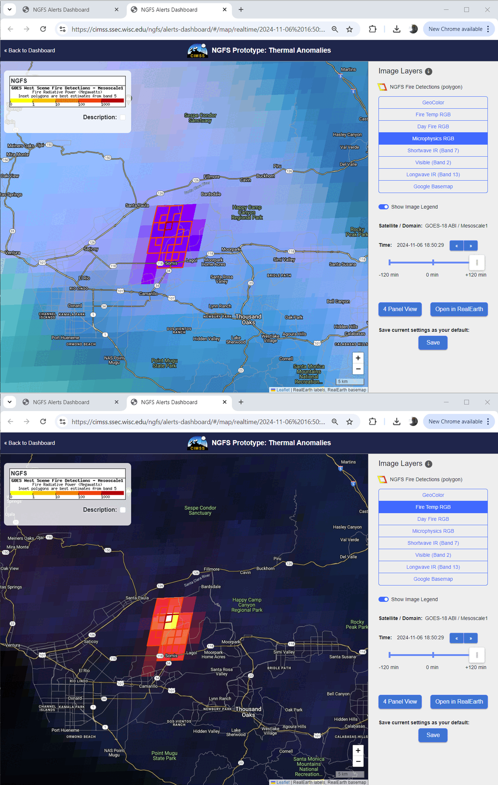
The toggle below compares the NGFS microphysics RGB and the Fire Temperature RGB at 1850 UTC, about 2 hours after the fire’s start. Significant growth in the fire area is apparent, and it has become very intense.
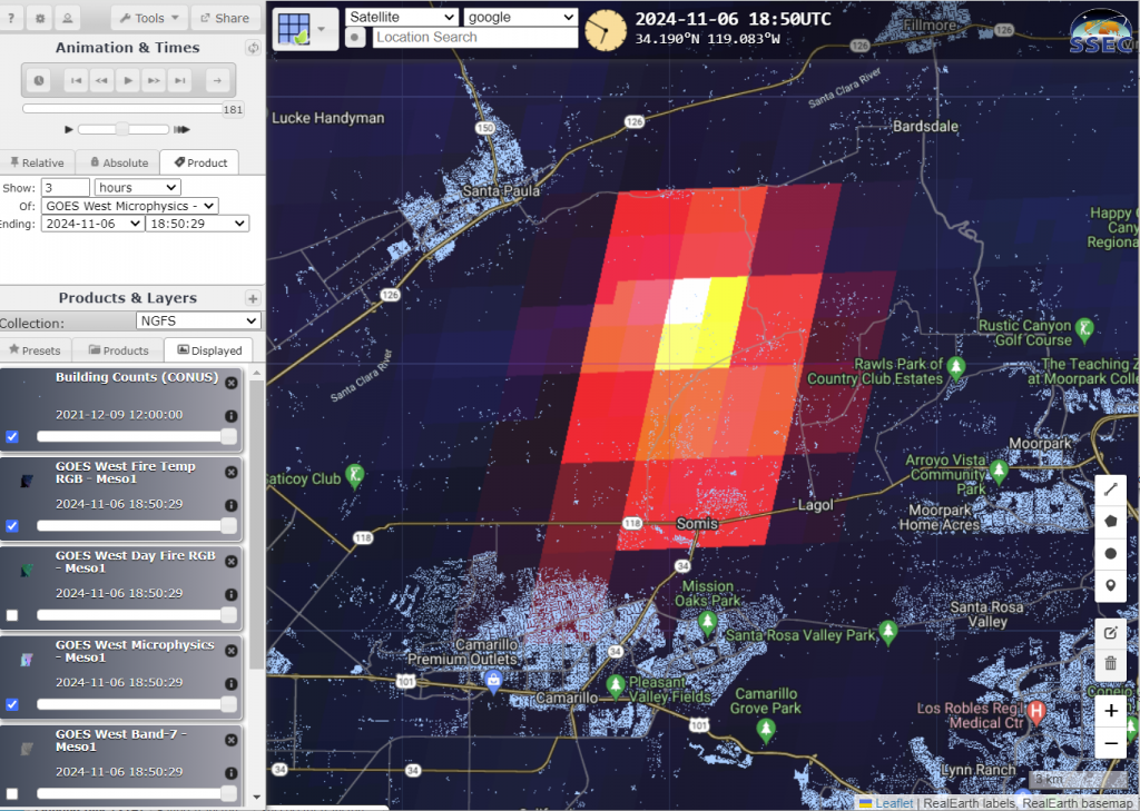
The RealEarth NGFS instance for the Mountain Fire allows a user to add other fields to the display in addition to satellite imagery and fire detections. GOES-18 Fire Temperature RGB with Building Counts is shown below. This active fire is just upwind of a significant amount of development!
The animation below from the CSPP Geosphere site shows the effect of the strong winds: the plume from this fire rapidly moves offshore. There is also a dust plume in the southern part of the the animation, also suggestive of strong winds. Indeed, the winds are strong enough to ground fixed-wing aircraft that might otherwise be used to fight this fire!
The animation for the same time of shortwave infrared data, below, shows the rapid development and expansion of the hotspot.
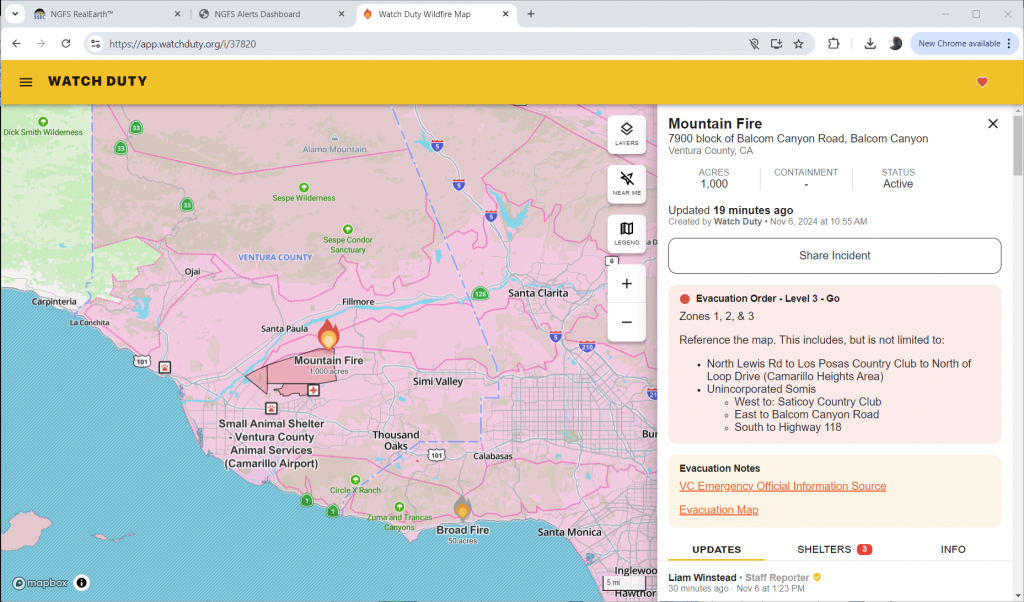
More information on this fire is available at the Watch Duty website, shown below. Active evacuations are occurring as of 2100 UTC on 6 November 2024. The first entry for this fire is at 1655 UTC — “Possible vegetation fire reported at Balcom Canyon, with smoke visible on Alert California cameras.”
Webcam imagery of this fire is available here.
—————
Free Secure Email – Transcom Sigma
Transcom Hosting
Transcom Premium Domains
