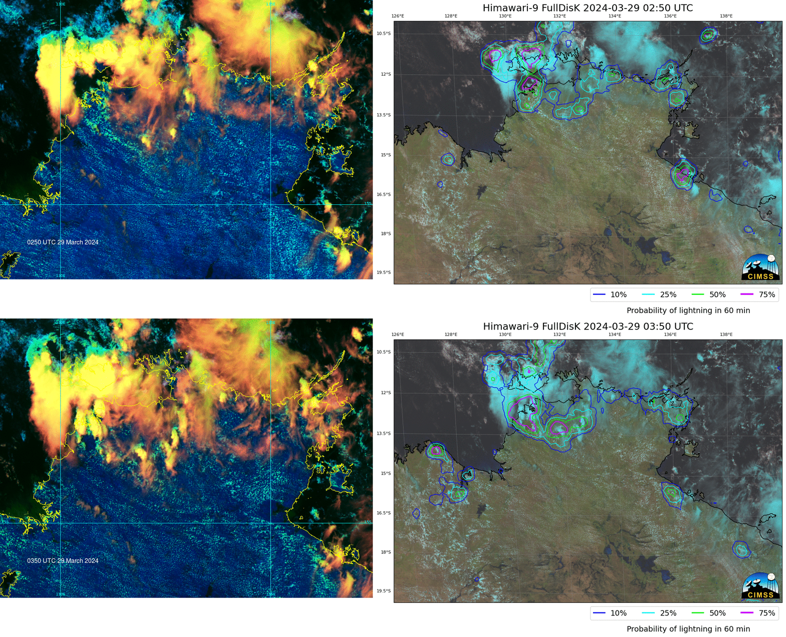
LightningCast probabilities over Australia

LightningCast is a product within the ProbSevere portfolio that uses 4 ABI (or AHI) channels to estimate the likelihood of a GLM observation within the next 60 minutes. For the past couple years, this product has been used experimentally over Guam (using Himawari-9 data), even though the product was trained using GOES-16 data. ABI and AHI channels are similar enough that a useful signal can occur. The animation shows the Himawari-9 Day Cloud Phase RGB (using Band 3, 5 and 13; those 3 bands plus Band 15 are used by the LightningCast algorithm to create probabilities) over northwestern Australia, showing both Darwin and Tiwi Island. The contours of the right show the likelihood of a lightning observation within the next 60 minutes. Note how some of the cirrus clouds (yellow in the RGB) have high probabilities whereas others — correctly — have low (usually in regions where the thick cirrus is dissipating). Careful inspection of the animations show that probabilities increase before deep convection is present. That is perhaps more easily seen in the toggle below of imagery at 0250 and 0350 UTC; at 0250 UTC probabilities are elevated in/around Darwin Australia with only a few glaciated clouds over land (i.e., clouds that are yellow in the RGB). At 0350 UTC, in contrast, well-developed convection is apparent (with continuing high probabilities) in the same region; lightning is probably occuring.

These LightningCast probability fields were computed using CSPP-Geo software; that software is nearing a beta release.
—————
Free Secure Email – Transcom Sigma
Transcom Hosting
Transcom Premium Domains
