Lightning with Bebinca in the western Pacific
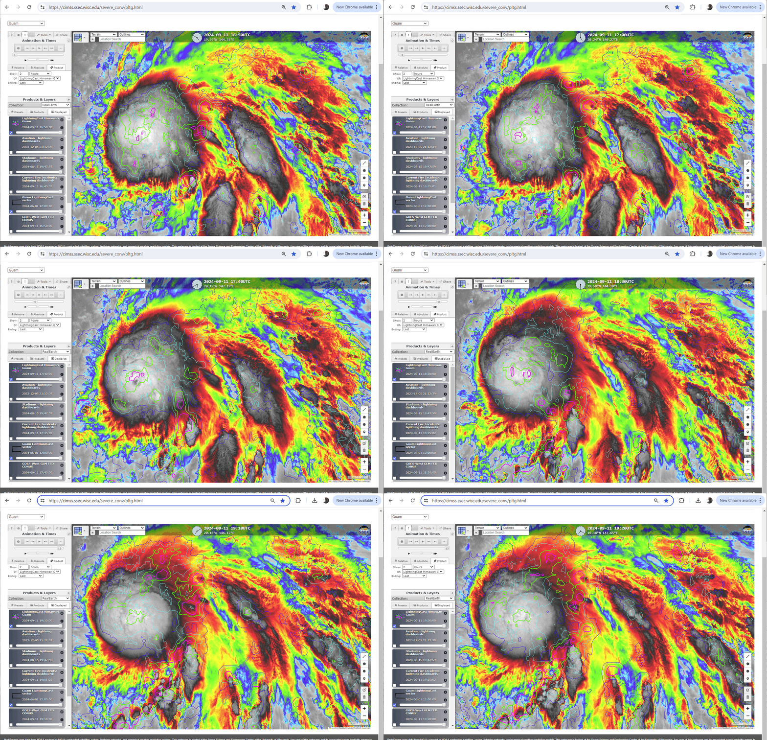
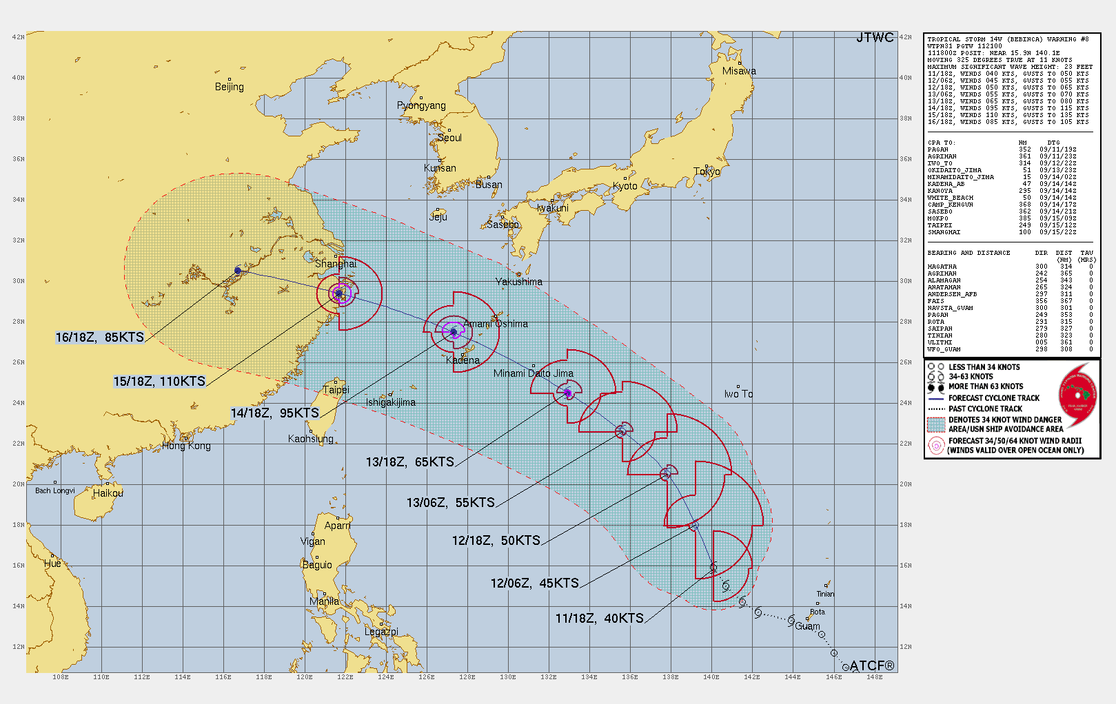
LightningCast probabilities (from this website) over the Central Dense Overcast of Tropical Cyclone Bebinca in the western Pacific to the northwest of Guam, above, show increasing values (the island of Guam is center bottom of the imagery above): magenta are values of 75%. Lightning activity within the central core is often a precursor to strengthening in a tropical cyclone, and the JTWC Forecast (below) for the system suggests just that.
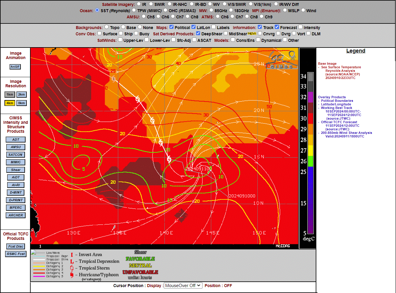
Bebinca is over very warm SSTs and in a region of low shear. The projected path of the storm continues over warm water.
Himawari-9 Clean Window imagery, below (courtesy of the NWS Forecast Office in Pago Pago) overlain with lightning shows the cold cloud tops associated with the convection. Lightning becomes more common at the end of the animation, especially after 1800 UTC. This is in agreement with the LightningCast predictions shown above.
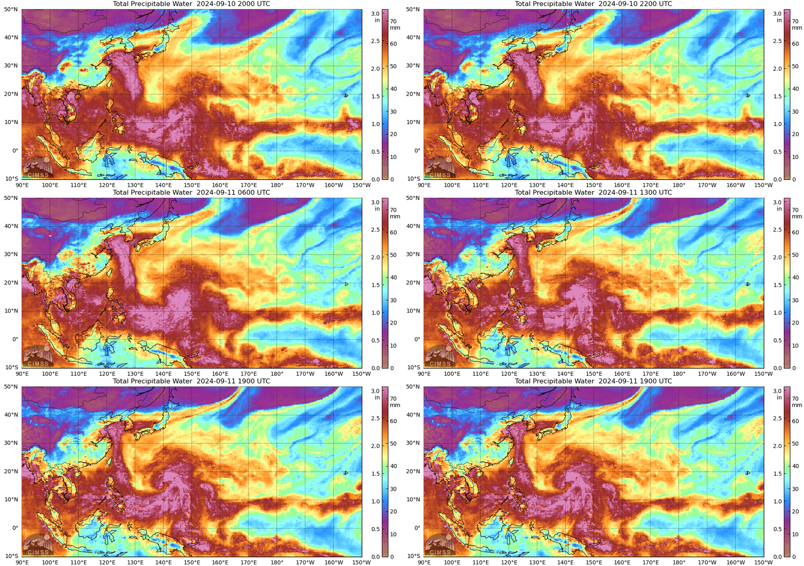
MIMIC Total Precipitable Water fields (source), below, show the spinup of the Tropical Storm. The circulation of this system continues to draw very moist air over the Marianas. The National Weather Service in Guam has issued Flood Watches, High Surf advisories and a wind advisory related to this event on 11 September.
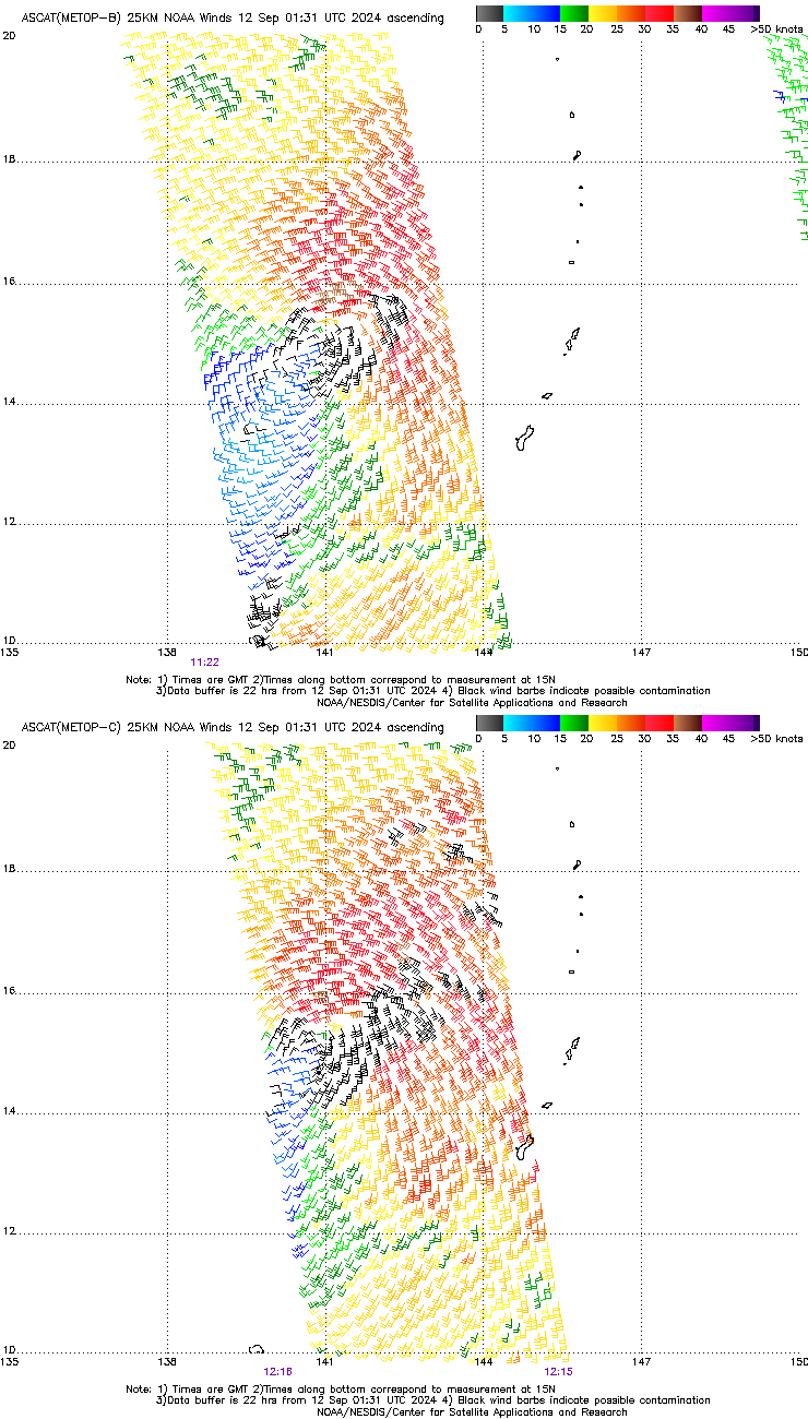
Timely overpasses from Metop-B and Metop-C at around 1200 UTC on 11 September, shown below (from this site), helped benchmark the strength of the storm at that time.
—————
Free Secure Email – Transcom Sigma
Transcom Hosting
Transcom Premium Domains
