
Lake effect fog/stratus in North Dakota
GOES-16 Nighttime Microphysics RGB and Day Snow-Fog RGB images [click to play animated GIF | MP4]
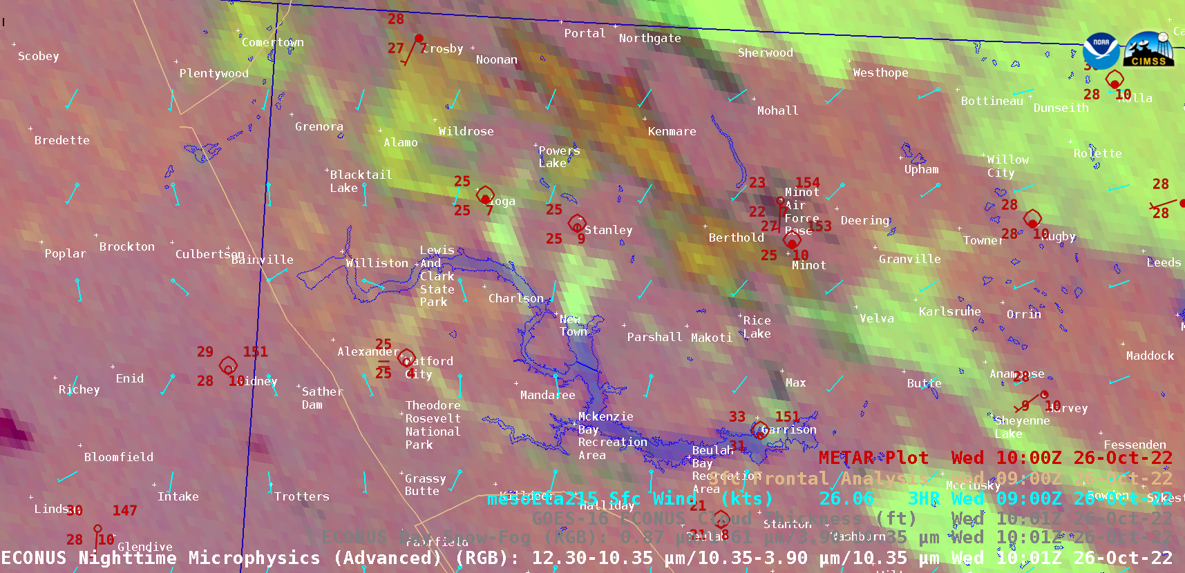
A sequence of GOES-16 (GOES-East) Nighttime Microphysics RGB and Day Snow-Fog RGB images (above) showed the nocturnal development of lake effect fog/stratus plumes, which moved northward from Lake Sakakawea in northwestern North Dakota on 26 October 2022. Two of the fog/stratus features (lighter shades of yellow) moved across the Tioga and Stanley areas, where surface reports briefly indicated a drop in surface visibility to zero along with freezing fog. After sunrise, Day Snow-Fog RGB images revealed the dissipation of these lake effect fog/stratus features — and also displayed the areal coverage of snow cover (shades of red) across the Montana/North Dakota border region.
The GOES-16 Nighttime Microphysics RGB image at 1001 UTC (below) includes an overlay of NOAA-20 VIIRS Sea Surface Temperature (SST) — the southerly flow of cold air (in the 20s F) across Lake Sakakawea’s SST values of 50-54ºF (shades of cyan) helped to create the lake effect fog/stratus features.
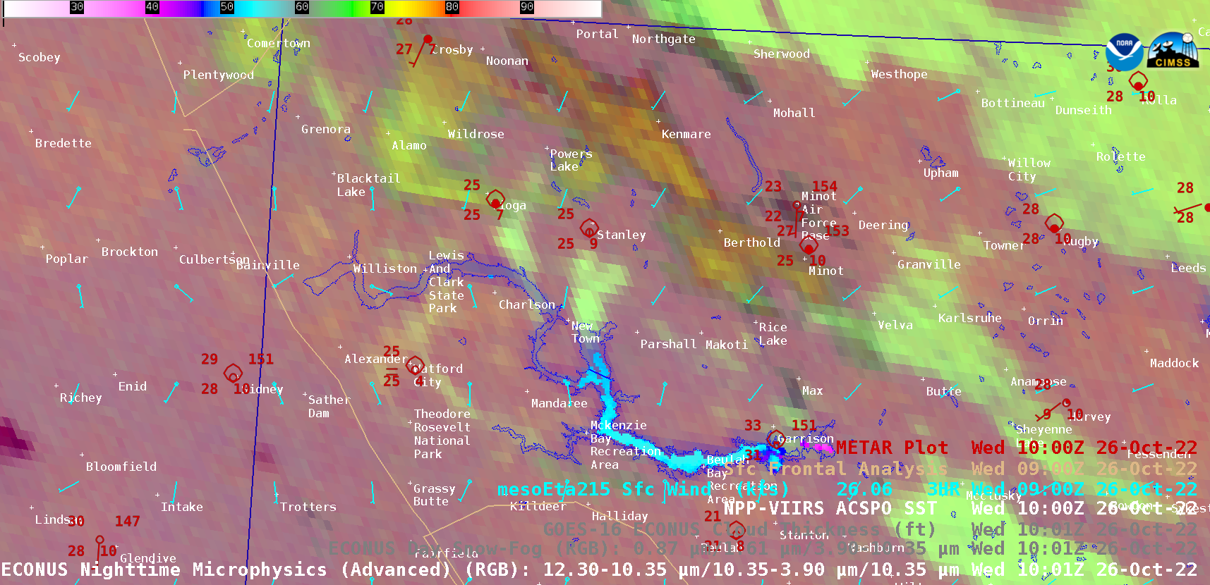
GOES-16 Nighttime Microphysics RGB image at 1001 UTC, with NOAA-20 VIIRS Sea Surface Temperature [click to enlarge]
—————
Free Secure Email – Transcom Sigma
Transcom Hosting
Transcom Premium Domains