
John along the coast of Mexico
Hurricane John was an intense cyclone that affected the Pacific coast of Mexico for a about a week in late September 2024. (Click here to see an approximate path). The storm was noteworthy in that it made landfall, dissipated, re-developed, and then made landfall again. The animation above shows the lifecycle of the system, starting as a tropical wave south of Mexico and ending with a slow approach to the coast on the 26th and 27th. John weakened as it moved along the coast, before dissipating late on the 27th.
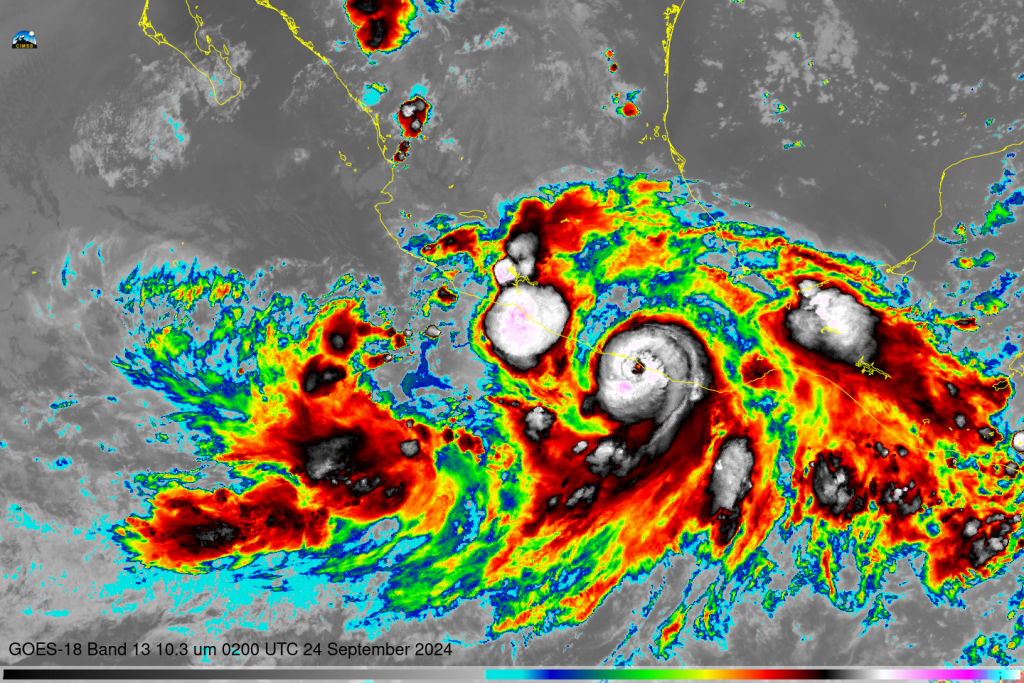
Hurricane John made landfall just after 0300 UTC UTC on 24 September. At 0200 UTC, shown below, a well-developed eye is apparent in satellite imagery, and strong convection is wrapped around that eye. The structure of the hurricane was quickly disrupted once inland, and by 1800 UTC on the 24th, the National Hurricane Center ceased advisories on the system, with the caveat that the system could still generate heavy rain, and might redevelop.
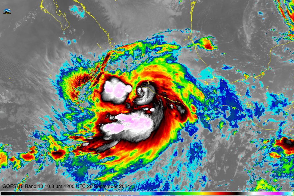
At 1200 UTC on 26 September 2024, shown below, John has redeveloped into a hurricane, with curved bands in the infrared imagery, to the east of a large mesoscale convective system. John weakened as it moved parallel to the coast for the next 30 hours, dissipating at 2100 UTC on 27 September.
—————
Free Secure Email – Transcom Sigma
Transcom Hosting
Transcom Premium Domains