Hurricane Kristy reaches Category 5 intensity
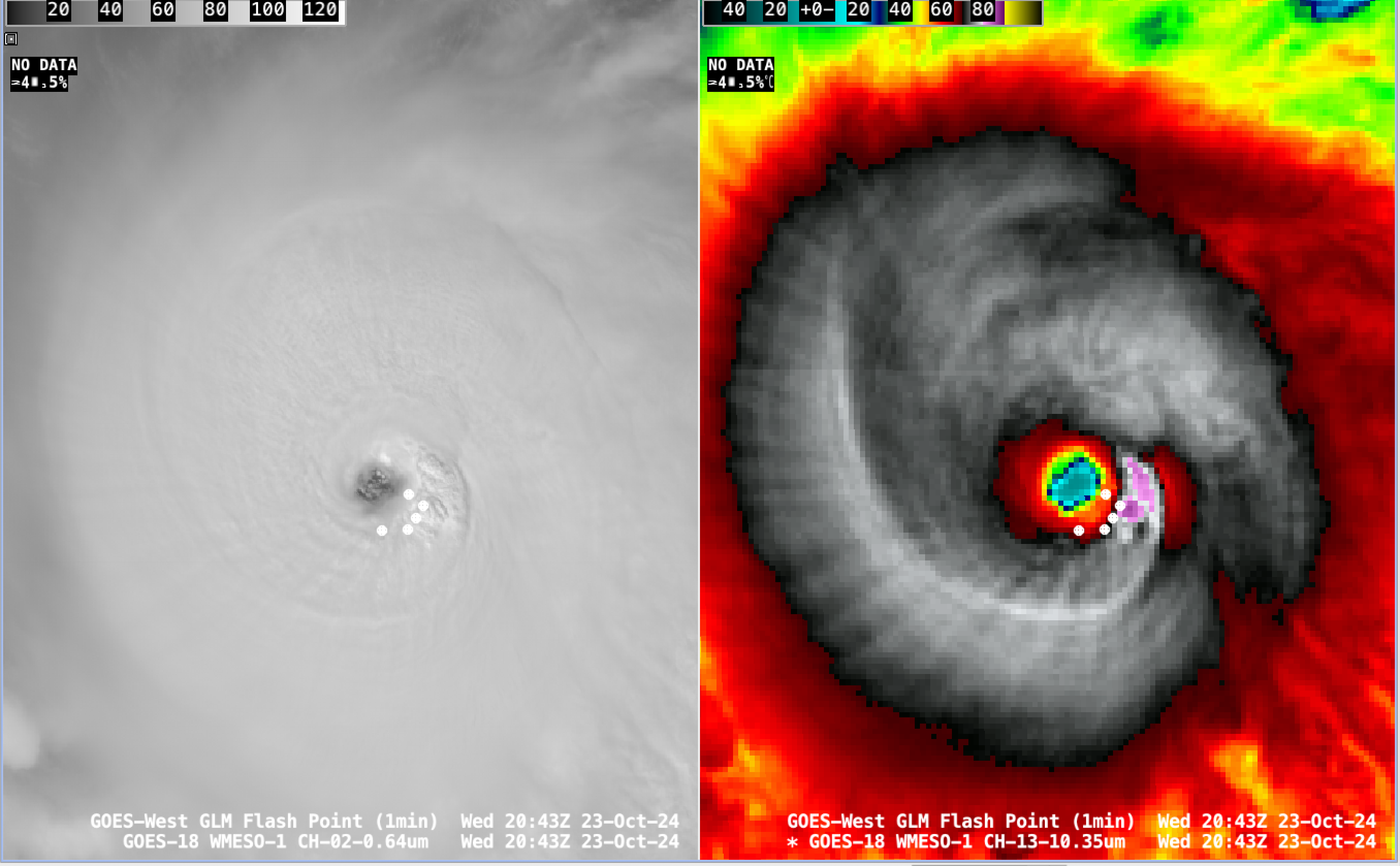
1-minute GOES-18 Visible (left) and Infrared (right) images with an overlay of GLM Flash Points, from 1331-1600 UTC on 23 October [click to play MP4 animation]
1-minute Mesoscale Domain Sector GOES-18 (GOES-West) Visible and Infrared imagery of Hurricane Kristy on 23 October (above) highlighted a well-defined eye, with GLM-indicated lightning activity increasing within the inner eyewall. Cloud-top infrared brightness temperatures in the -80s C (shades of violet to purple) were apparent at times. Kristy reached Category 4 intensity as of the 2100 UTC advisory from NHC.
A closer view of GOES-18 Visible images (below) revealed low-altitude mesovortices within the eye.
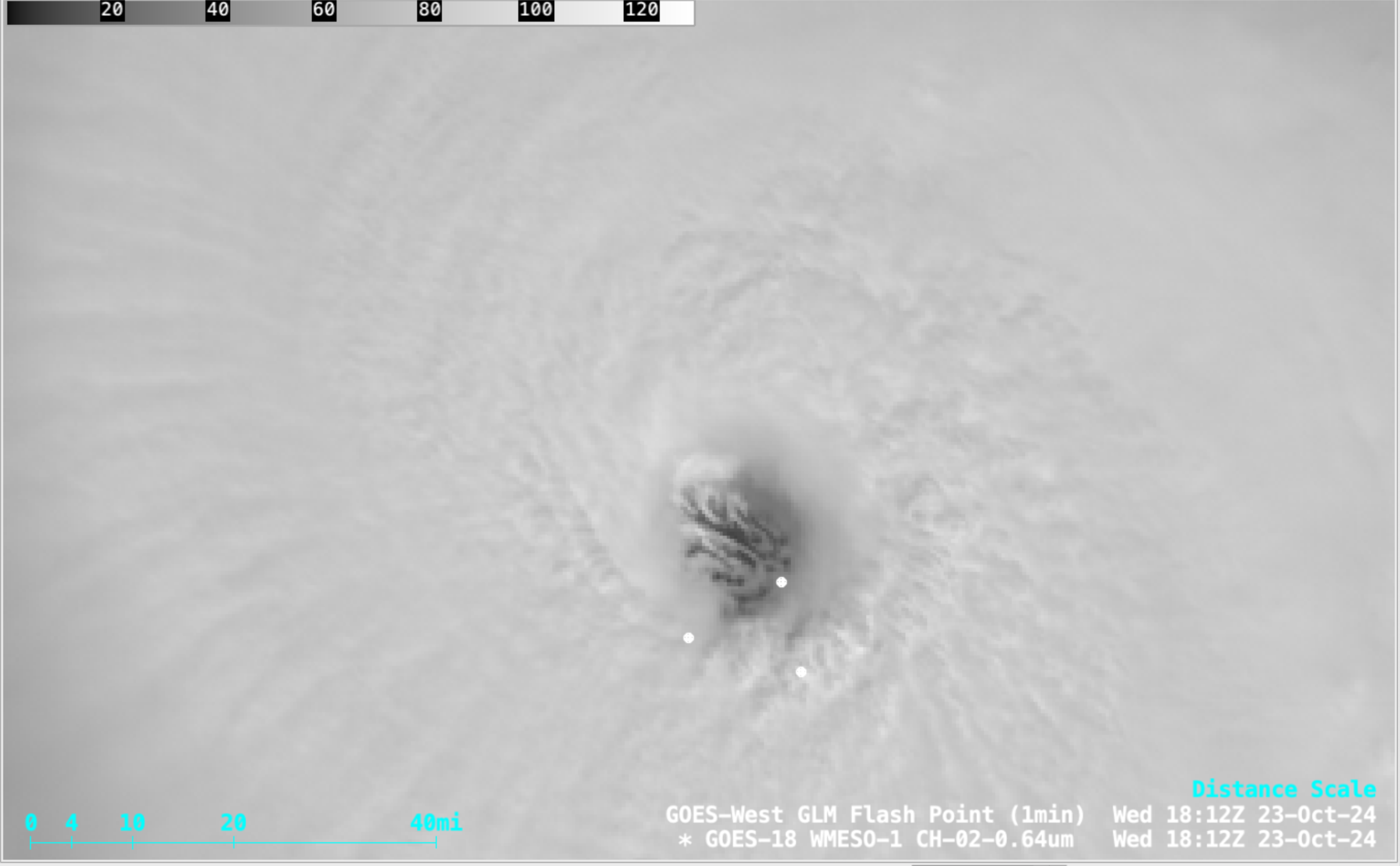
1-minute GOES-18 Visible images with an overlay of GLM Flash Points, from 1601-2100 UTC on 23 October [click to play MP4 animation]
Hurricane Kristy was moving through an environment characterized by low values of deep-layer wind shear (below) — a factor which favored its rapid intensification.
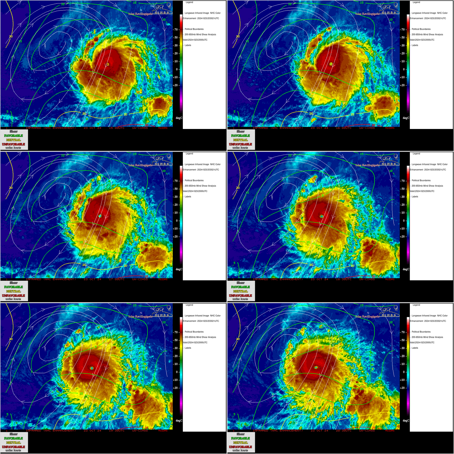
GOES-18 Infrared images, with an overlay of 2000 UTC deep-layer wind shear contours and streamlines
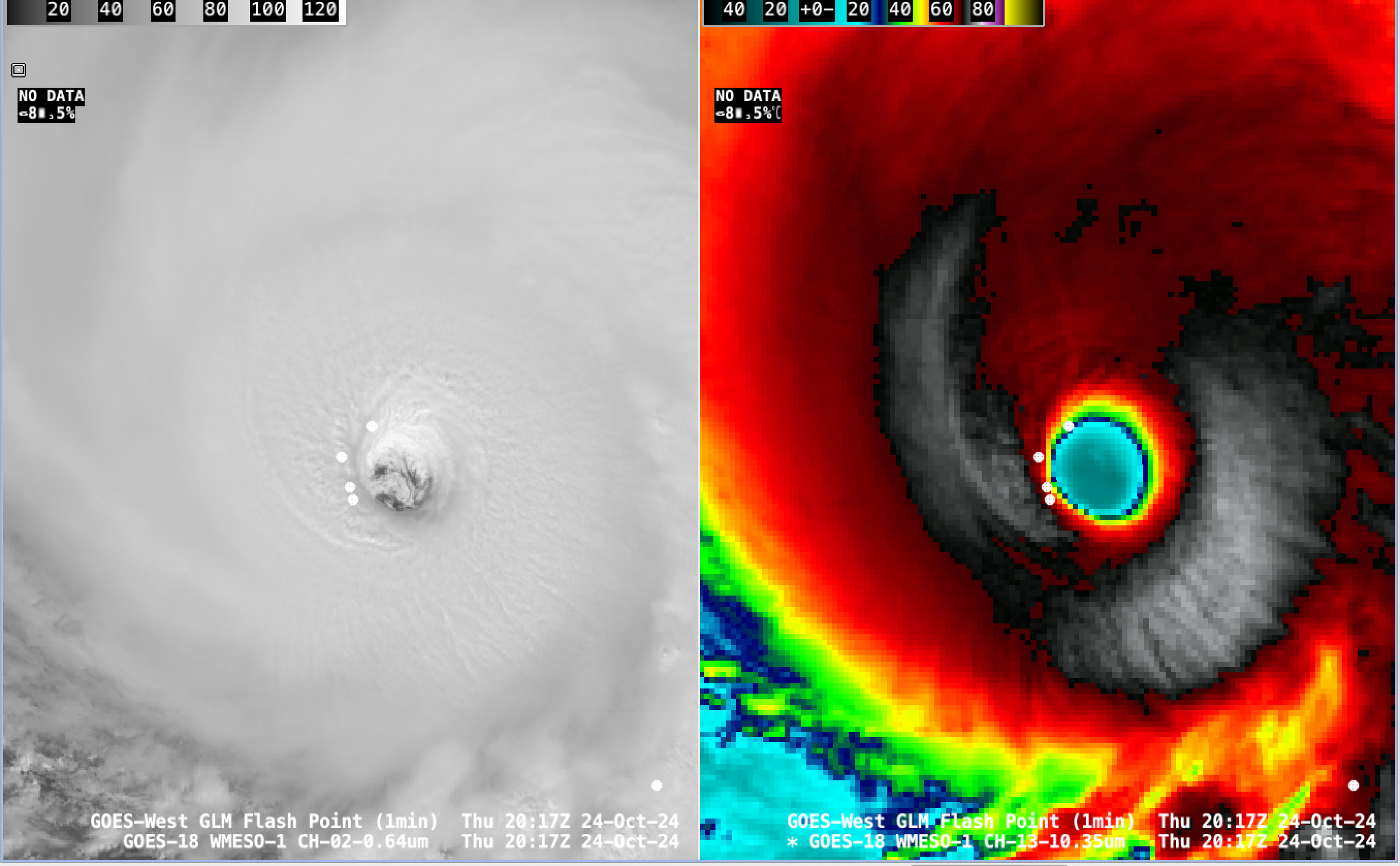
1-minute GOES-18 Visible (left) and Infrared (right) images with an overlay of GLM Flash Points, from 1802-2300 UTC on 24 October [click to play MP4 animation]
On 24 October, 1-minute GOES-18 Visible and Infrared imagery (above) again displayed a well-defined eye, with GLM-indicated lightning activity increasing within the inner eyewall — and cloud-top infrared brightness temperatures in the -80s C (shades of violet to purple) were apparent at times. Kristy reached Category 5 intensity as of the 2100 UTC advisory from NHC.
In a closer view of GOES-18 Visible images (below), low-altitude mesovortices were again seen within the eye.
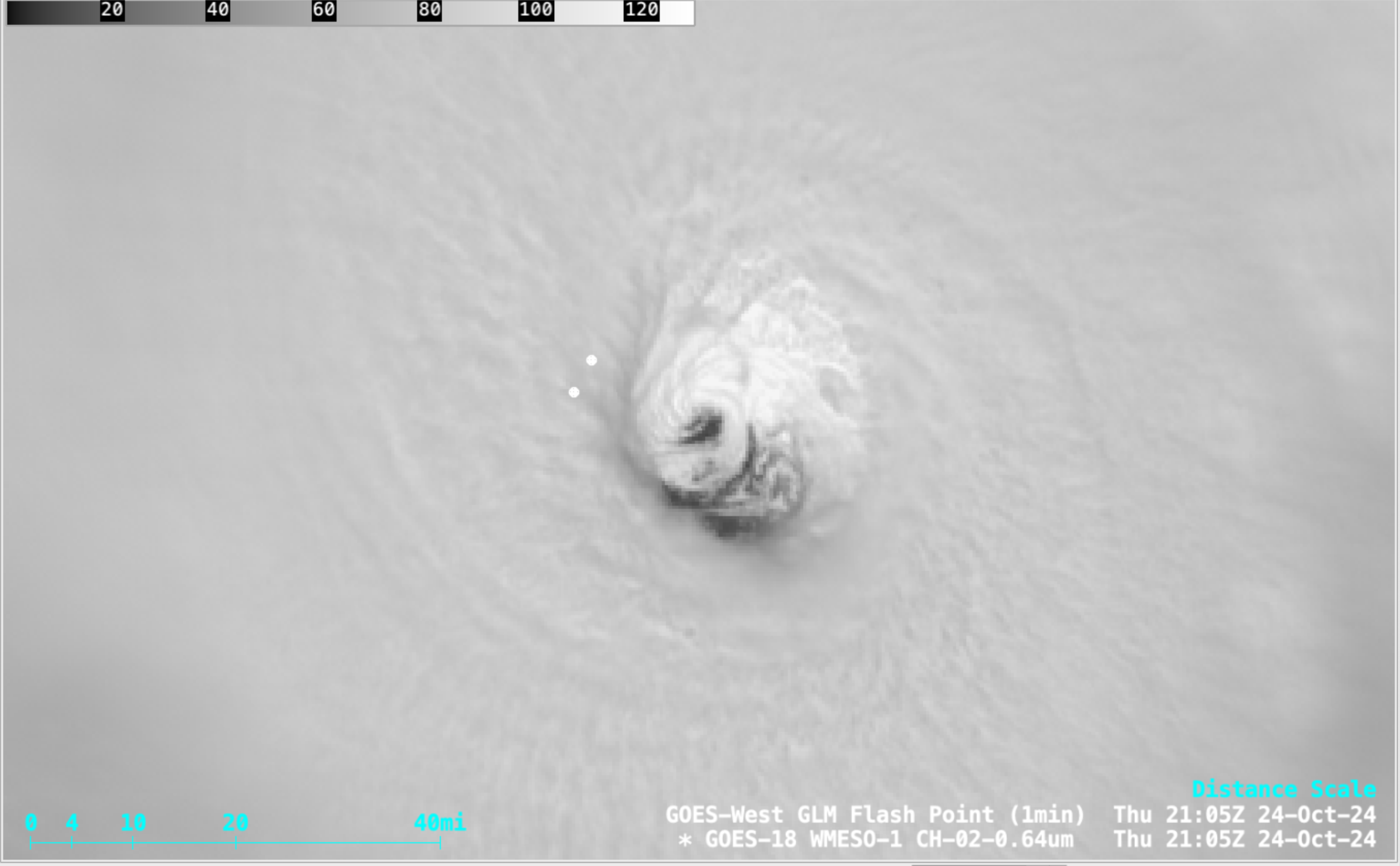
1-minute GOES-18 Visible images with an overlay of GLM Flash Points, from 1802-2300 UTC on 24 October [click to play MP4 animation]
—————
Free Secure Email – Transcom Sigma
Transcom Hosting
Transcom Premium Domains
