
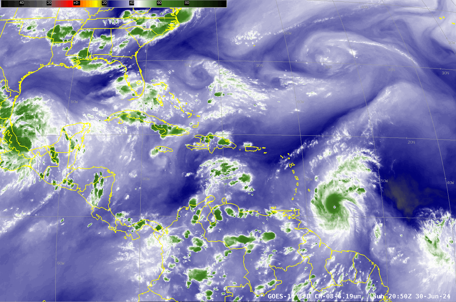
Hurricane Beryl moves through the Windward Islands
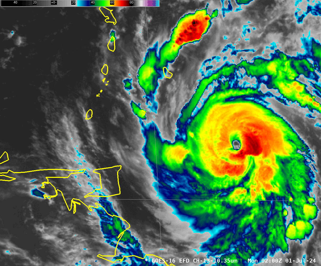
GOES-16 Full-disk imagery, above, shows strong Hurricane Beryl moving through the windward islands on 1 July 2024. Beryl made her first landfall on Carriacou Island at 1510 UTC on 1 July. Of note is that the distinct eye of Beryl is lost between about 0800 and 1000 UTC as very strong convection develops over the southeastern quadrant of the storm. (The animation above also includes Tropical Storm Chris that made landfall in Mexico shortly before 0500 UTC on 1 July). The strong convection over Beryl’s southeast wall is better visualized in the zoomed-in Band 13 (10.3 µm) imagery shown below.
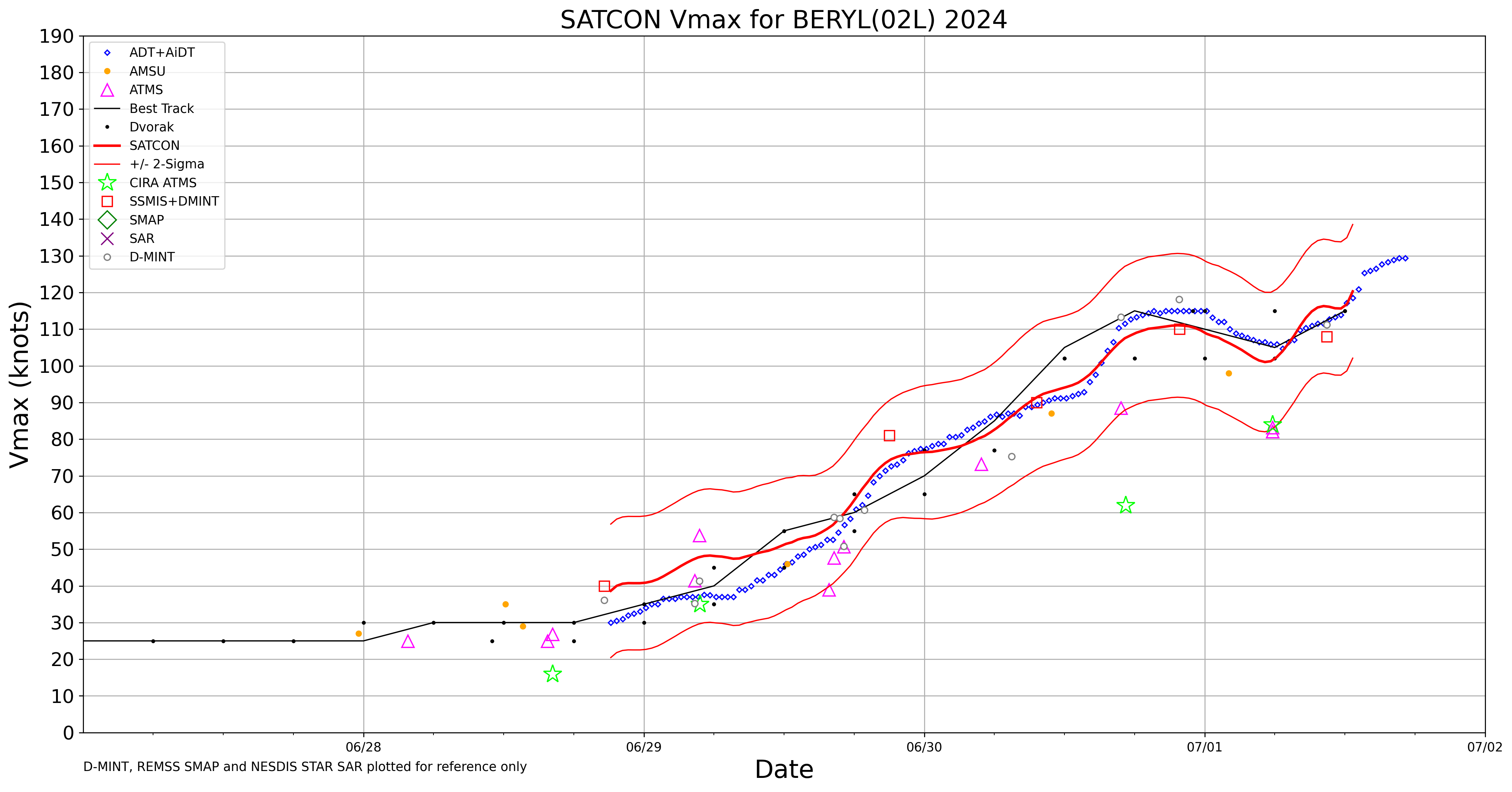
SATCON (Satellite Consensus) wind values for Beryl, below, (source), show a storm that was strengthening after a modest and temporary weakening that ended around 0600 UTC on 1 July.
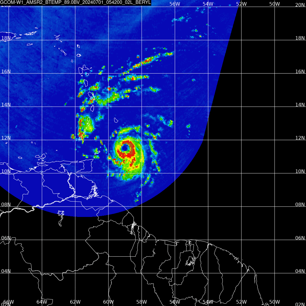
Microwave data over Beryl from GCOM-W1 AMSR-2 observations at 0542 UTC, below (from this source), show a compact eye that is not quite closed at upper levels (as shown by the 89 GHz data) at that time. The two observations also shows a slight shift in the center position: use the 36.5 GHz data to make the best estimate of where the center actually sits as the 36.5 GHz shows information from lower in the troposphere.
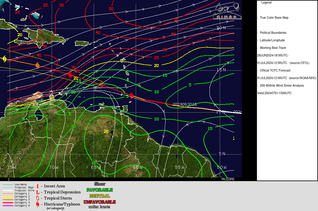
Although Beryl is in a very favorable environment at about 1800 UTC on 1 July, the predicted path takes the storm into a region of increasing shear, as shown in the toggle below showing 850-200 mb shear and SSTs. The increase in shear may affect the strength of the system, but residents throughout the central Caribbean should closely monitor the progress of this dangerous storm.
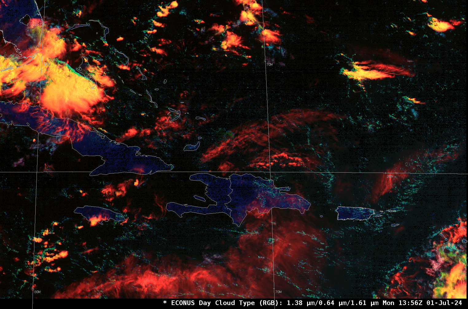
Wind shear can be visualized with the Day Cloud Type RGB, shown below from GOES-16 CONUS domain imagery; Beryl is just entering the CONUS domain in the far southeastern corner. This RGB similar to the Day Cloud Phase Distinction RGB, but the ‘red’ beam in Day Cloud Type uses Band 4 (that is, the ‘Cirrus band’ at 1.38 µm) reflectance rather than Band 13 (‘Clean Window’, 10.3 µm) brightness temperatures in the Day Cloud Phase Distinction. In the Day Cloud Type RGB, upper-level clouds, even thin ones, are more noticeable as red, and the animation below shows the high clouds over the Caribbean moving in a much different direction that the lower clouds that show up as cyan.
For the latest information on Beryl, refer to the website of the National Hurricane Center.
—————
Free Secure Email – Transcom Sigma
Transcom Hosting
Transcom Premium Domains