Historic snowstorm across the Deep South

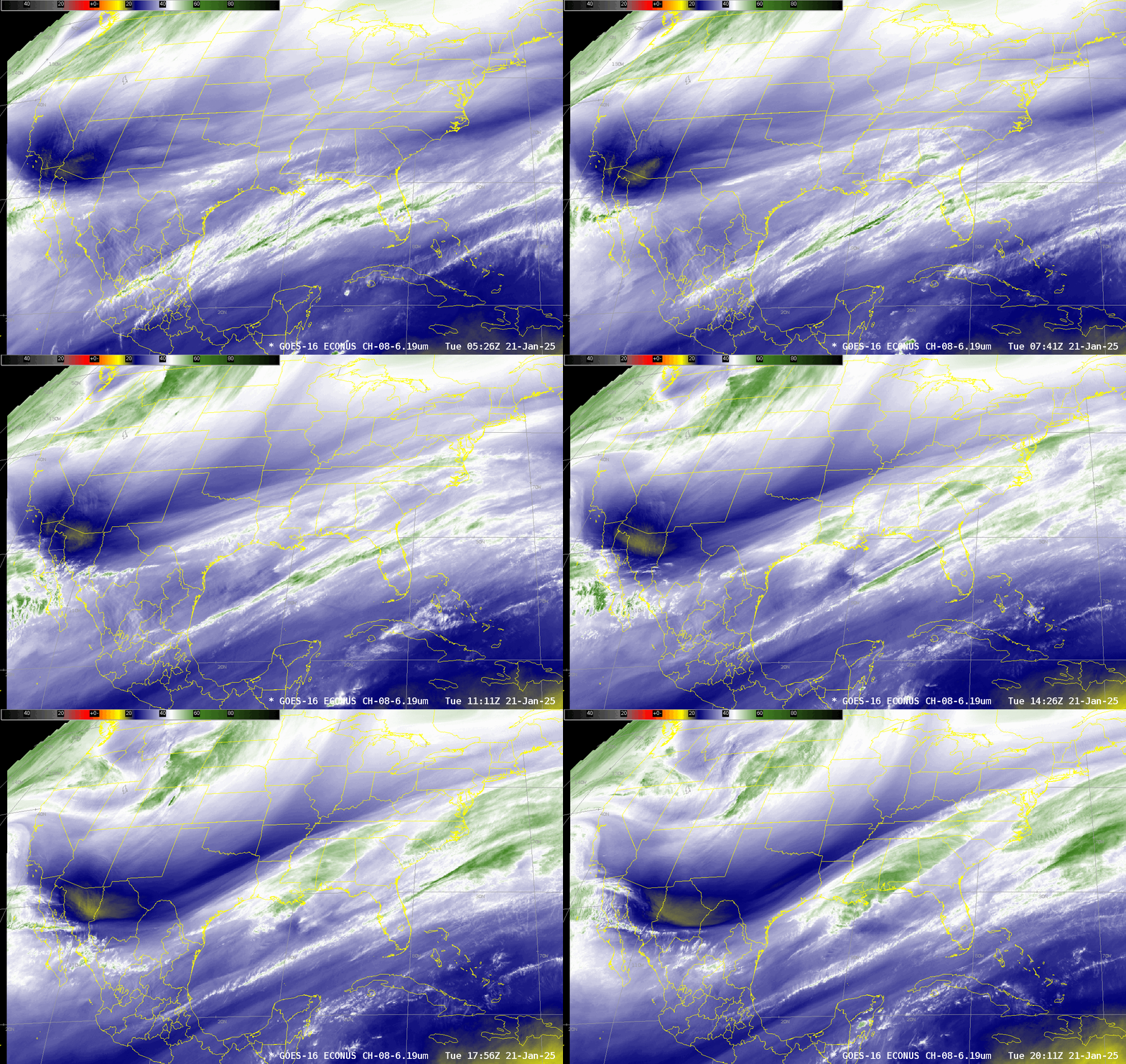
GOES-16 Upper-level water vapor infrared imagery for the 15 hours ending at 2011 UTC on 21 January 2025, above, shows the development of cold cloud tops (white and green in the enhancement used) especially after 1100 UTC over east Texas and Louisiana in response to the eastward propagation of a digging shortwave indicated by yellow (warmer brightness temperatures) moving across northern Mexico into west Texas at the end of the animation. The combination of this storm and an unusually cold and dry airmass over the deep south (and the rest of the country east of the Rockies) has resulted in a near-unprecedented snowstorm over the Gulf Coast states.
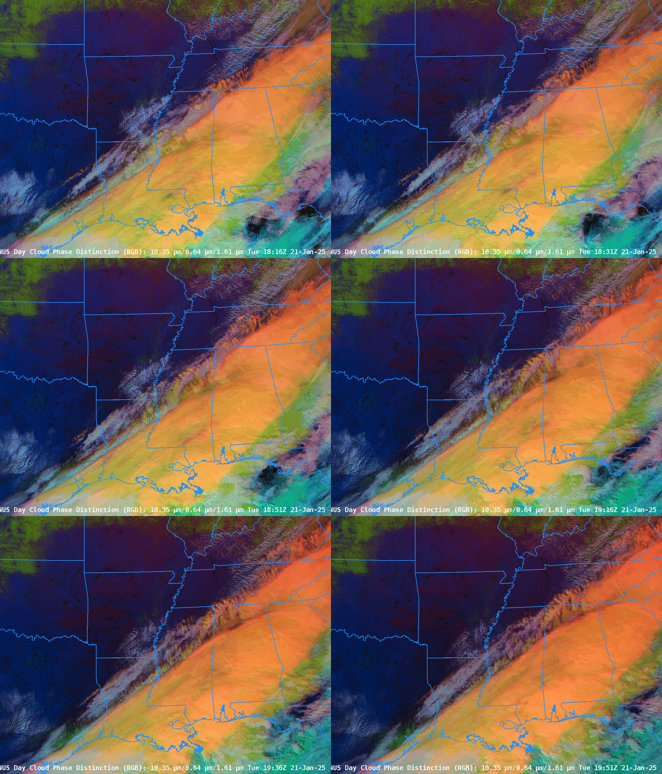
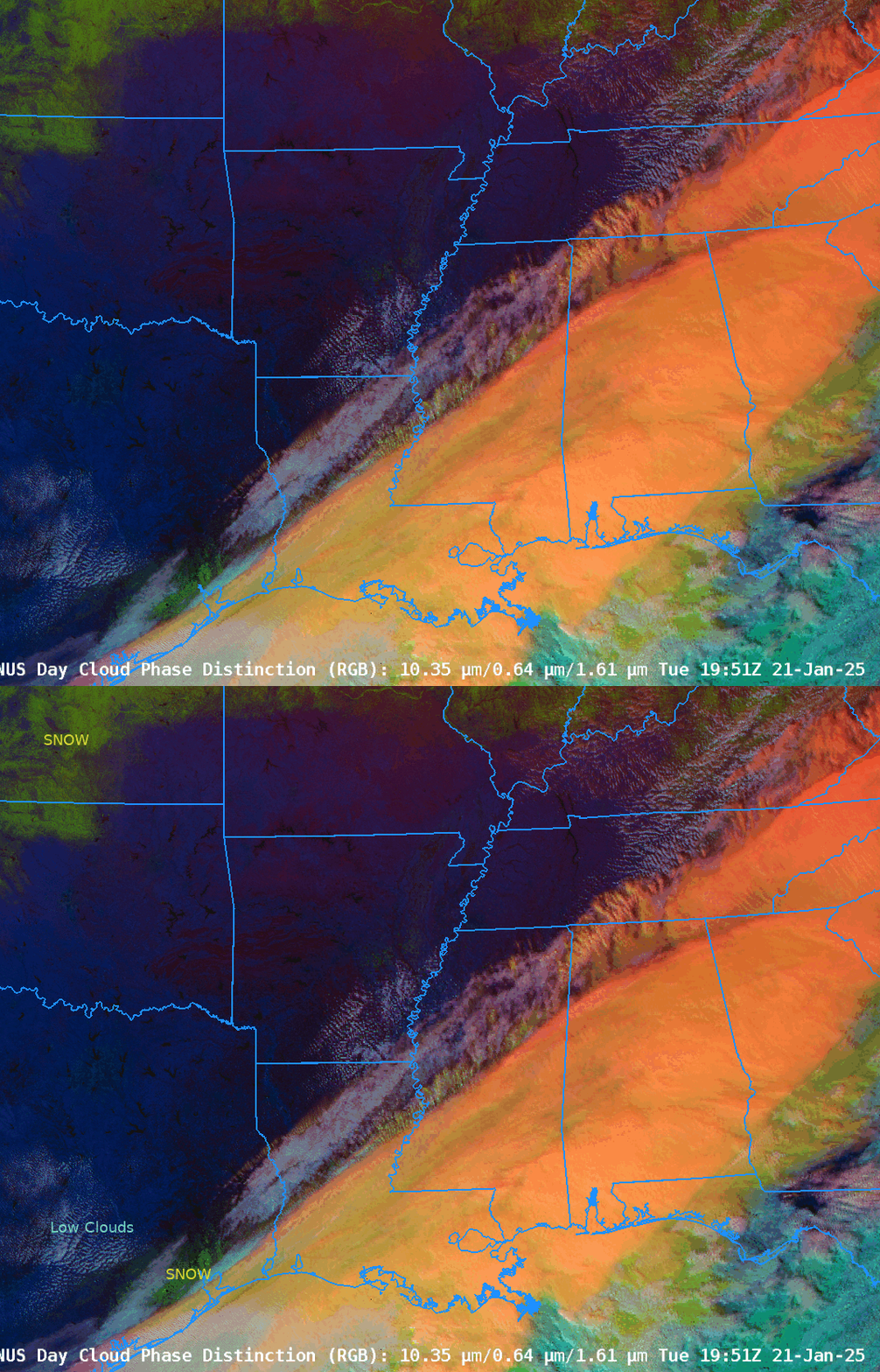
GOES-16 Day Cloud Phase Distinction from 1816-1951 UTC, below, shows the strengthening storm. You can use the cloud texture over Louisiana to infer regions where precipitation is occurring (all in the form of snow!). Day Cloud Phase Distinction also highlights — in green — snow that is on the ground in Kansas and Oklahoma, and also in southeast Texas that becomes apparent as the deeper clouds (orange/yellow in this RGB) pull away. That snow on the ground in southeast Texas is inhibiting the development of cumulus clouds (white/cyan).

The toggle below includes annotations highighting regions of snow and low clouds.

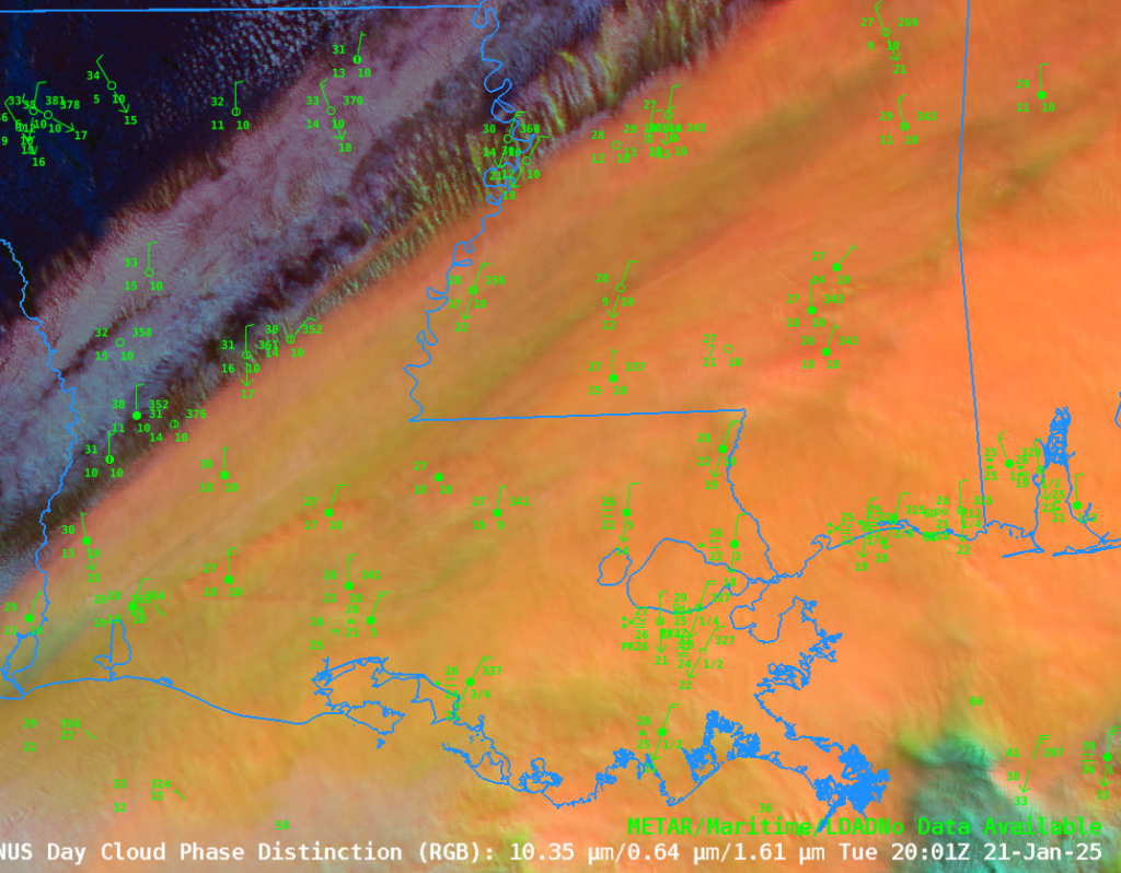
A zoomed-in Day Cloud Phase Distinction RGB over Louisiana at 2001 UTC, below, shows how one might use this RGB, both the color and texture, to infer regions where precipitation is occurring.

Imagery from just before Noon Central Time (1800 UTC) included this Traffic Cam shot from Lake Charles, LA, this view of Galveston TX (from here) and this view of Bourbon Street in New Orleans (source).
This is an ongoing storm, and this blog post will be amended later.
—————
Free Secure Email – Transcom Sigma
Transcom Hosting
Transcom Premium Domains
