Helene’s genesis
Hurricane Helene spent time percolating in the northwestern Caribbean over the past week. The animation above show true-color imagery from the CSPP Geosphere site at 1-day intervals from 13 to 24 September. Convection over the southern Gulf of Mexico on 18-20 September moved northward and expanded greatly before being designated a tropical storm at 1500 UTC on 24 September, shortly before the end of the stepped animation above.
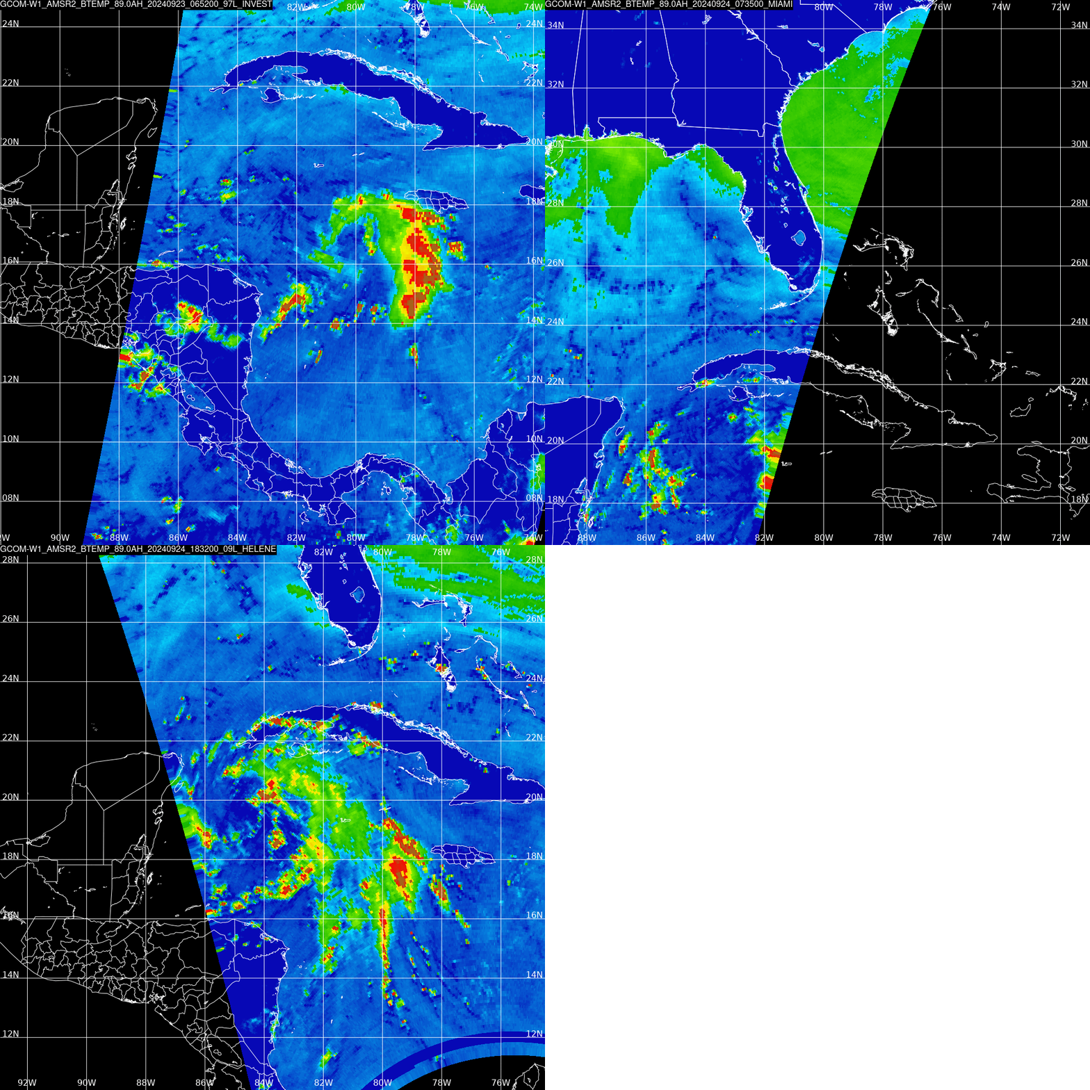
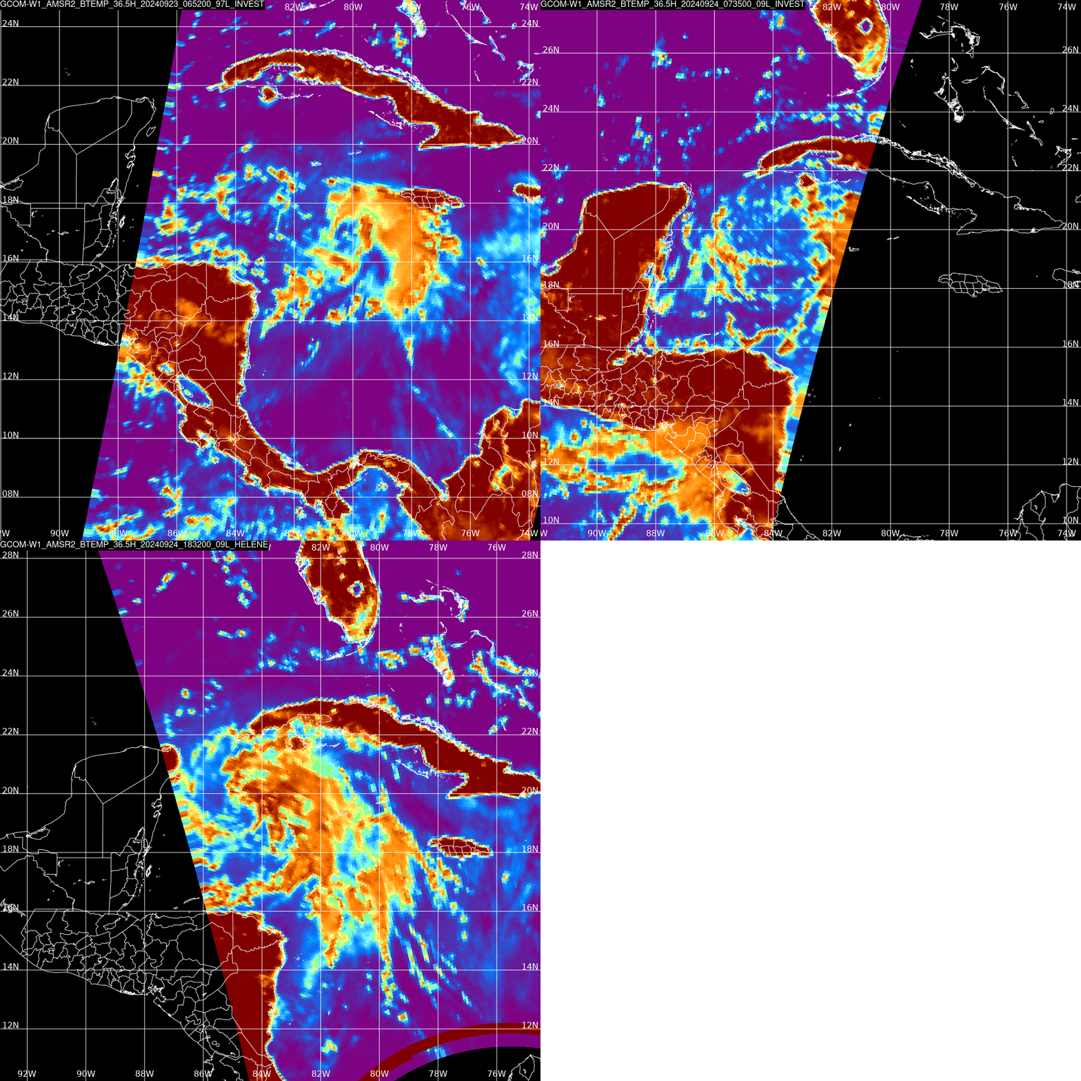
Helene’s genesis was captured well by data from the direct broadcast antenna at AOML in Miami FL (link). The toggles below show GCOM-W1 AMSR-2 imagery at 36.5 and 89.0 GHz; the images are centered on the cyclone. The 89.0 GHz imagery, below, shows a strong signal of convective clouds shown in red. These cold features show up because 89.0 GHz energy is strongly scattered by ice. At all three times, curvature is apparent, but a definite center is not until the 1832 UTC imagery from 24 September.

The 36.5 GHz imagery, below, is more affected by cloud and rain water features below the freezing level. The background ocean shown to be very cold because ocean water has low emissivity at 36.5 GHz; energy is added to the upwelling signal from the cloud and rain droplets. For Helene, as it developed, this was mostly over the eastern half of the storm. By 1832 UTC on 24 September, there are pronounced curved bands near the center of newly-named Tropical Storm Helene.

Those in the southeast US should closely monitor the approach of Helene. For the latest on Hurricane Helene, and the multiple dangers it poses, refer to the National Hurricane Center.
—————
Free Secure Email – Transcom Sigma
Transcom Hosting
Transcom Premium Domains
