
Hail swath near Willard, New Mexico
1-minute GOES-18 Day Cloud Phase Distinction RGB images, from 2000 UTC on 19 June to 0019 UTC on 20 June; Interstates and State Highways are plotted in violet [click to play animated GIF| MP4]
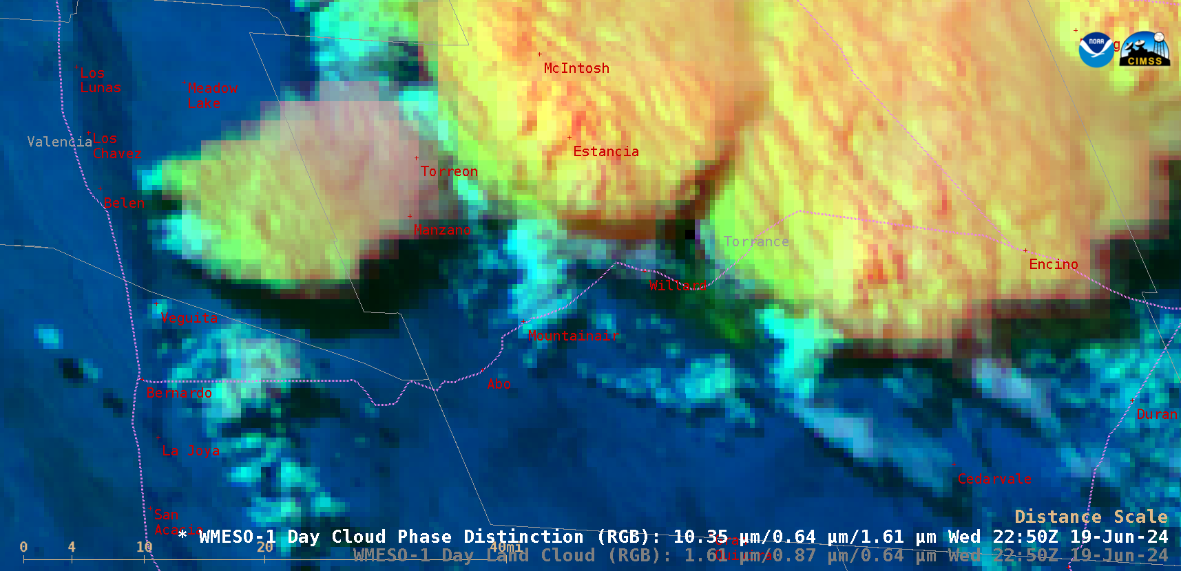
1-minute Mesoscale Domain Sector GOES-18 (GOES-West) Day Cloud Phase Distinction RGB images (above) showed clusters of slow-moving thunderstorms across Torrance County in central New Mexico on 19 June 2024. In addition to generating strong winds and heavy rainfall, these storms were also prolific hail-producers — most notably, there was one Local Storm Report of 2.00-inch diameter hail that lasted for 1.5 hours and accumulated to a depth of 6 inches just southeast of Willard.
Parts of the northwest-to-southeast oriented swath of hail accumulation near Willard were evident through occasional breaks in the clouds — exhibiting varying shades of green, such as was seen at 2005 UTC, 2250 UTC and 2305 UTC. The hail swath appeared to have crossed State Highway 60, which jogs west-to-east across Torrance County (passing through Willard).
—————
Free Secure Email – Transcom Sigma
Transcom Hosting
Transcom Premium Domains