
Gravity waves with convection over the Great Lakes
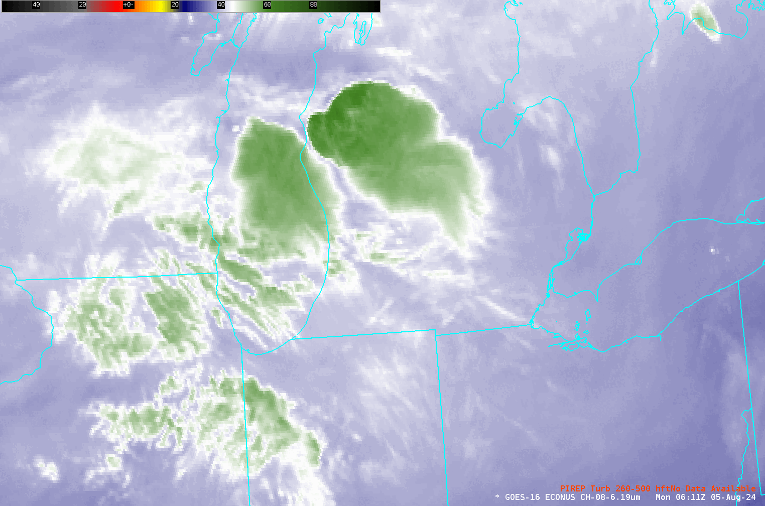
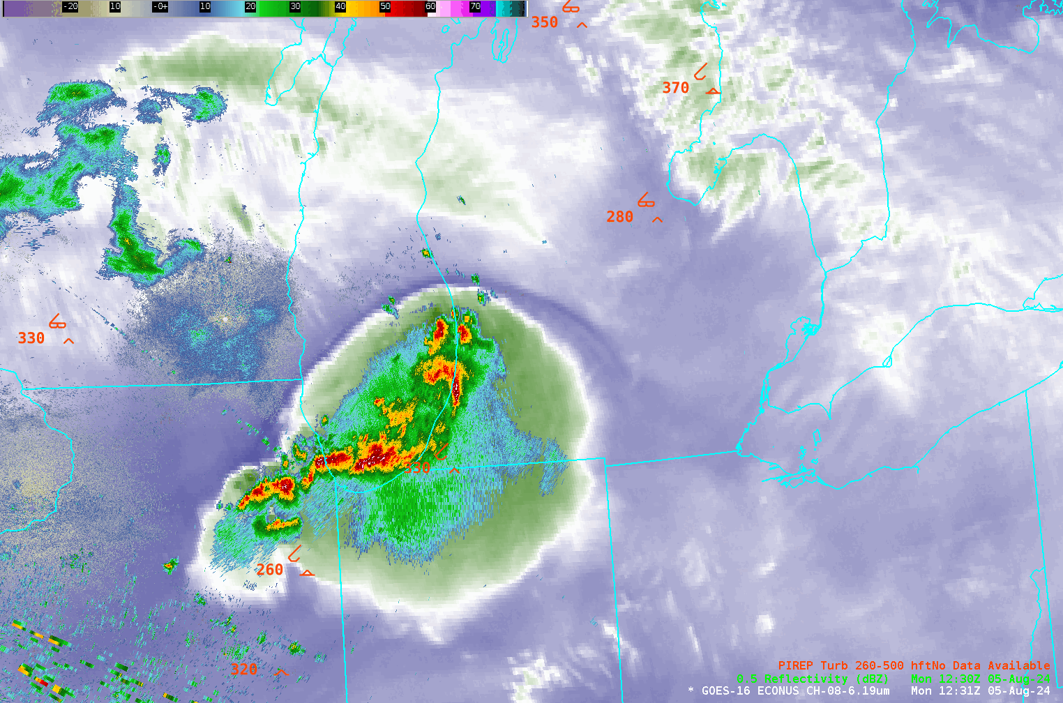
Strong convection developed over southern Lake Michigan early in the morning on 5 August, as depicted in the animation above. Multiple pilot reports of moderate turbulence occurred in/near the developing convection. Gravity waves developed on the upwind side of the deep convection, shown in the enhancement above as darker blue (that is, warmer brightness temperatures); the circulation with the gravity waves had an observable effect on approaching clouds as well. Note, for example, how the convection initially on the eastern central Lake Michigan shoreline (highlighted by the black arrow in the animation below) dissipates as it moves under the gravity wave structure. Clouds moving in from the northwest also change abruptly as they encounter the gravity wave barrier (and its vertical circulation).
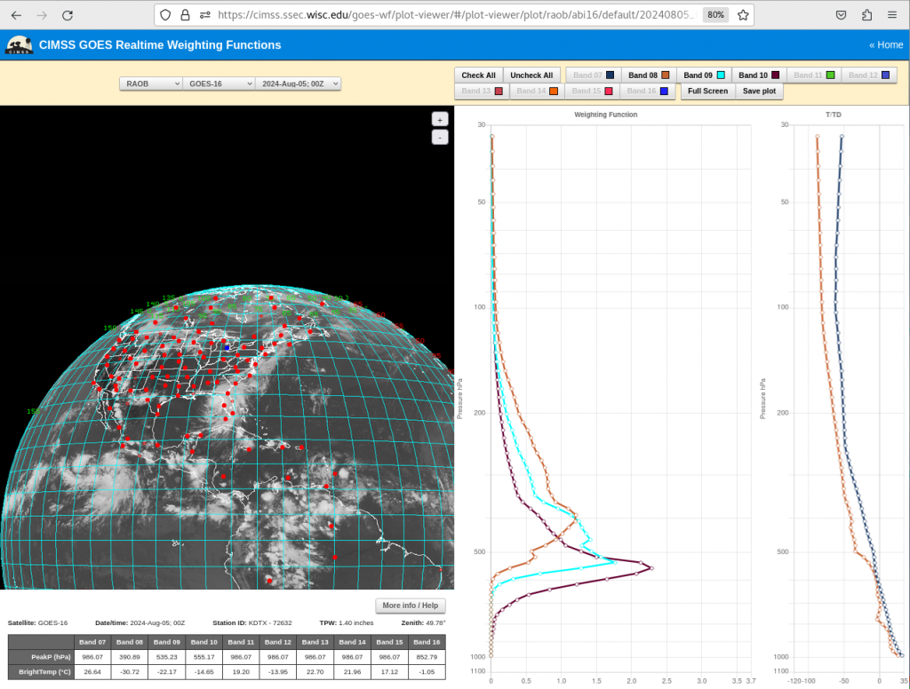
Weighting Functions from the 1200 UTC Detroit Rawinsonde site, below (source), show contributions to the signal in the Band 8 water vapor imagery originating from a layer between 500 and 200 hPa.
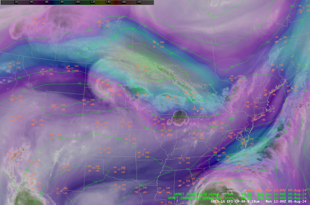
The strong convection formed in the exit region of a 100-knot jet at 200 mb as shown in the analysis below. Note the large scale difluence in the region: north-northwest winds (40 knots) at Lincoln, IL; Northwest winds at 55 knots at Detroit MI; West winds at 65 knots in Maniwaki, QB!
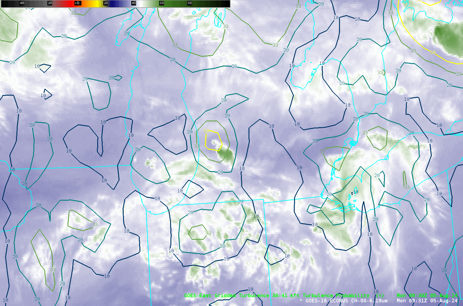
The CIMSS Turbulence Product — that predicts via a Machine-learning algorithm the likelihood of Moderate or Greater (MOG) turbulence — increased markedly as the convection developed, as shown below.
GOES-16 Visible imagery, below (from the CSPP Geosphere site), also shows the gravity waves, and their interaction with/affect on convection.
I am grateful to Greg Mann and TJ Turnage, Science and Operations Officers (SOOs) in Detroit and Grand Rapids, respectively, for their comments on this event (and for letting me know about it!)
—————
Free Secure Email – Transcom Sigma
Transcom Hosting
Transcom Premium Domains