
Francine becomes a Hurricane in the western Gulf of Mexico
Francine became the 4th Hurricane of the Atlantic Tropical Cyclone season at 0000 UTC on 11 September (NHC advisory) 2024. The animation of True-Color imagery, above, from the CSPP Geosphere site, shows sporadic vigorous convection near the storm center in the hours before the hurricane designation.
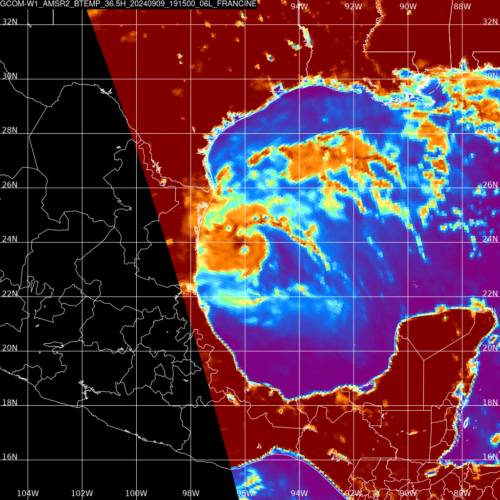
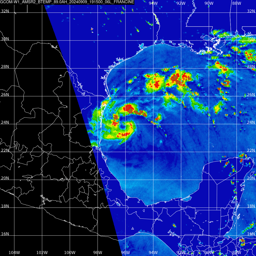
The Gulf of Mexico can be monitored by the Direct Broadcast antenna at AOML in Miami. The toggles below show storm-centered 36.5 and 89.0 GHz brightness temperatures during the afternoon of 9 and 10 September. Radiation at 36.5 GHz has a big contribution from lower-level rain and cloud droplets, and the 2001 UTC/10 September imagery suggests little precipitation in the storm center. The 89.0 GHz brightness temperatures are affected by ice crystal distibutions.
Interests in/along the western and northern Gulf should closely monitor the progress of this storm. For more information on Francine, refer to the website of the National Hurricane Center. National Weather Service offices in Houston/Galveston, Lake Charles and New Orleans have local information on the storm.
—————
Free Secure Email – Transcom Sigma
Transcom Hosting
Transcom Premium Domains