
Flooding on Maui and Oahu
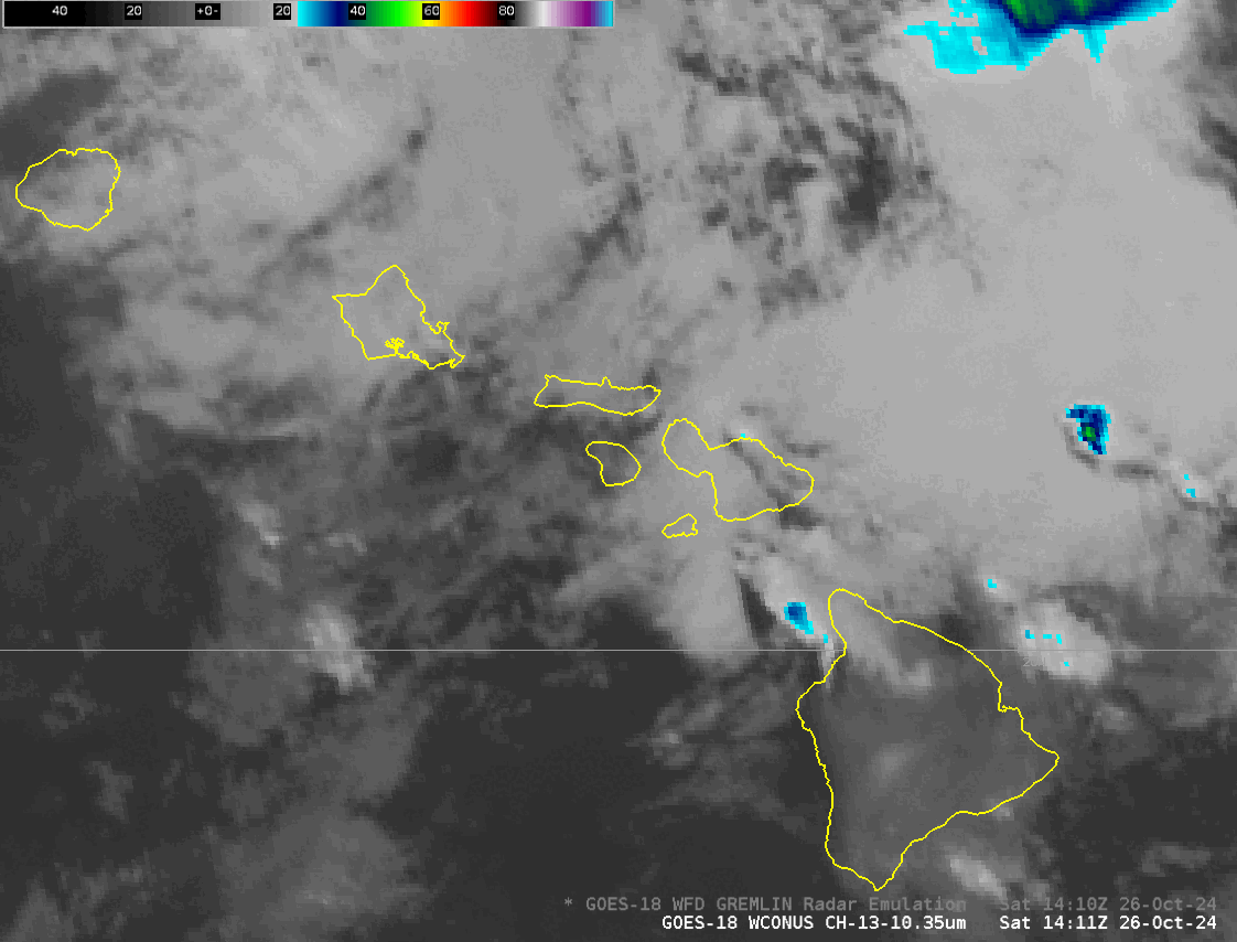
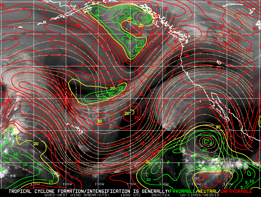
Infrared imagery over the Hawai’ian Islands on 25/26 October, below, shows convective development over Maui and Oahu. This was also a region of strong vertical wind shear, as shown below, as upper level cloud features were moving southeastward, low level clouds were moving to the west).
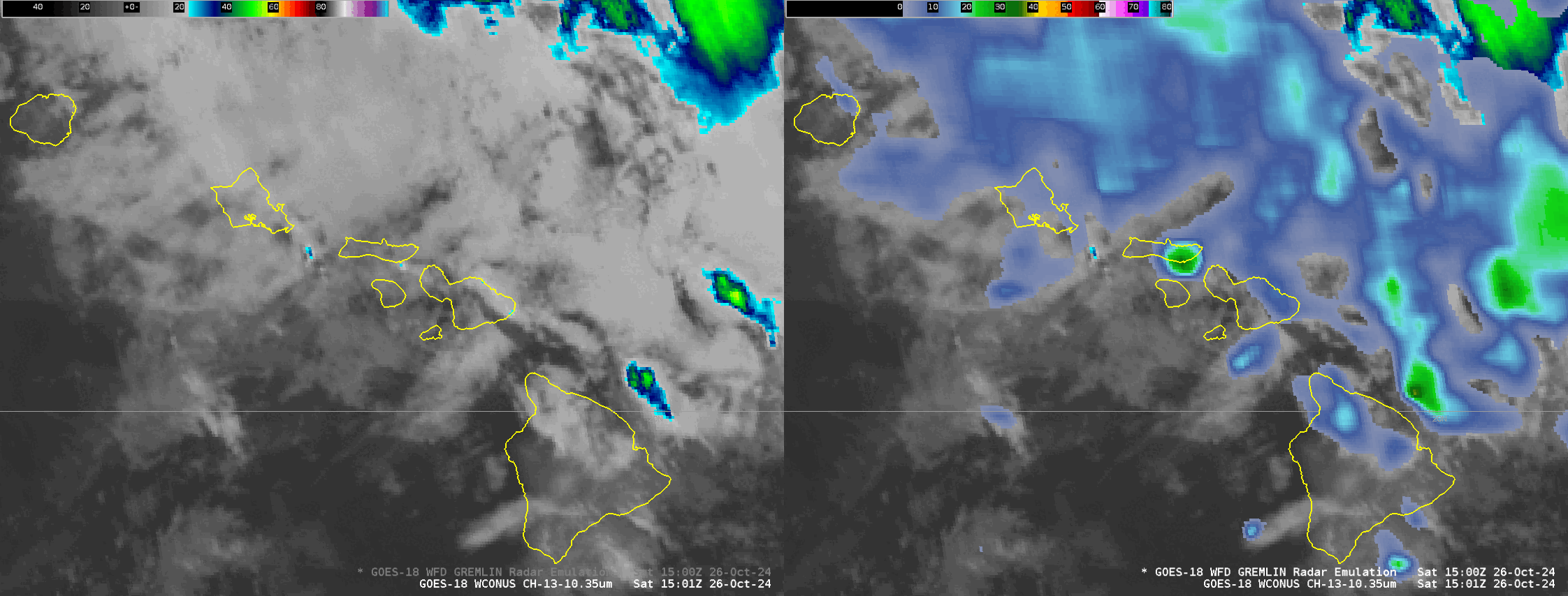
GREMLIN is a machine-learning tool that uses Bands 7, 9 and 13 fields from GOES-18 to emulate what NEXRAD radar echoes might look like. The animation below shows GOES-18 infrared data, and GREMLIN radar estimates. GREMLIN shows radar returns over both Oahu and Maui.
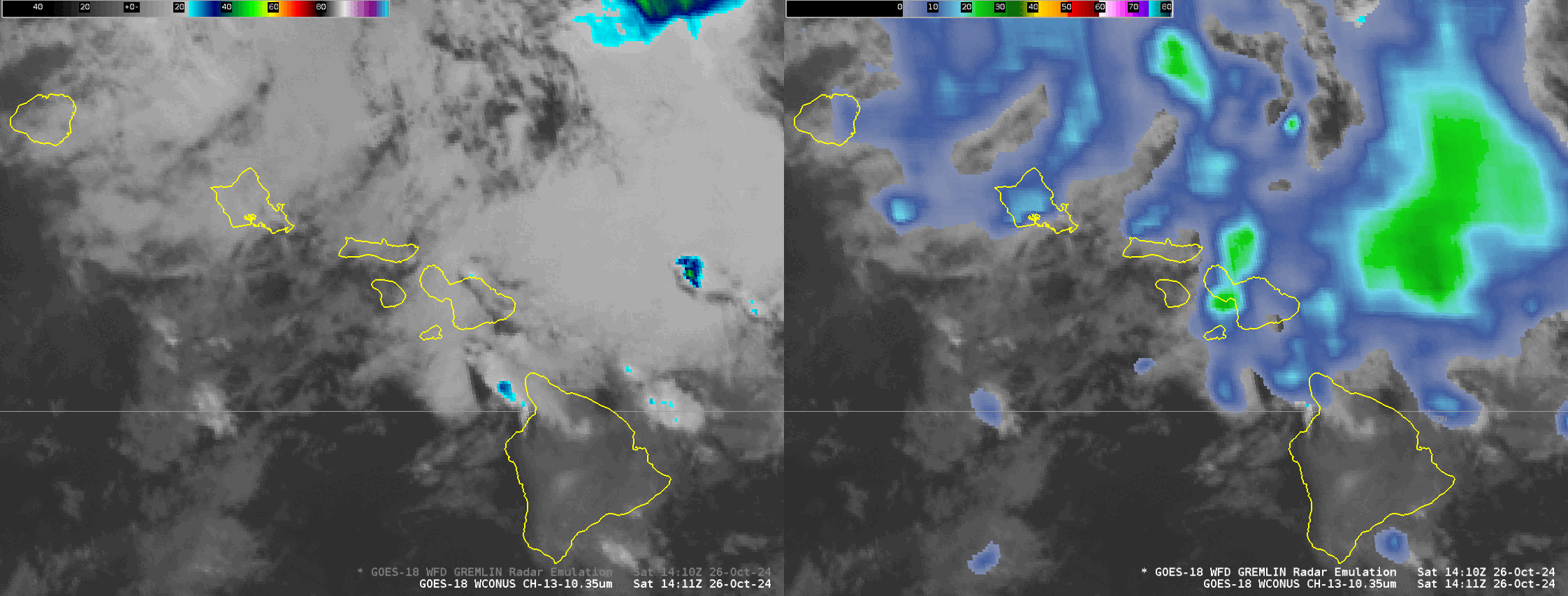
Strong convection with radar returns occur over both Maui and Oahu after 1500 UTC. The National Weather Service in Honolulu issued Flash Flood Warnings at 1638 UTC for Maui and at 1640 UTC for Oahu. The side-by-side animation, from 1501-1701 UTC shows the heavy rain indicated by GREMLIN as the Flash Flood Warning was issued.
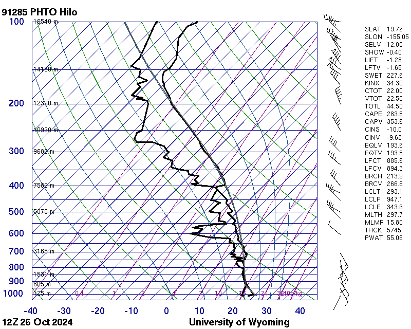
The Hilo sounding from 1200 UTC on 26 October, below, (from here) shows a moist atmosphere (55 mm of Total Precipitable Water) and mid-level instability. MIMIC Total Precipitable Water (TPW) at that time (here) shows the horizontal distribution of the moisture.
—————
Free Secure Email – Transcom Sigma
Transcom Hosting
Transcom Premium Domains