
Evidence of a moisture discontinuity in a satellite image
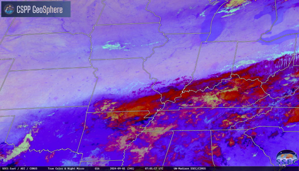
Nighttime Microphysics RGB Imagery (Quick Guide) from the CSPP Geosphere site, above (direct link to image), from early on 1 September, shows a distinct color change from the southern US to the northern US, stretching east-northeast from Oklahoma to Pennsylvania. This abrupt change from deep purple to light purple heralds a change in moisture — as one might expect in early September as cooler, dryer air starts its inexorable move south as Summer wanes. The cyan color of low clouds is also present along this boundary (and in central Iowa).
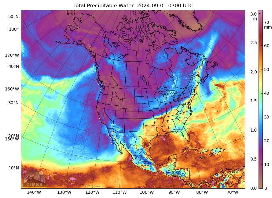
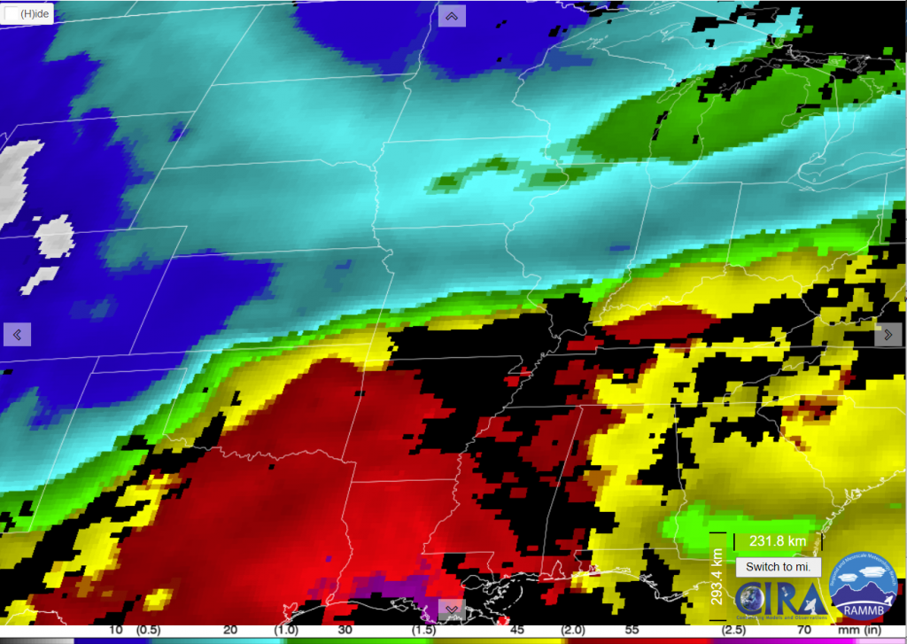
MIMIC Total Precipitable Water fields, above, from 0700 UTC, also show the sharp gradient in total precipitable water along this boundary as values drop from near 2″ over Arkansas to closer to 1/2″ over central Missouri. Blended TPW fields, below, taken from the CIRA SLIDER, show a similar sharp boundary.
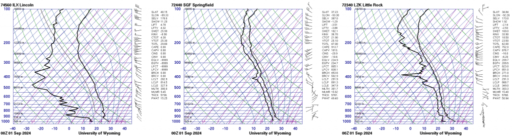
How did Precipitable Water (PWAT) change across this boundary in the 0000 UTC Soundings on 1 September? Skew-Ts, below (from the Wyoming Sounding site), from Lincoln IL (left, in the dry air), Springfield MO (center) and Little Rock AR (right), show PWAT values of 15, 49 and 51 mm, respectively!
Hat tip to Jochen Kerkmann, EUMETSAT, for noting this event today and sending out an email.
—————
Free Secure Email – Transcom Sigma
Transcom Hosting
Transcom Premium Domains