
Eruption of La Cumbre in the Galápagos Islands
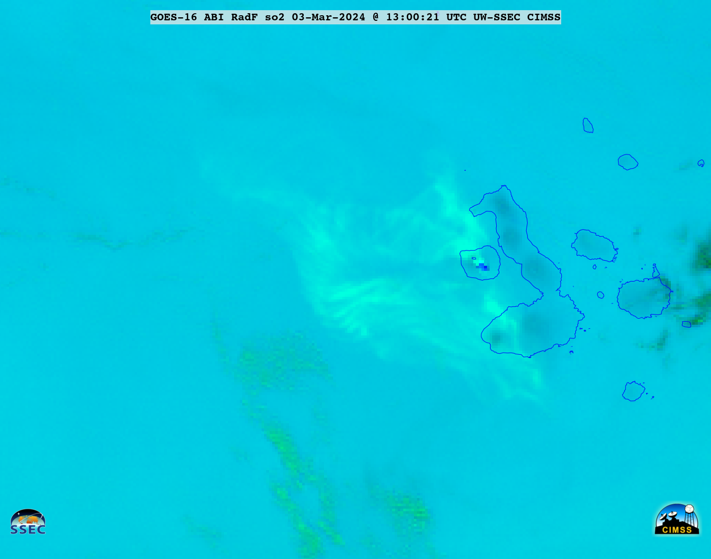
GOES-16 SO2 RGB images, from 0500-2100 UTC on 03 March [click to play animated GIF | MP4
GOES-16 (GOES-East) SO2 RGB images created using Geo2Grid (above) showed the volcanic cloud (lighter shades of cyan) resulting from an eruption of La Cumbre in the Galápagos Islands on 03 March 2024. The thermal anomaly at the volcano summit — which first became apparent at 0550 UTC — appeared as clusters of darker blue pixels.
A comparison of SO2 RGB and retrieved Ash products from the NOAA/CIMSS Volcanic Cloud Monitoring site (below) indicated that this particular volcanic cloud was entirely SO2-dominated, with no signature of ash content.
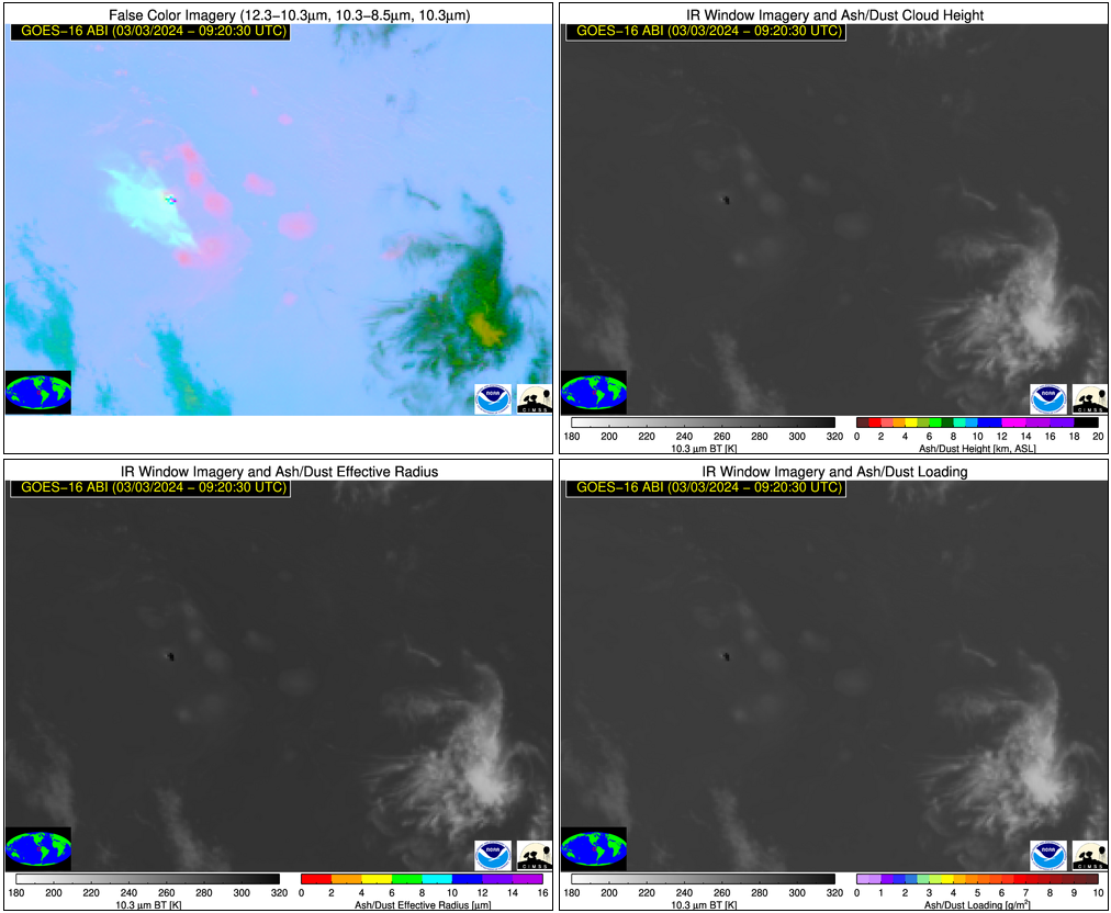
GOES-16 SO2 RGB (top left), Ash Height (top right), Ash Effective Radius (bottom left) and Ash Loading (bottom right) [click to play animated GIF | MP4]
—————
Free Secure Email – Transcom Sigma
Transcom Hosting
Transcom Premium Domains