Disturbed weather near the Samoan Islands
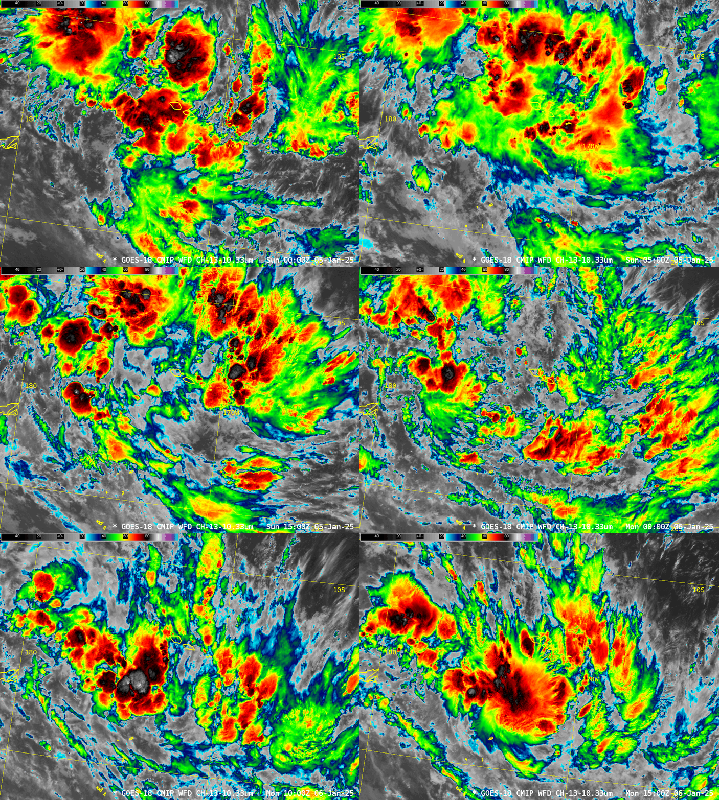
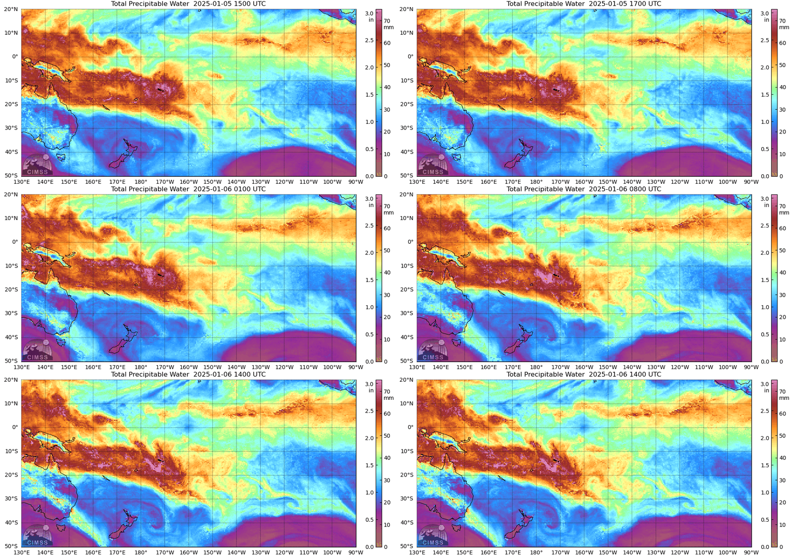
Hourly GOES-18 infrared imagery, above, shows the development of strong convection to the south of the Samoan Islands during the morning hours of 6 January (on American Samoa) or 7 January (Independent Samoa). Is this the start of a tropical system? Total Precipitable Water (MIMIC TPW) imagery from microwave data, below (TPW estimates from GOES-18 require clear skies that aren’t occurring during this time in the domain shown), show the rich moisture of the South Pacific Convergence Zone sagging south through the Samoan Islands. GFS model winds that are used to construct hourly MIMIC TPW fields suggest, perhaps, the beginnings of a cyclone circulation as well.
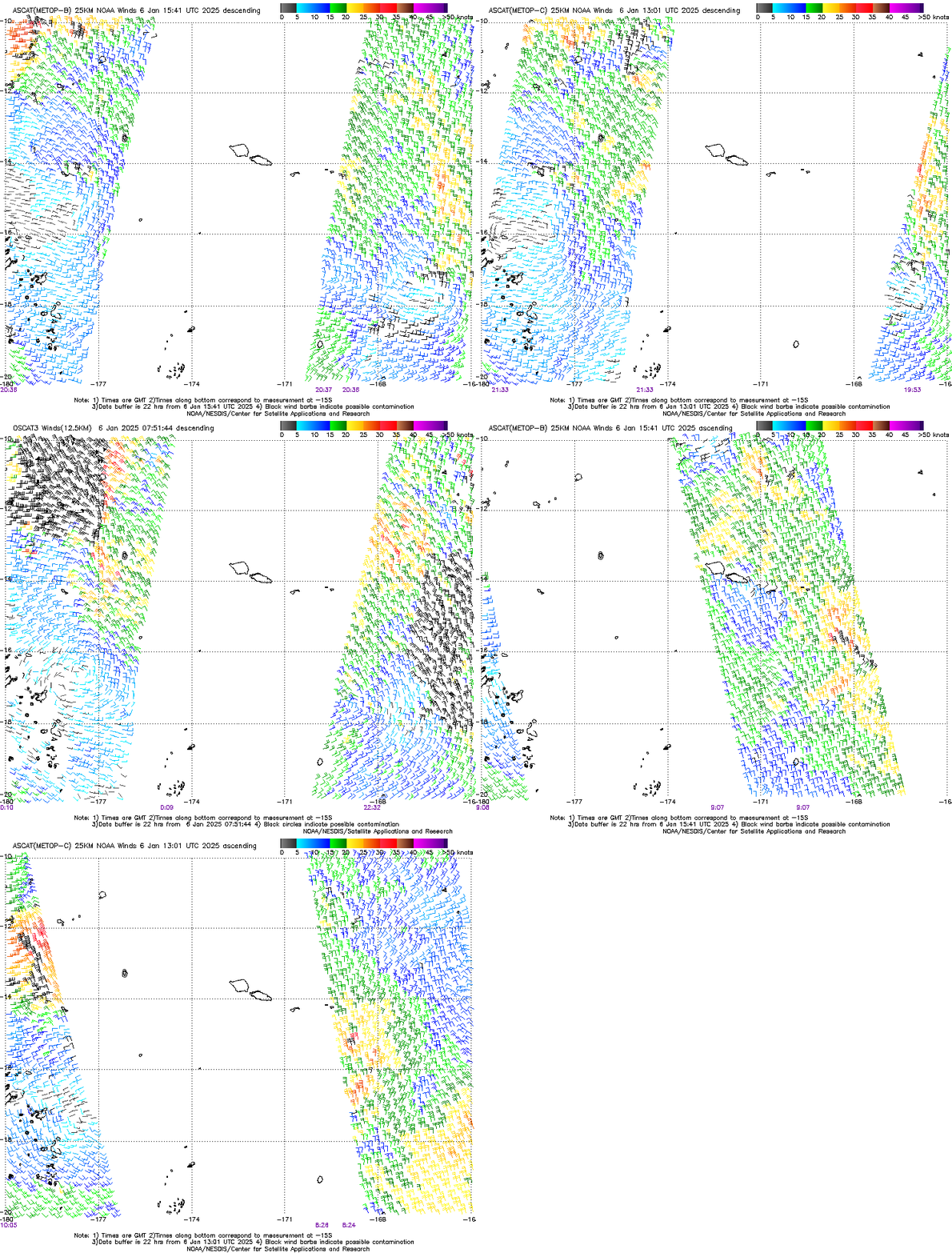
Scatterometry winds can be used to determine the presence of a low-level circulation center. The plots below, from this site, show MetopB / MetopC / OSCAT3 scatterometry for 05/06 January. The challenge, as always is that overpasses miss: the final MetopB overpass in the animation, for example, misses the circulation entirely. It is sampled, however, by MetopB, MetopC and OSCAT3 between 2000 and 0000 UTC on 5/6 January when the circulation was near 178oW, 16oS.
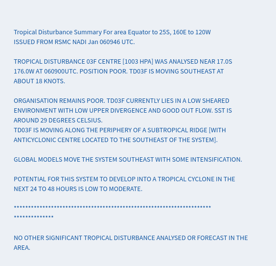
The RSMC (Regional Specialized Meteorological Center) in Fiji notes that the system may strengthen slowly; that discussion is shown below.
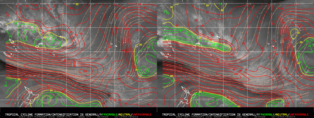
Although SSTs are warm, the region of favorable deep layer shear (shown below from 0000 UTC and 1200 UTC 6 January 2024 from this source) is very narrow, and it shrinks during the 12 hours shown.
—————
Free Secure Email – Transcom Sigma
Transcom Hosting
Transcom Premium Domains
