
Debby’s effect on the Susquehanna River
Tropical Cyclone’s Debby slow progress up the east coast of the US (Blog Post) resulted in a prolonged rain event. The slider above compares the Susquehanna River on 1 August (a clear day before Debby) and on 13 August, after the inundation. The turbidity of the river, and its discharge into Chesapeake Bay increased enough to be obvious to satellite detection.
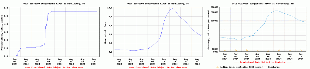
Data from the USGS Gauge at Harrisburg, below, shows the heavy rain (especially on 9 August), the increase in river height, and the large increase in river flow for the week ending 13 August 2024.
Thanks to Dave Zaff, NWS Eastern Region HSD, for alerting us to this imagery. Imagery for this post was created with Geo2grid.
—————
Free Secure Email – Transcom Sigma
Transcom Hosting
Transcom Premium Domains