Dark Oceans in Day Night Visible imagery

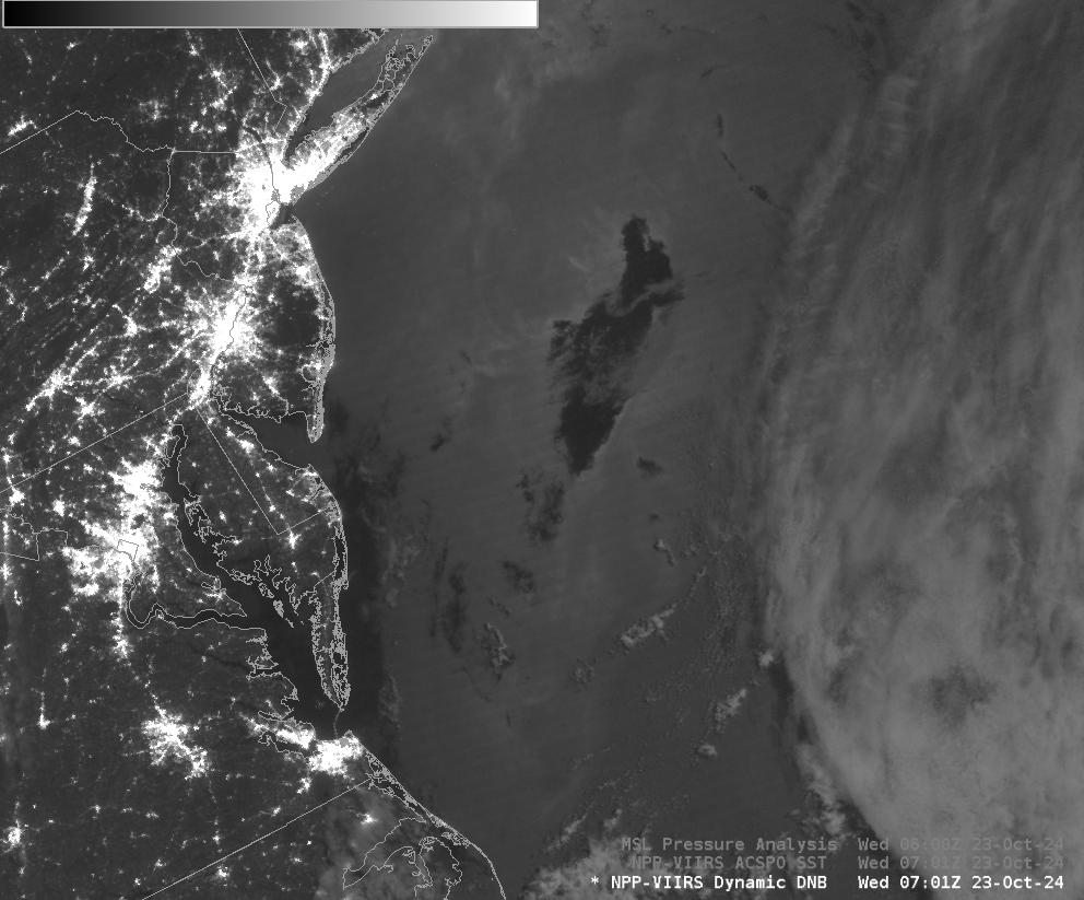
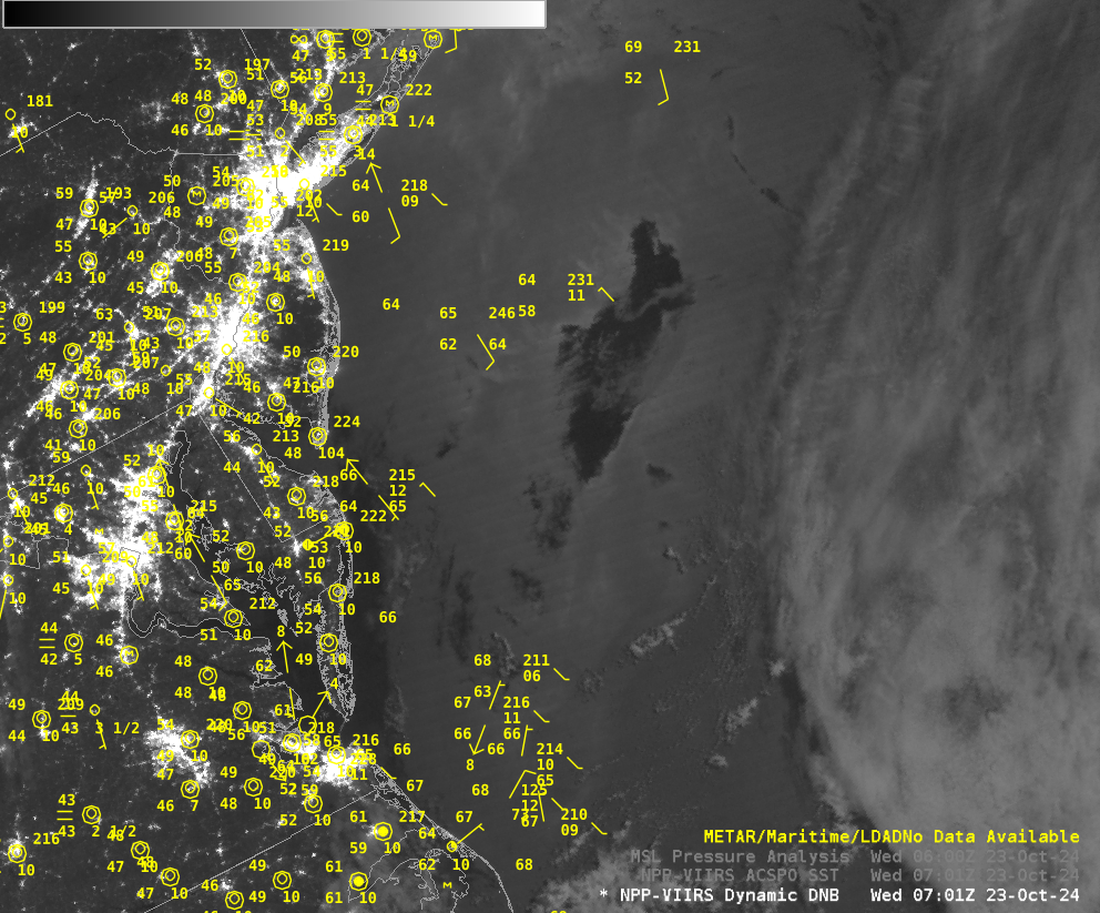
VIIRS Day Night Band visible imagery (at 0.7 µm) on 23 October, above, shows a dark patch over the Mid-Atlantic right to the east of New Jersey and the Delmarva peninsula. Chesapeake Bay waters are also much darker than most of the adjacent Atlantic Ocean. Dark patches such as these are associated with light (or no) winds (as noted here and here on this Blog). A lack of winds means the unperturbed sea surface will reflect less moon light back to the satellite. Winds are indeed light around Chesapeake Bay, as shown below. Sparse wind observations over the ocean also suggest light winds in/around the dark patch; this surface analysis shows that the region of the oceanic dark patch is within a ridge of High Pressure where light winds would be expected.

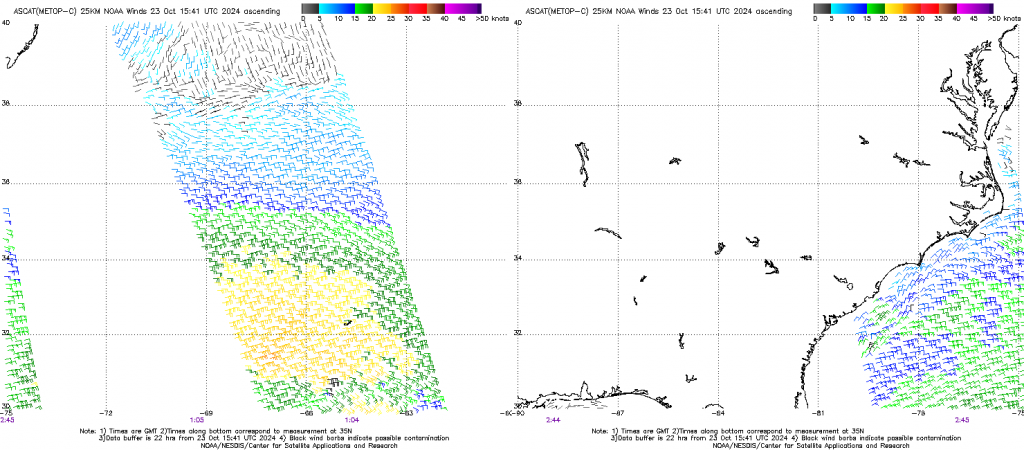
Metop-C ASCAT data from early on 23 October, below (from this site), also show very light winds near the dark spots.

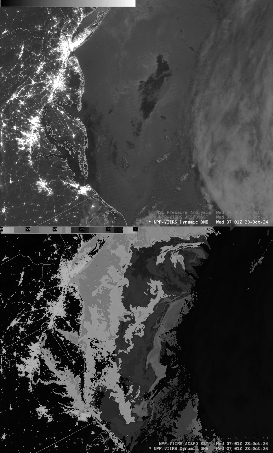
The VIIRS ACSPO SST analysis toggled below with the Day Night Band shows that the dark oceanic patch is in a region of relatively cooler water east of the North Wall of the Gulf Stream. That cooler surface could suppress any kind of atmospheric convection that might transport higher velocity down to the ocean surface.

Day Night Band imagery in this post is actually from NOAA-20, not Suomi-NPP. Thanks to Kathy for alerting me to this great case!
—————
Free Secure Email – Transcom Sigma
Transcom Hosting
Transcom Premium Domains
