Cyclone Hidaya reaches Category 1 Hurricane intensity

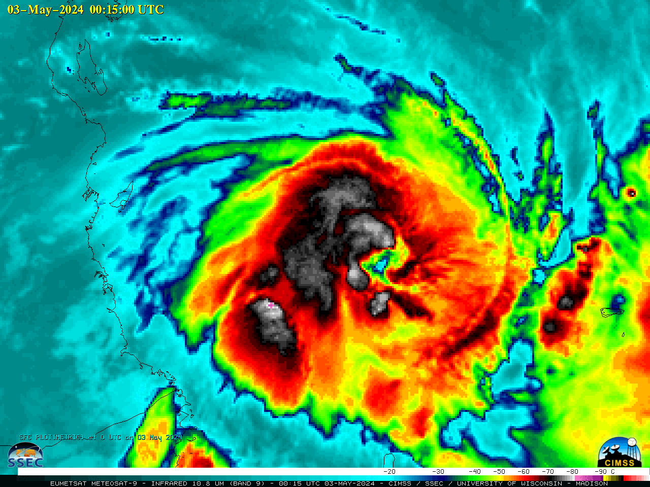
EUMETSAT Meteosat-9 Infrared Window (10.8 µm) images, from 1200 UTC on 02 May to 1200 UTC on 03 May [click to play animated GIF | MP4]
EUMETSAT Meteosat-9 Infrared Window (10.8 µm) images (above) showed Cyclone Hidaya as it intensified from a Tropical Storm (at 1200 UTC on 02 May) to Category 1 Hurricane intensity at 0000 UTC on 03 May 2024 (advisory | discussion). JTWC later noted that Hidaya had become the most intense tropical cyclone on record for this region, peaking at 80 kt (discussion).
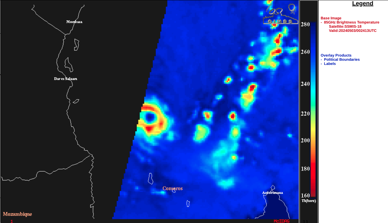
A DMSP-18 SSMIS Microwave (85 GHz) image at 0024 UTC on 03 May, from the CIMSS Tropical Cyclones site (below) revealed a well-defined eye and surrounding eyewall structure.

DMSP-18 SSMIS Microwave (85 GHz) image at 0024 UTC on 03 May [click to enlarge]
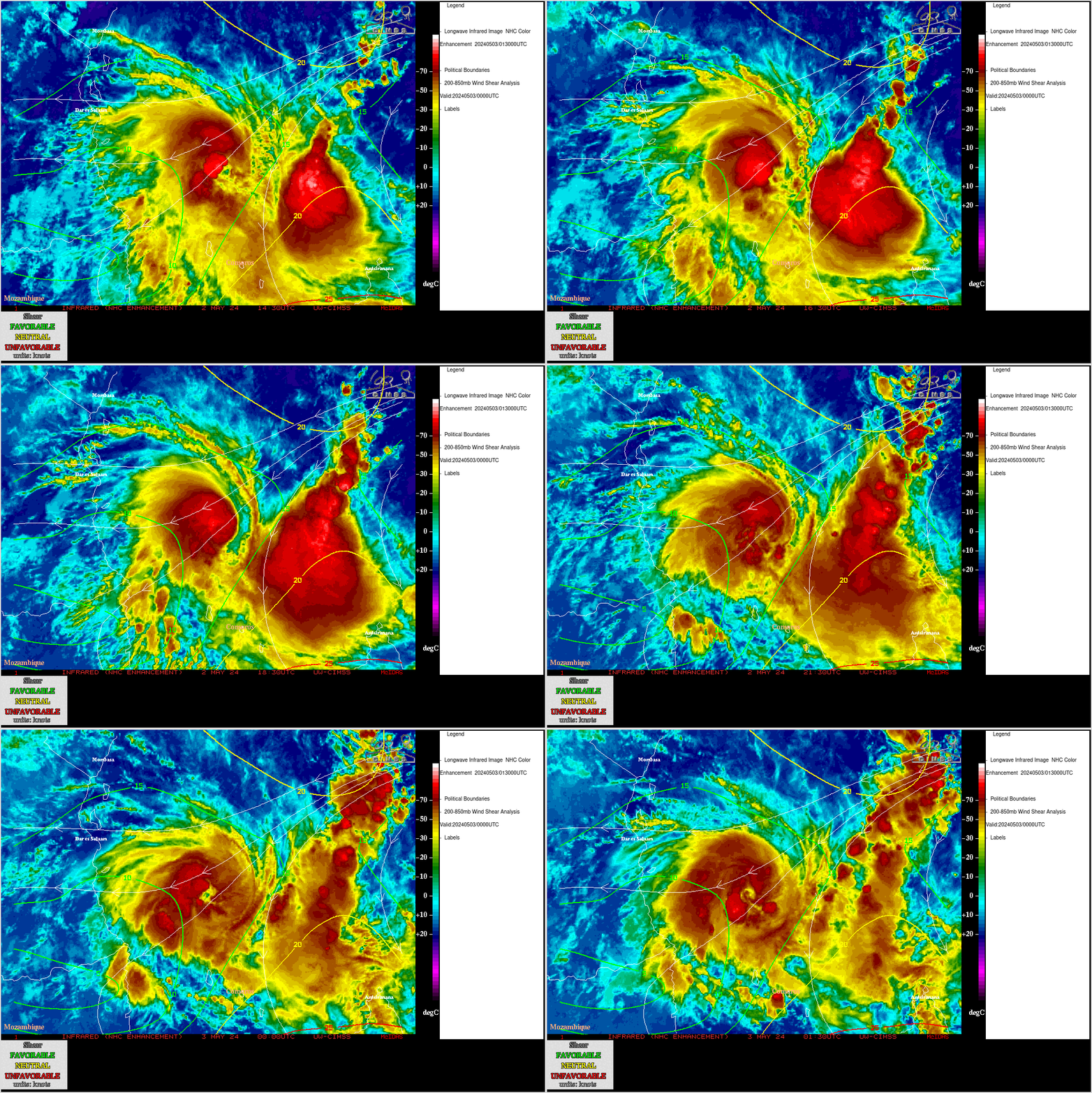
Cyclone Hidaya had been moving across warm water and through an environment of fairly low deep-layer wind shear (below), two factors which were favorable for intensification.

Meteosat-9 Infrared Window images, with contours and streamlines of deep-layer wind shear at 0000 UTC on 03 May [click to enlarge]
An overpass of RCM-3 provided Synthetic Aperture Radar (SAR) imagery (source) at 1531 UTC on 02 May (below) — the maximum sensed wind speed was 74.94 kt in the SE quadrant of the eyewall.

RCM-3 SAR image at 1531 UTC on 02 May [click to enlarge]
However, an overpass of RCM-3 at 1539 UTC on 03 May (below) sensed a maximum velocity of 92.29 kt in the NE quadrant.

rcm
—————
Free Secure Email – Transcom Sigma
Transcom Hosting
Transcom Premium Domains
