Cyclone Chido makes landfall in Mozambique

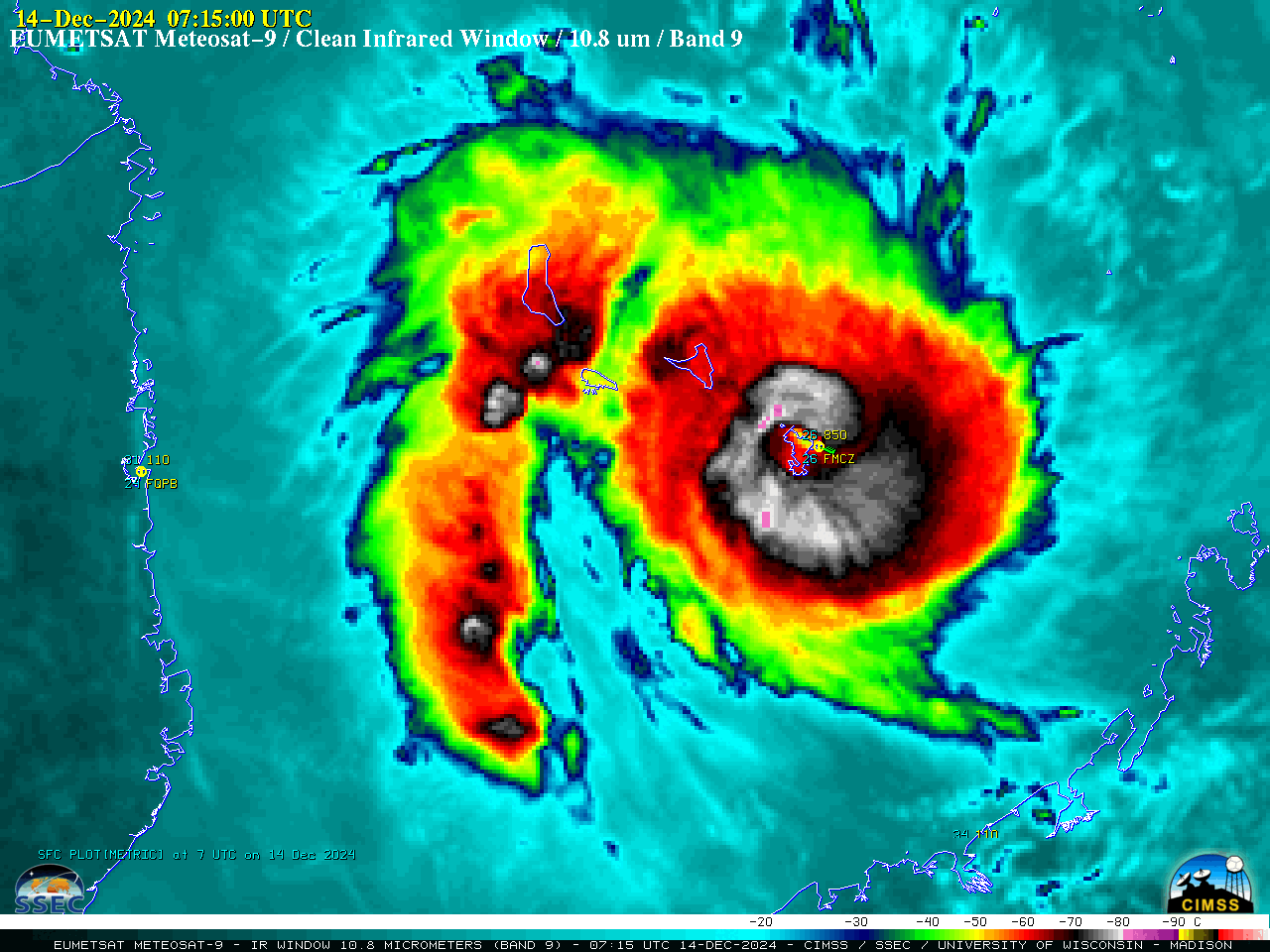
EUMETSAT Meteosat-9 Infrared Window (10.8 µm) images, from 1800 UTC on 13th December to 0700 UTC on 15th December [click to play animated GIF | MP4]
EUMETSAT Meteosat-9 Infrared Window (10.8 µm) images (above) showed Category 4 Cyclone Chido as its eye moved across the small island of Mayotte (airport identifier FMCZ) in the Mozambique Channel around 0730 UTC on 14th December 2024 — and went on to make landfall just south of Penba, Mozambique (airport identifier MQPB) around 0400 UTC on 15th December. Chido traversed increasingly warmer sea surface temperatures (source) as it approached Mozambique.
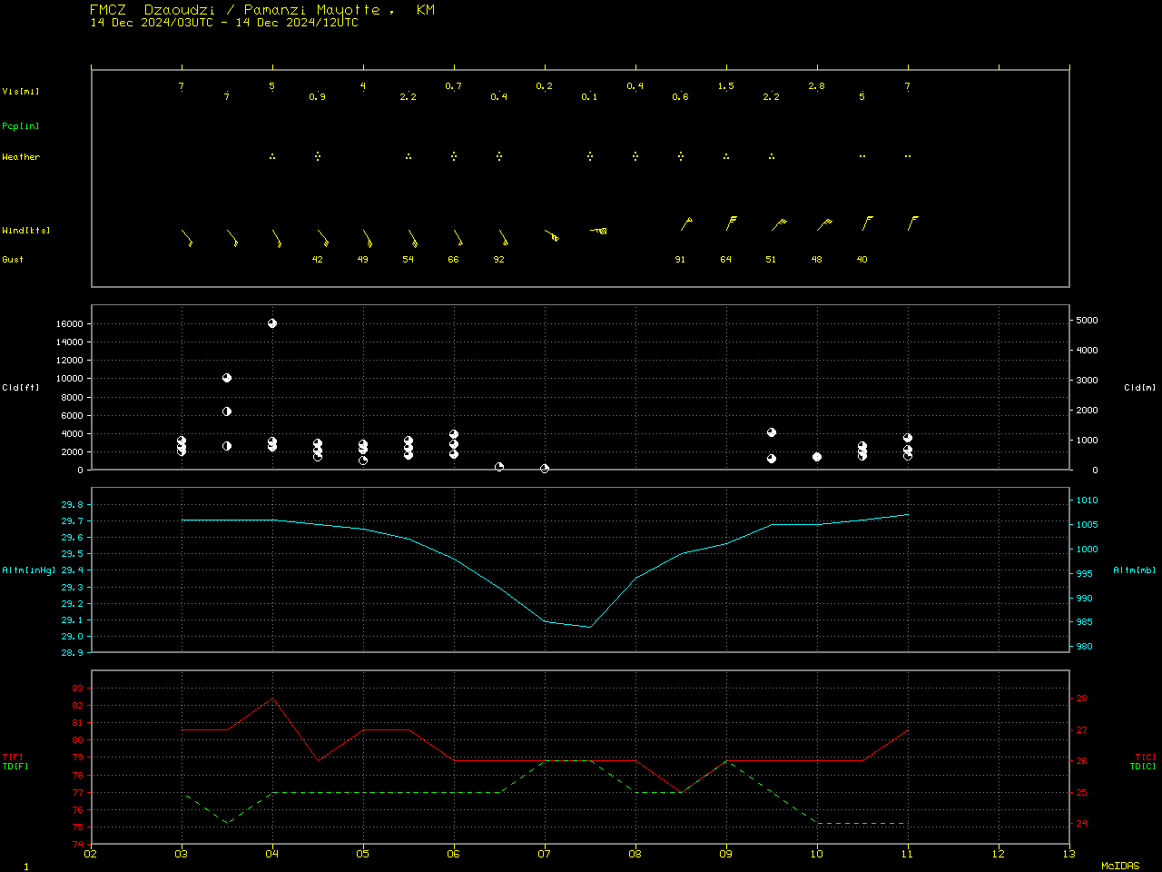
As Cyclone Chido passed over Mayotte, the airport reported wind gusts of 92 kts (106 mph) as the eye approached and 91 kts (105 mph) as the eye departed (below).

Time series plot of surface report data from Dzaoudzi–Pamandzi International Airport on the island of Mayotte [click to enlarge]
Shortly before Chido made landfall in Mozambique, a Synthetic Aperture Radar (SAR) image at 0253 UTC (below) indicated that a derived maximum wind speed of 123.84 knots was present in the SE quadrant of the eyewall (source).

RCM-1 SAR image at 0253 UTC on 15th December [click to enlarge]
—————
Free Secure Email – Transcom Sigma
Transcom Hosting
Transcom Premium Domains
