
CSPP Geo Software to create LightningCast imagery released
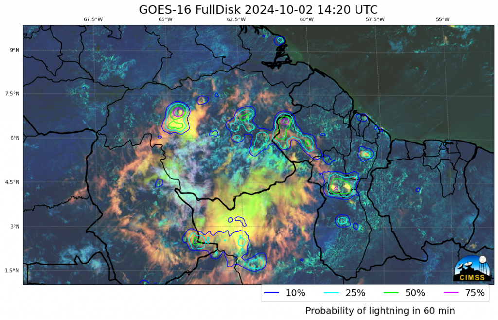
As first hinted at in this blog post, the Community Satellite Processing Package for Geostationary Data (CSPP-Geo) (https://cimss.ssec.wisc.edu/csppgeo/ ) group at CIMSS has released a beta version of a unix-based package that computes LightningCast probabilities. LightningCast (available online in real time for select regions) diagnoses the probability of a Geostationary Lightning Mapper (GLM) observation of lightning within the next hour, given a suite of ABI Channels (Bands 2, 5, 13, 15, that is: 0.64 µm, 1.61 µm, 10.3 µm, 12.3 µm) or AHI Channels (Bands 3, 5, 13, 15; 0.64 µm, 1.61 µm, 10.4 µm, 12.3 µm). Output is in the form of GeoJSON files, GR Placefiles, netCDF files (including AWIPS-compatible netCDFs), and imagery with lightning probability contours overlain on top (as shown above). The software will also plot GLM Flash Extent Density fields if you have access to the gridded GLM fields (and CSPP Geo has a package that will create those if you don’t). The package works on GOES-R CONUS/PACUS domains, or mesoscale domains, or within subsected regions of the Full Disk (provided the subsected region is smaller than about twice the size of the CONUS/PACUS domain). The generated contours can also be parallax-corrected.
Access to the software does require a free log-in that supplies your email to the CSPP Geo team. This email is used for follow-on support for things like updates and patches that might occur. Download the package (from here) to a clean directory on your machine, un-tar it, and you’re ready to go.
The following (simple!) command, run in the directory created when the downloaded software package is un-tarred, created the image shown up top. Refer to the users’ manual for a complete set of commands. Note that the domain created — from 53oW to 70oW and 1oN to 10oN — is not available at the RealEarth instance.
./lightningcast --skip-geojson --make-dcp-image --ll-bbox -70.0 -53.0 1.0 10.0 /path_to_GOES16_Data/abi/L1b/RadF/*M6C02*s20242761420*The software allows you (if you wish) to change the contour values from the defaults of 10/25/50/75. That is shown in the invocation that created the imagery beneath the code.
./lightningcast --skip-geojson --make-dcp-image --ll-bbox -70.0 -53.0 1.0 10.0 --probability-contours 1 2 5 50 90 --image-probability-colors "#00A5A5" "#00FFFF" "#00FF44" "#554400" "#FF1010" /path_to_GOES16_Data/abi/L1b/RadF/*M6C02*s20242761420*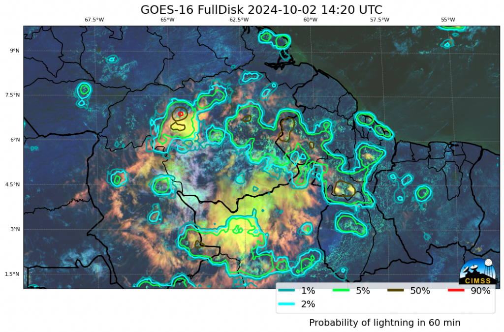
CSPP Geosphere imagery subsequent to the LightningCast Probabilities shown above is below. Where do you think lightning has occurred?
As noted above, the software package creates LightningCast probabilities with Himawari data as well, as along as you have access to Himawari HSD data. The following command created the imagery at the bottom. Note in all the invocations in the blog post that the file name specified resolves to one unique file. The software package will be able to resolve the other data needed from this one file name.
./lightningcast --skip-geojson --make-dcp-image --ll-bbox 110.0 130.0 -1.0 10.0 /path_to_HSD_Data/HS_H09_20241002_0500_B03_FLDK_R05_S0110.DAT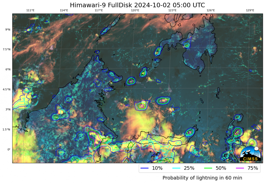
LightningCast software released is a beta version of the code. If you encounter unexpected behavior, please report it!
—————
Free Secure Email – Transcom Sigma
Transcom Hosting
Transcom Premium Domains